
MOLINE, Ill. — We are now less than two months away from the official start of the winter season and that means it's time to start piecing together the puzzle that is the upcoming winter weather outlook. As we draw closer to December in the weeks ahead, more pieces of that puzzle are beginning to fall into place.
What will drive the patterns this winter
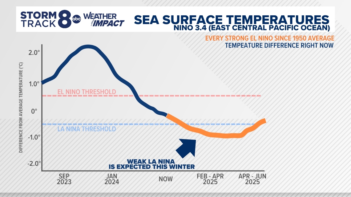
After experiencing a relatively strong El Niño last winter, this winter we're expecting a weak La Niña to develop in the east-central Pacific Ocean later this fall. By weak, we mean that the sea surface temperature departure, which we use to measure El Niño and La Niña conditions, is not expected to be all that large. Still, weak La Niña events have impacted the winter season here in the Quad Cities, as recently as 2022-2023.
The Polar Vortex is also something we'll be tracking in the months ahead. As of early October, the Polar Vortex itself is quite weak. Not always good news. More on that later.
How La Niña impacts the global weather pattern
La Niña involves the water temperatures in the east-central Pacific Ocean and tropical atmosphere near the equator acting in symphony. It interrupts the average air circulation pattern over this region of the globe, known as the Walker circulation, bringing stronger than normal tradewinds that blow from east to west, pushing warm surface waters toward Asia and allowing cooler waters to rise to the east.

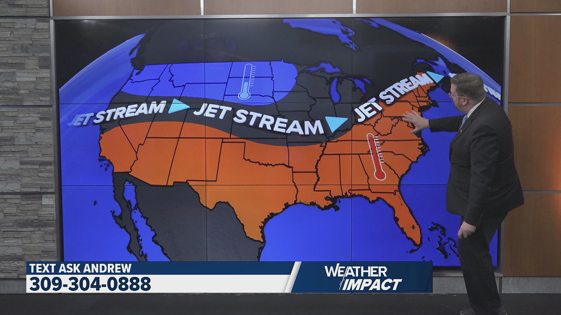
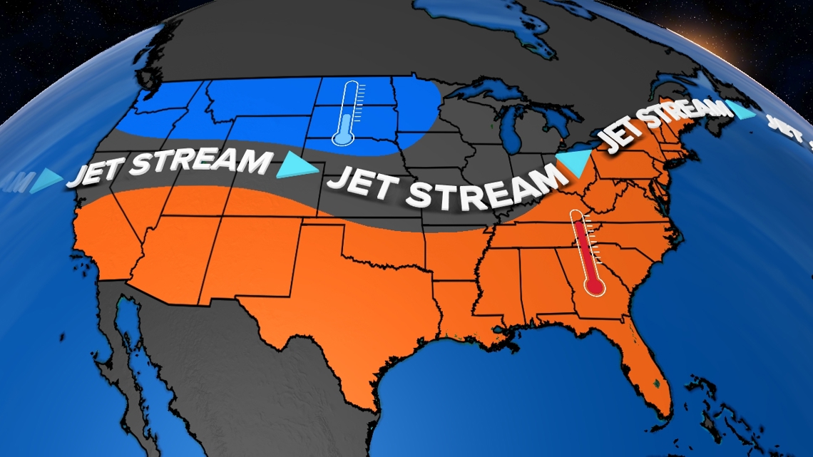
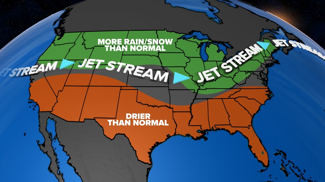
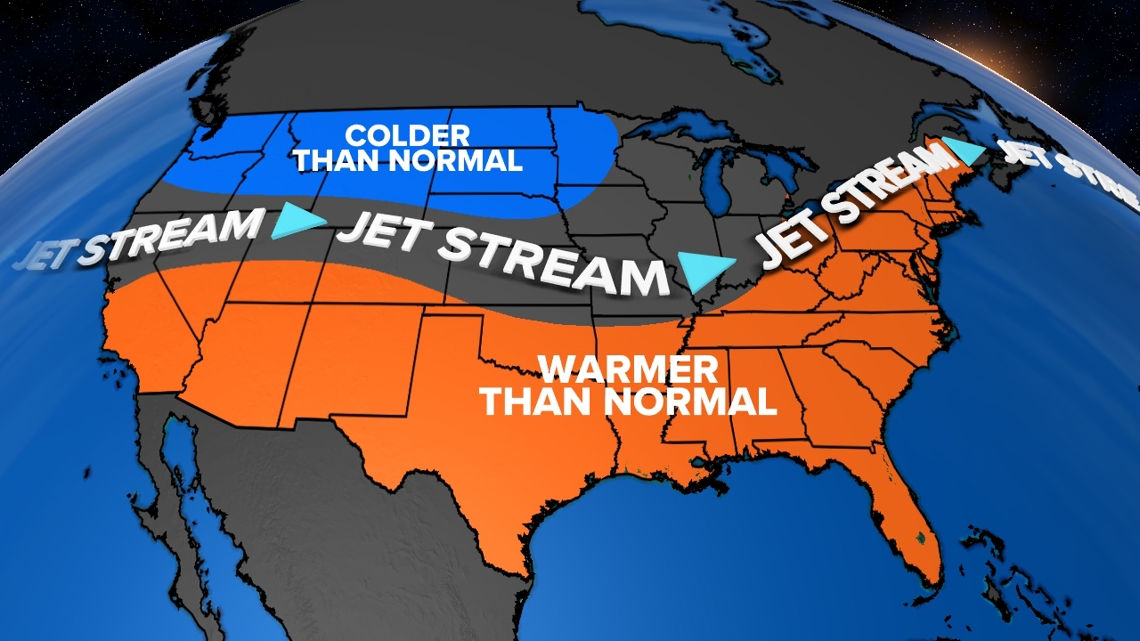
This forces the active polar jet stream to dive further south into parts of the Midwest and Northeast, while an active Pacific jet stream moves further north into the Pacific Northwest. The end result: colder than normal temperatures for the north-central and northwest portion of the U.S. along with wetter than normal conditions from Illinois into the Ohio Valley. Meanwhile, drier-than-normal conditions are expected across the southwest, south-central, and southeast.

As of early October, we are currently experiencing neutral conditions. Neither El Niño nor La Niña conditions currently exist. However, model data and history tell us La Niña conditions are likely to develop later this fall, lasting into winter and early next spring. It won't be an immediate switch. It will take weeks for the impacts of La Niña to be felt.
Looking back to look forward
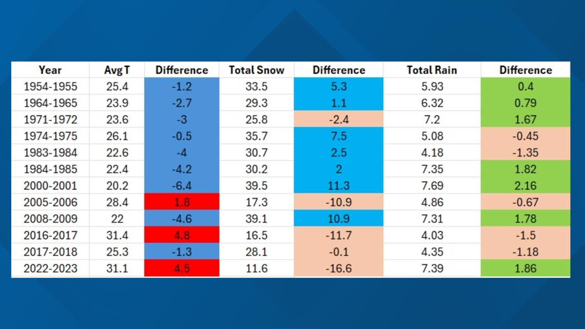
Since 1950, the Quad Cities has experienced 12 weak La Niña events. These years can give us some hints regarding what this upcoming winter season will bring.

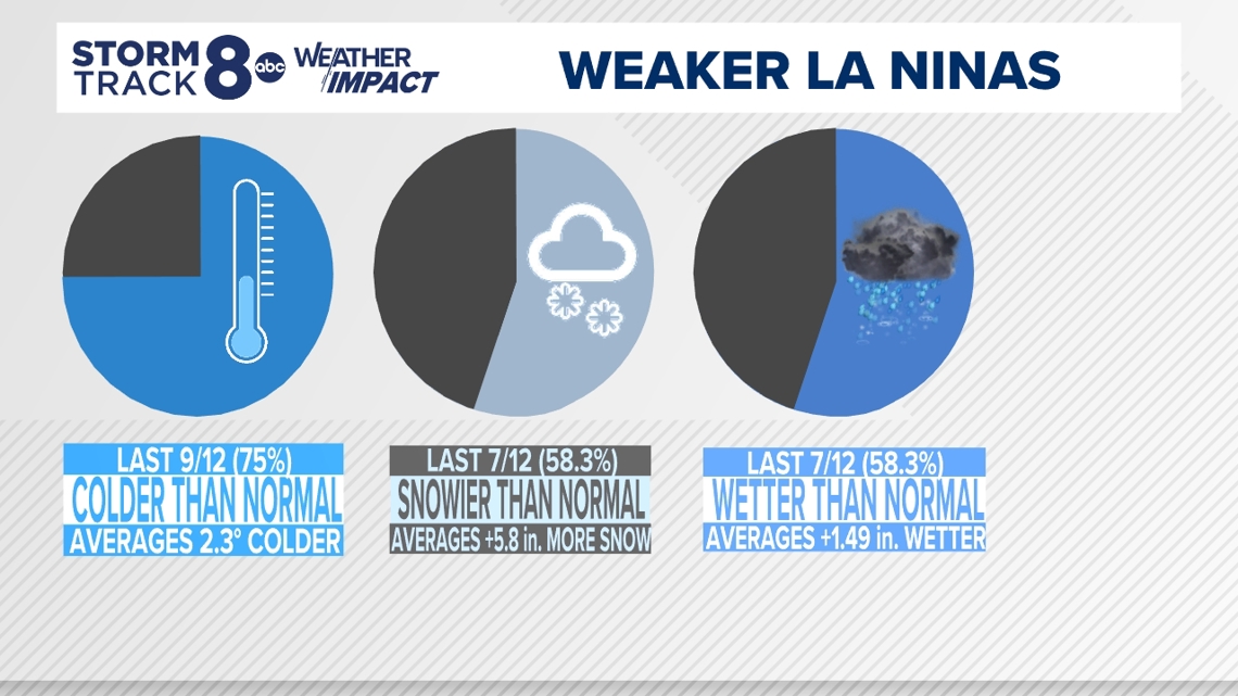
Of those 12 years, more than three-quarters of them featured colder-than-average winter temperatures. Around 2.3°F colder on average. More than half also brought generous snowfalls, averaging around 6" more for the total winter season compared to normal. These winters also brought more wet weather, with more than half experiencing more rainfall. Check out the raw data below regarding the average winter temperature for these years along with the difference in rain and snow compared to normal.

Tracking the Polar Vortex
The strength of the Polar Vortex is another critical piece of the puzzle we have to take into consideration. As of early October, the polar vortex remains exceptionally weak. While this may sound like a good thing, it isn't. A weak polar vortex doesn't have a circular shape, rather it is oblong with different pockets of cold air sinking further south than usual. A stronger polar vortex appears nearly perfectly circular, keeping the worst of the cold bottled up near the poles. A weaker polar vortex means we'll be vulnerable to occasional Arctic blasts of air.

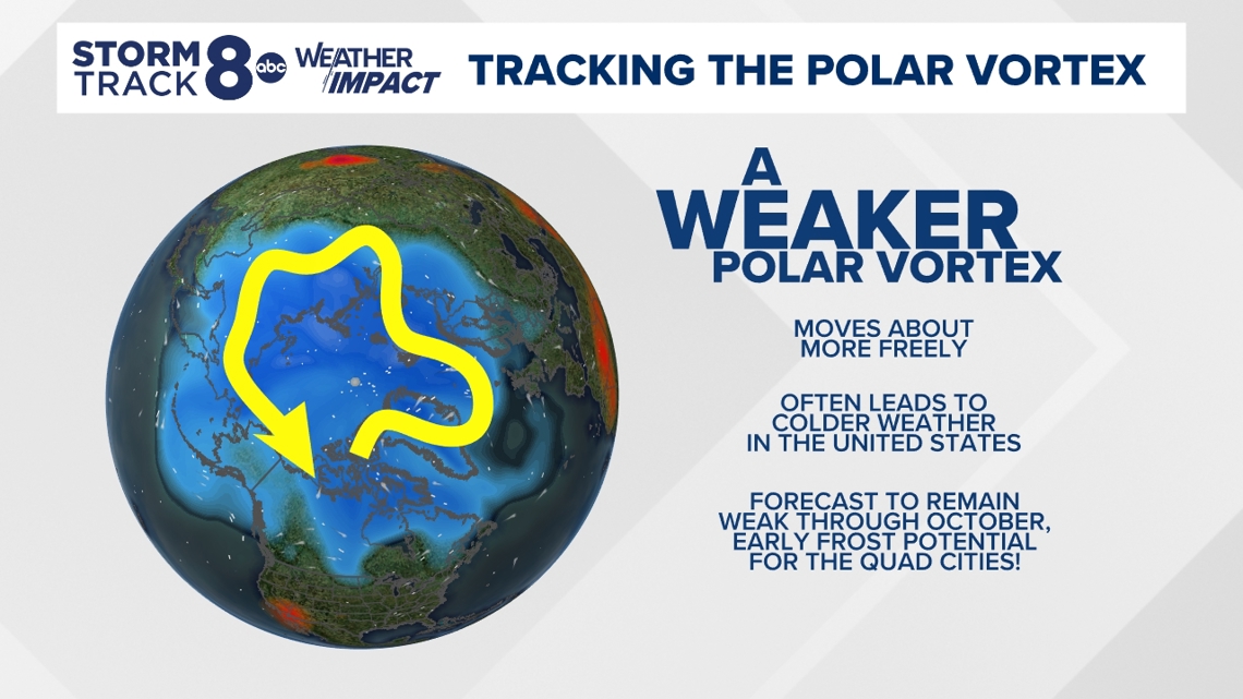
Should the polar vortex remain weak through the winter months, we can anticipate some bitterly cold periods to take place this winter season. Remember, the polar vortex doesn't technically move into the United States, rather offshoots or children of the vortex itself move through our region.
The final verdict
Piecing the entire puzzle together, the Quad Cities will likely experience a colder-than-normal winter season, with occasional blasts of bitter cold should the polar vortex remain weak, which it is currently forecast to be.

On the rain and snow front, we've seen many variations of this play out during the winter season. The odds right now favor above-normal snowfall for the entire Quad Cities region, and above-normal rainfall as well.

NOAA's official winter season outlook agrees with this thinking, especially when it comes to snow and rainfall. Where they differ is in temperatures, with equal chances of both above and below-normal temperatures currently in their outlook.