MOLINE, Ill. — The U.S. National Weather Service in the Quad Cities has confirmed that significant damage along the John Deere Road corridor on April 4, 2023, was the result of a tornado with winds up to 100 mph.
The tornado formed from a supercell thunderstorm that dropped tennis-ball-sized hail in parts of Davenport earlier that morning, causing significant damage to vehicles. Straight-line winds of 90 mph were also measured at the Quad Cities International Airport as the storm rolled through, toppling trees and powerlines. Meteorologists continue to conduct storm surveys and review damage photos as they put together their final assessment.


Meteorologists say the tornado touched down around 9:47 a.m. just east of Interstate 74 along John Deere Road and lifted shortly after 9:49 a.m., traveling a path of 1.6 miles. The tornado itself was quite narrow, with a width of about 25 yards. The tornado caused significant damage to retail signage and roofs, and even flipped a semi-tractor trailer on its side.


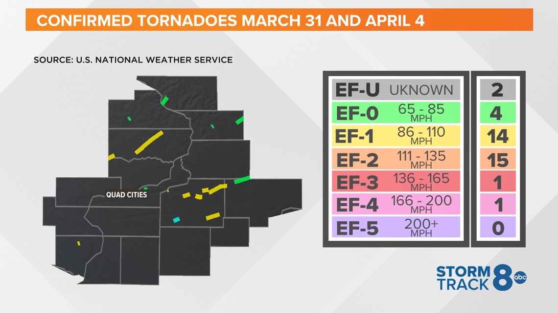
This storm system was part of a multi-day severe weather outbreak that began on March 31, which spawned another outbreak of tornadoes, including an EF-2 tornado that tore the roof off of a Colona gas station, causing one wall of the building to completely collapse. In all, from March 31 through April 4, 37 tornadoes were confirmed in the Quad Cities region.


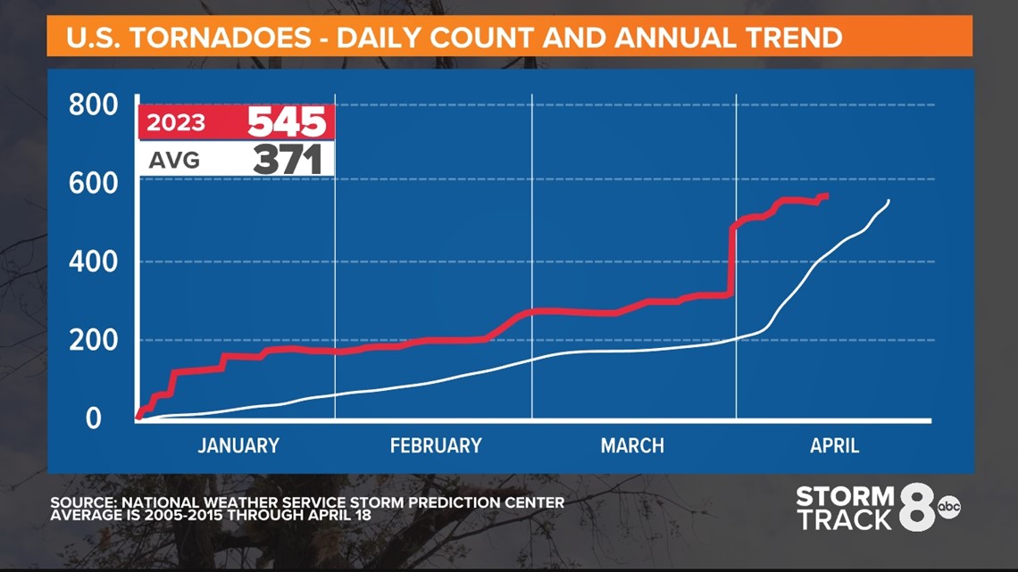
2023 as a whole continues to see an above-average number of tornadoes so far, with 545 confirmed. The average is just shy of 400. In fact, according to the National Weather Service Storm Prediction Center, January, February, and March of this year saw the most number of tornadoes on record, 410. The previous record was 398 set in 2017.
March 31, 2023 will also go down as the fourth most confirmed tornadoes on a single day since 1950, with 122 recorded.

