MOLINE, Ill. — Spring is just under two weeks away. With spring comes severe weather, and most notably, thunderstorms. There are many types of thunderstorms that you might not even think about when you go outside and see that it's raining.
The most basic type of thunderstorm is called a single-cell thunderstorm. They don’t last for long and can range from a couple of minutes to an hour . They're small and most common during the summer, especially off the coast of Florida. They can produce brief, heavy rainfall and lightning.
Multi-cell thunderstorms are many single-cell thunderstorms put together. Just like a single-cell, the individual thunderstorms within the system can last under an hour individually. However, the system as a whole can last for hours, as long as updrafts are still blowing. They can produce hail, strong winds, brief tornadoes and flooding.
Squall lines are a group of storms moving in a line. They derive their name from the squalls of high winds and heavy rain they carry. They pass through quickly like a single-cell, and can infrequently produce weak tornadoes. Squall lines are not that wide, they can only get about 10 to 20 miles wide. However they can get very long, sometimes stretching across multiple states.
A bow and echo has the same shape as a squall, but it bows out (curves) due to winds falling behind the line and circulations developing on either end. The more the bow curves indicates stronger or higher winds, where the storms are moving the fastest. Tornadoes have the possibility of occurring mainly on the leading edge (curve) of the storm.
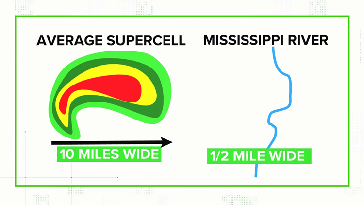
A supercell thunderstorm is a strong, highly organized single-cell storm that can rotate. These storms are capable of producing large, violent tornadoes. Rotation develops within in the storm, becoming what is called a mesocyclone, anywhere from 20 minutes to an hour, and lasts for hours afterwards. There are three types of supercells: rear flank, classic and front flank. Rear flank supercells produce low amounts of precipitation and front flank supercells produce high precipitation.
A derecho is a widespread, long-lived storm that is accompanied by rapidly moving showers or thunderstorms. They do not produce tornadoes, but they can produce straight-line winds which can cause similar damage. In order for an event to be classified as a derecho, its wind damage path must extent 240 miles and have winds greater than 58 mph for at least majority of the duration, if not all.


