MOLINE, Ill. — UPDATE: THIS THREAT HAS PASSED THROUGH THE REGION
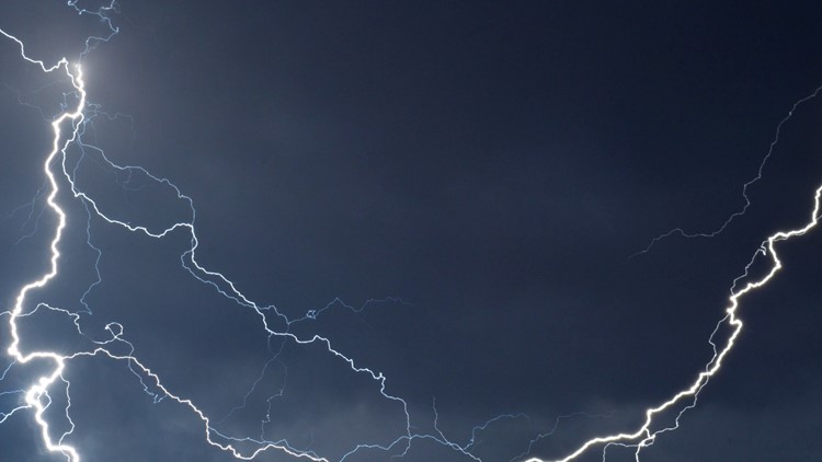
A line of strong storms is set to move through the News 8 viewing region Tuesday evening. There is a potential for severe weather threats, including damaging winds, tornadoes and hail.
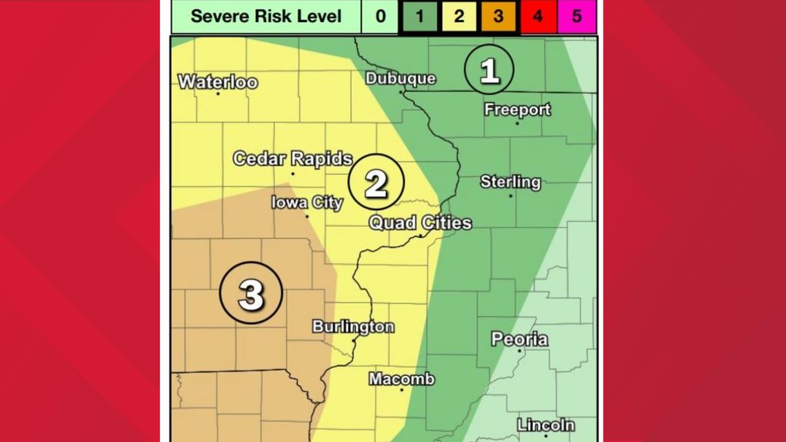
Areas west of the Quad Cities have a higher potential for severe weather at a 3/5 threat. According to the National Weather Service Quad Cities, the metro area is at a 2/5 as of 3 p.m. Areas eastward into Illinois sit at a 1/5 threat.
Find storm photos from the News 8 community on our Near Me page


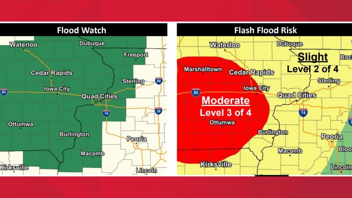
As Mississippi River water levels continue to rise, tonight's forecasted heavy rain could result in flash flooding throughout the area. Areas west of the Quad Cities near Ottumwa are at a moderate risk for flash floods while the News 8 viewing region sits at slight risk, or 2 out of 4.

StormTrack8 is monitoring the storm as it passes through the Quad Cities area on Tuesday afternoon. Sctoll down for live updates to keep you weather-aware.
Need tips on how to stay safe during severe weather? Check out the National Weather Service's Severe Weather Safety Guidelines here.
Stay weather aware by downloading the Storm Track 8 mobile app to get live weather alerts sent straight to your phone.
Follow the StormTrack8 weather team on social media:
Live update
9:10 p.m. | NWS Quad Cities says severe threat continues to die down
8:47 p.m. | NWS Quad Cities provides update on storms moving through
8:06 p.m. | A severe thunderstorm warning is in effect until 9 p.m. in Stark and Knox counties
8:03 p.m. | Severe thunderstorm warning in effect until 8:45 p.m. near Kewanee, Galva and Cambridge
7:29 p.m. | Parts of Illinois are under a severe thunderstorm watch until 11 p.m.
7:21 p.m. | A severe thunderstorm warning is in effect until 8 p.m. for much of the viewing region
7:13 p.m. | A flash flood warning is in effect for Dubuque, Jo Daviess, Jones, Delaware and Jackson counties until 1:15 a.m.
7:07 p.m. | A severe thunderstorm warning is in effect until 7:45 p.m. for parts of the viewing region
7:06 p.m. | A severe thunderstorm warning is in effect until 7:45 p.m. for hometowns on the Illinois side
6:52 p.m. | A flash flood warning is in effect until 1 a.m. for Washington, Louisa, Keokuk and Johnson counties
6:47 p.m. | A severe thunderstorm warning is in effect for Scott, Clinton, Cedar and Muscatine counties in Iowa and Rock Island, Henry and Whiteside counties until 7:30 p.m.
6:34 p.m. | A flash flood warning is in effect for parts of Cedar, Muscatine and Johnson counties until 12:45 a.m.
6:33 p.m. | A severe thunderstorm warning is in effect for Louisa, Henry, Muscatine and Washington counties in Iowa and Mercer and Rock Island counties in Illinois
6:32 p.m. | NWS Quad Cities provides update on storm system moving into the Quad Cities metro
6:27 p.m. | A tornado warning is in effect for Jones, Dubuque, Jackson and Delaware counties until 7:15 p.m.
6:23 p.m. | A tornado warning is in effect for Scott, Muscatine, Cedar, Clinton and Johnson counties until 7:15 p.m.
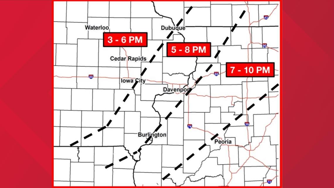
6:17 p.m. | Here's a look at when the line of storms is set to hit Muscatine, Davenport and Moline
6:16 p.m. | A severe thunderstorm warning is in effect until 7 p.m. for Muscatine, Scott, Washington, Johnson Cedar and Louisa counties in Iowa and Rock Island County in Illinois
6:13 p.m. | Storms continue to move east with NWS Quad Cities predicting they'll hit the metro area around 7:30 p.m.
6:10 p.m. | Severe thunderstorm warning still in effect until 6:30 p.m. for parts of Iowa
6:07 p.m. | Flash flooding warning in effect until 12:15 a.m.
6:02 p.m. | A severe thunderstorm warning is in effect until 6:30 p.m. for Muscatine, Washington, Johnson and Cedar counties
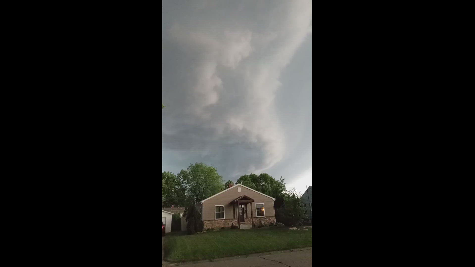
6:02 p.m. | Those in Iowa City should take cover now as a storm with rotation is set to move in
5:59 p.m. | A severe thunderstorm warning is in effect for towns on the Iowa side of the News 8 viewing region. NWS Quad Cities says the storm will have wind gusts up to 80 mph
5:53 p.m. | A severe thunderstorm warning is in effect for Jefferson, Henry, Washington, Van Buren, Keokuk and Louisa counties until 6:45 p.m.
5:51 p.m. | A tornado warning is in effect for Johnson, Muscatine, Washington, Cedar and Iowa counties until 6:30 p.m.
5:29 p.m. | Areas on the western edge of the News 8 viewing region are under a severe thunderstorm warning until 6:15 p.m.
4:56 p.m. | A storm west of the News 8 viewing region near Wellman, Iowa has rotation. NWS Quad Cities says it could reach Iowa City around 6 p.m.
https://x.com/StutzkeWX/status/1808236814768943303 A look at severe weather probabilities for the area
3:13 p.m. | A tornado watch is in effect for parts of Iowa, Illinois and Missouri until 9 p.m.