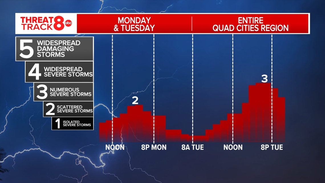
MOLINE, Ill. — Severe storms are forecasted to come through the greater Quad Cities region Monday night and most of Tuesday.
According to the National Weather Service (NWS), two to three rounds of thunderstorms will come through the region from mid-morning to late evening, with the strongest storms coming sometime between 3-9 p.m. Tuesday. The NWS projects the greatest potential dangers to be damaging winds up to 80 mph, large hail and strong tornadoes.
The NWS forecasts three rounds of storms for Tuesday. All modes of severe weather are in play with threats being high wind and a couple of tornadoes. The threat will quickly come to an end after 9 pm.
- Round 1 (7-11 a.m.)
- Along and North of Highway 30
- High confidence of severe storms
- Round 2 (1-5 p.m.)
- Along and North of I-80
- Low confidence of severe storms
- Round 3 (6-11 p.m.)
- Areawide
- Highest confidence of severe storms
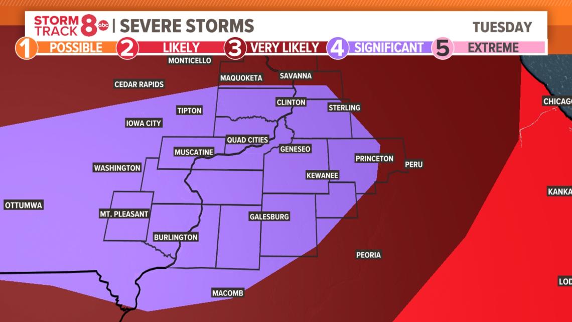
Severe Weather Threat Tuesday Afternoon

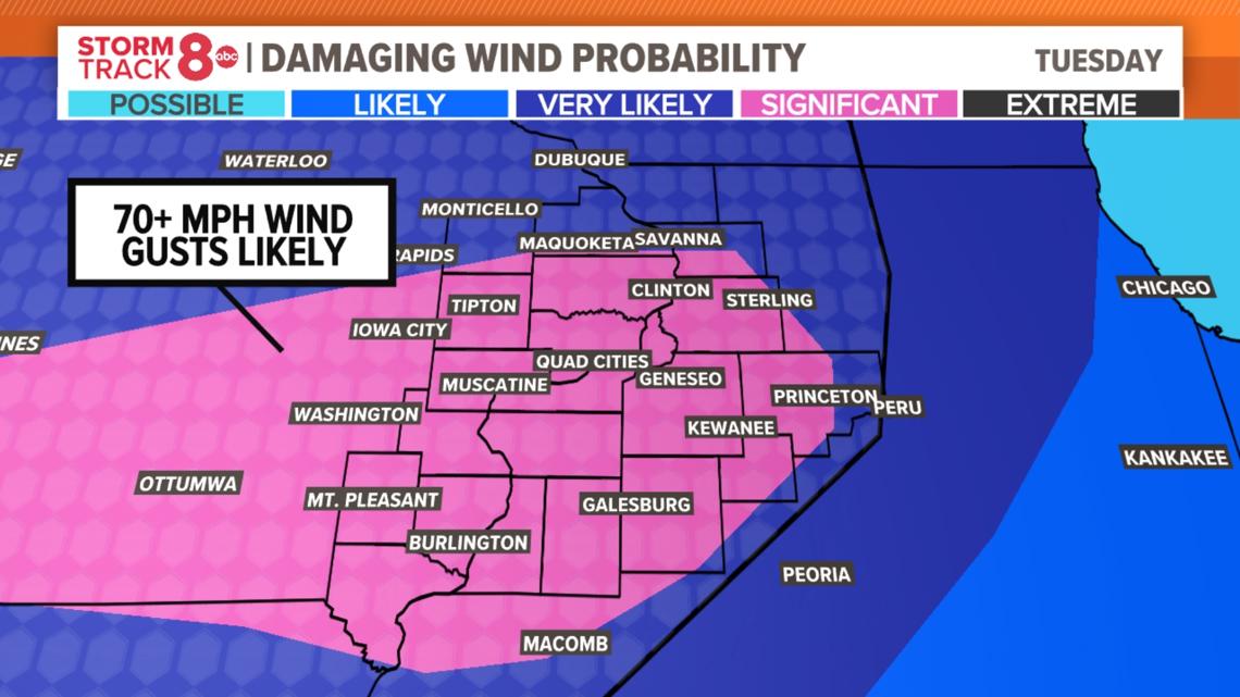
Damaging Wind Probability Tuesday Afternoon

Severe Weather Timeline

Need tips on how to stay safe during severe weather? Check out the National Weather Service's Severe Weather Safety Guidelines here.
Stay weather aware by downloading the Storm Track 8 mobile app to get live weather alerts sent straight to your phone.
Follow the StormTrack8 weather team on social media:
Watch more news, weather and sports on News 8's YouTube channel


