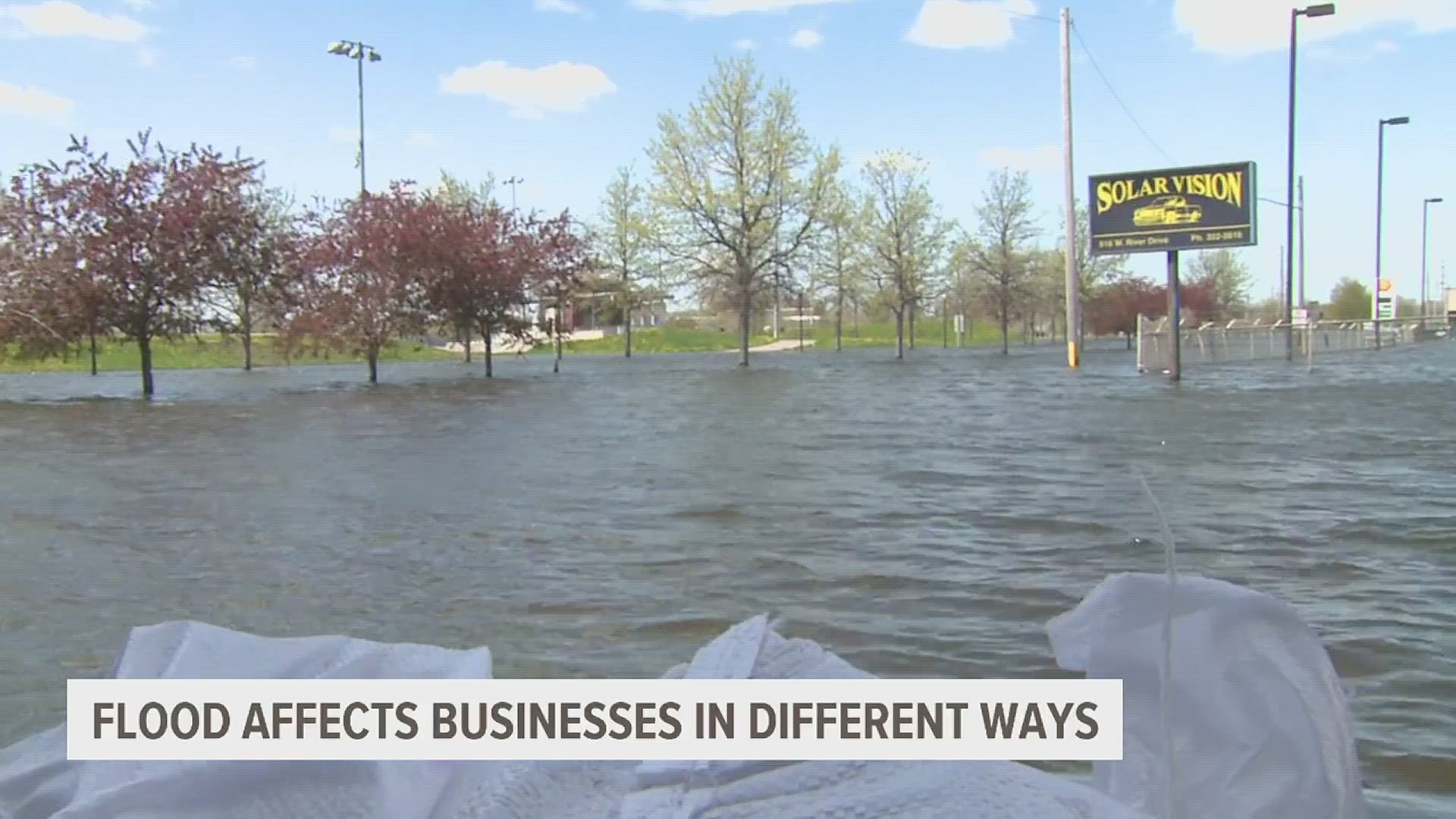
DAVENPORT, Iowa — Dale O’Donnell bought his small brick home only 100 yards or so from the Mississippi River because he enjoys watching the river and wanted a good view from his front porch.
He got his money’s worth Monday as the Mississippi crested at a near-record high just feet from his home, which was surrounded by sandbags and with a sump pump hose snaking from his basement.
“It was a lot of work to get the sandbags in place but then it was just a matter of watching and hoping it goes down,” said O’Donnell, a 79-year-old retiree who bought the house three years ago. “I’ll sit on the porch and drink a cup of coffee in the morning or couple beers in the evening and see everything pass in front of me.”
O'Donnell thought his home would survive unscathed from the flooding, and that also appeared to be the case in Davenport, a city of 100,000 just a few miles north of Buffalo.
After rising for weeks, the Mississippi River reached its peak over the weekend in parts of southwest Wisconsin and northeast Iowa. It was cresting at midday Monday in Davenport and the neighboring cities of Bettendorf, Iowa, and across the river in Illinois at Rock Island and Moline.
The peak was slightly lower than forecast but still high enough to test the region's flood defenses and to keep officials on guard. Many larger cities have flood walls but Davenport relies on temporary sand-filled barriers and allows the river to flood in riverfront parks.
The rising river, caused by a surge of water from melting snowfall to the north, will likely rank in the top ten of all time in many places, but the National Weather Service still said river levels will generally remain well below past records. Forecasts call for little rain in the coming ten days, so once the river crests it should soon begin a slow decline that will last for at least two weeks.
Despite the good news, in the next few days officials will be checking their floodwalls and sandbag barriers closely. Others, though, were flocking to the Mississippi to see the giant river.
Friends Jimi Williams and Joseph Anderson of Davenport strapped kayaks atop their car and drove to the city's downtown, where they put the boats into the water and made a leisurely mile-long paddle along River Drive, which is normally busy with traffic but is now under several feet of water.
“It's smooth sailing for sure and traffic is light," Williams joked. “I haven't hit a red light, and you never can say that on River Drive.”
The high river was only a minor inconvenience in most of Davenport, and even businesses near the river were starting to return to normal.
That was the case at the Front Street Pub & Eatery, where the entrance is only about 20 feet from stacked sand barriers, said owner Tim Baldwin. People had been concerned about finding parking amid all the water but now were coming to the area to see the river, he said.
Baldwin said he wasn't worried, even though his restaurant flooded in 2019 and would again this year if the barrier failed.
“The way the city built them, we have all the confidence in the world,” Baldwin said. “We're able to stay open and that's a huge plus.”
National Weather Service meteorologist Matt Wilson said the river's crest at Davenport of 21.4 feet (6.52 meters) was slightly lower than the 21.6 feet (6.6 meters) predicted for the Quad-Cities area.
The lower crest was in part due to some of the floodwaters pushing back up into tributaries along the river, creating some extra storage space, Wilson said.
Watch more flood coverage on News 8's YouTube channel
Some roads and parks near the river are closed. The record at that spot is 22.7 feet (6.9 meters). The flood stage at that part of the river is 15 feet (4.57 meters).
Officials in towns along the river have said they are optimistic they will escape severe flooding this year, thanks to improved floodwalls and other prevention measures.
“Everybody’s plan along the river has been put to the test and everybody is passing right now,” Wilson said.
Two minor levee breaks were reported over the weekend near a wildlife refuge south of Bellevue, Iowa, and in Camanche, Iowa, that covered a couple streets with water, but Wilson said no homes were damaged, and officials were able to build a new sandbag barrier in Camanche to bring that flooding under control.
The river peaked in the Dubuque area Saturday at 23.03 feet (7 meters) — well below the 25.7 feet (7.8 meters) record — but officials there were grateful to have the floodwall still in place from when the city was built 50 years ago.
Without that floodwall, the city would be facing significant problems, said Deron Muehring, a civil engineer for the city of Dubuque.
“The floodwaters would be up to 6 feet deep in the Port of Dubuque and more than 7 feet deep in the south port,” Muehring told the Dubuque Telegraph-Herald.
The flooding is expected to ease as the spring surge of water from melting snow works its way further down the 2,300-mile (3,700-kilometer) length of the river on its way to the Gulf of Mexico. Most of the tributaries in Iowa, Illinois and other Midwest states are running lower than usual, so they won't exacerbate the flooding by dumping large amounts of water into the river.
The flooding woes come as Florida and Virginia residents are cleaning up from weekend tornadoes.
On Saturday, a tornado touched down in Palm Beach Gardens, Florida, with winds of 100 mph (160 kph), while a tornado moved through the City of Virginia Beach on Sunday, damaging dozens of homes, downing trees and causing gas leaks.
___
Associated Press writer Josh Funk contributed to this story from Omaha, Nebraska.

