When we think of thunderstorms, temperature is energy. And as our days lengthen and temperatures warm, thunderstorms will become more and more likely...especially through the month of March.
Typically, we receive our first thunderstorm days in the month of March which is why this week is "Severe Weather Awareness Week" in the state of Illinois. It's a week to begin thinking about what is necessary to stay safe during times of severe weather.


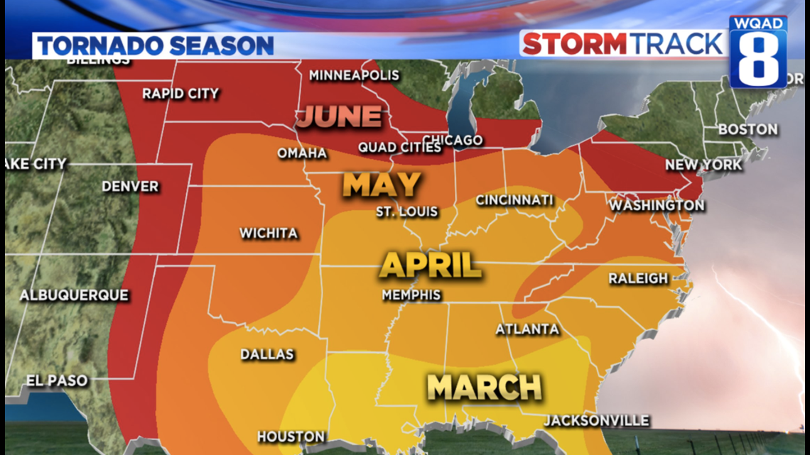
Severe weather and tornado season begins across the country in the month of March with places like Houston, New Orleans, and Mobile seeing more severe this month than any other.
The season loosely moves from south to north, affecting places like Dallas, Memphis, Atlanta, and Charlotte in April. May is primetime for tornadoes in Oklahoma and Kansas, as well as Central Illinois and Indiana.
For Eastern Iowa and Western Illinois, late May and early June are the peak of severe weather and tornado season. The peak of flash flooding season occurs a little later in the month of June.
So what should you do?
Now is the time to come up with a severe weather plan. Have a way to get warnings and know when to react.
WQAD News 8 has more Meteorologists than any team in Quad City television. We have the ability to be here round the clock to track every storm from the first warning to the all-clear.


What is the outlook?
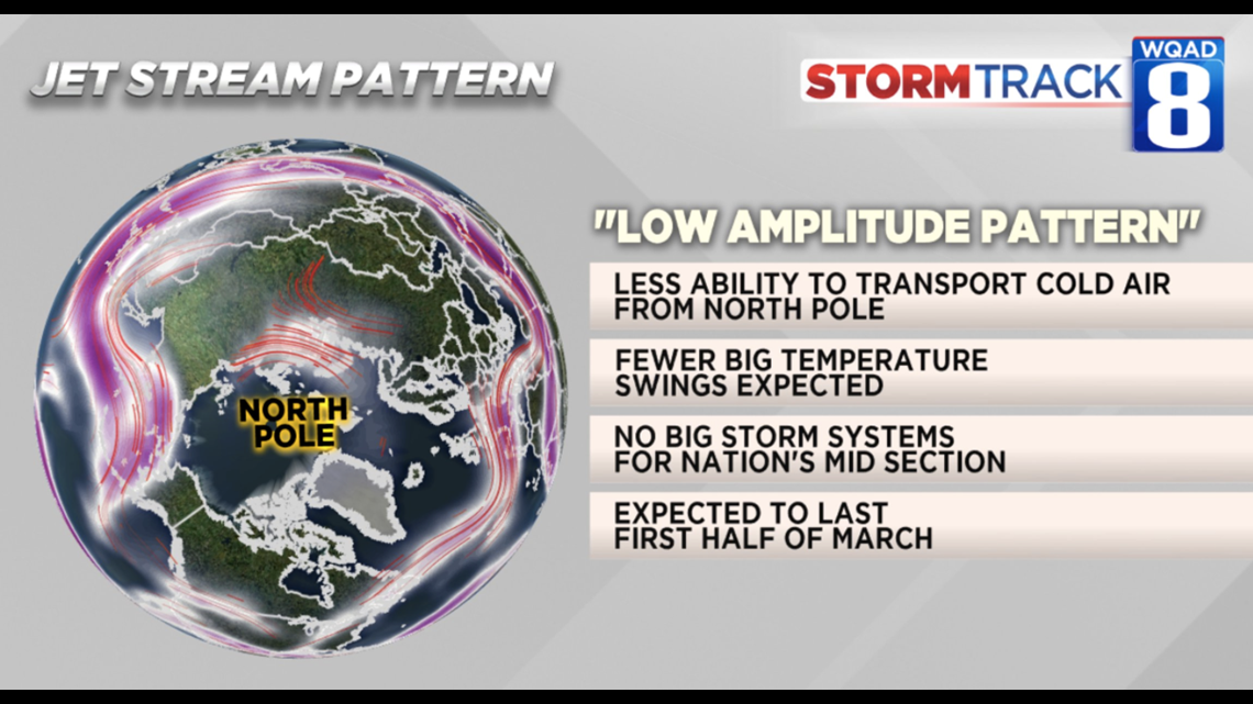
Severe weather is not looking very likely through the next 2 weeks as the jet stream (a component needed to produce severe weather) remains out of our area. Click here for the first few days of the severe weather outlook from the Storm Prediction Center.
-Meteorologist Eric Sorensen

