MOLINE, Ill. — The month of July has been much nicer to the Quad Cities when it comes to rainfall compared to the early part of the summer 2023 season. A flash drought quickly set in thanks to drier-than-normal conditions in May through much of June. This is also a critical time period for most crops as their growth accelerates.
How did we get here?
The month of May brought about an exceptionally long stretch of dry weather that began on May 15 and lasted until June 18. While some rain did fall during that time frame, it came in very small batches that amounted to no more than a quarter of an inch in total, extremely low for this time of the year. Looking at the data, we actually managed to make it through all of March through July without seeing more than an inch of rainfall in a span of 24 hours. Most events managed to bring a quarter to one-half inch of rain to the observation station in Moline. Remarkable!
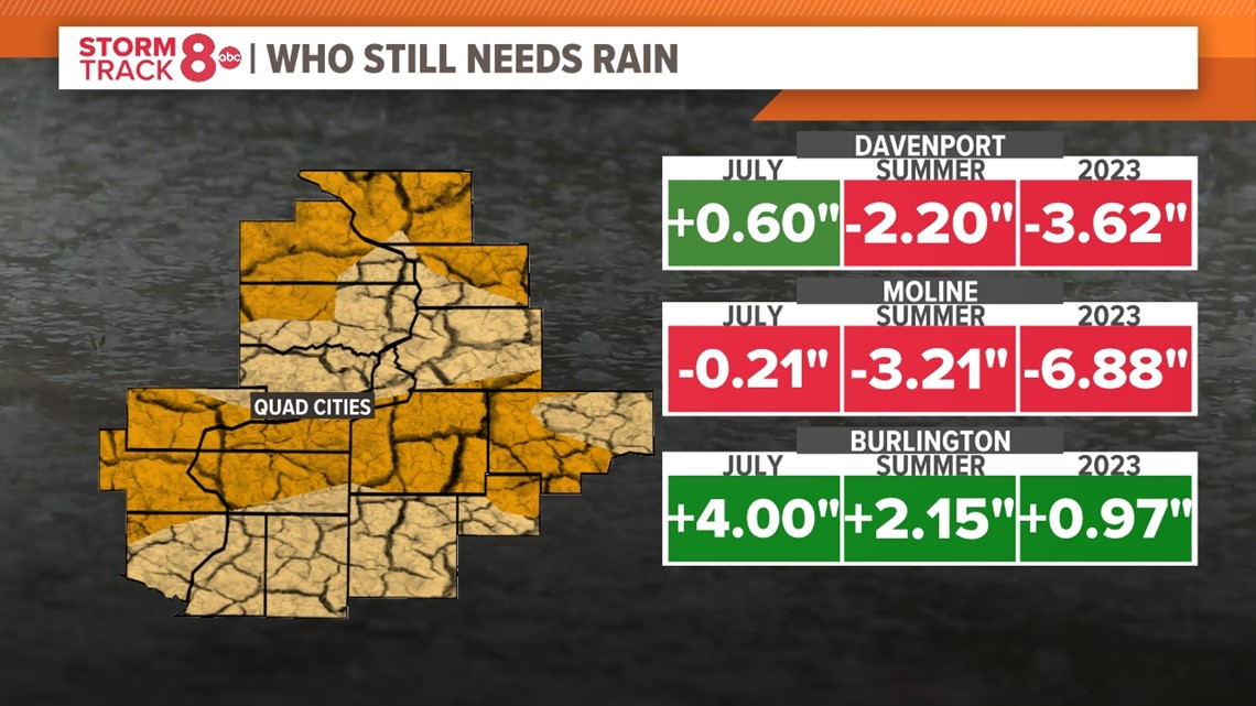
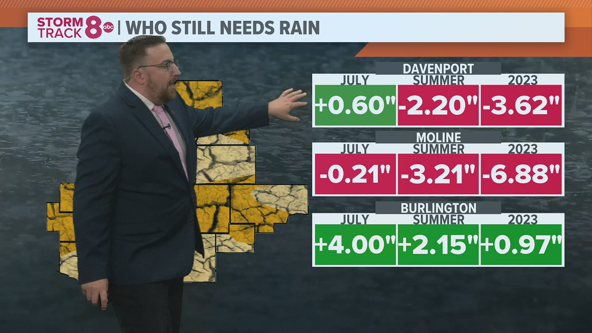
As of July 14, there are some fairly large deficits that have built up for many of our hometowns. In typical summer fashion, there are also some big differences in these deficits depending on where you live, since rainfall during the summer months is usually more scattered and localized versus other seasons. Take a look at some of the numbers below.


Moline has racked up a year-to-date rainfall deficit that is quickly approaching seven inches! Meanwhile, in Davenport, the deficit isn't nearly as large, right around three and three-quarters of an inch. Go further south toward Burlington, and a surplus exists for not only the month of July but also the summer season and the year to date so far. However, flash drought conditions are found there, too, because, like the Quad Cities, they have also had some sizeable gaps in rainfall frequency.
How do we get out of this?
Thankfully, the tide is beginning to shift in our favor in recent weeks. An active ring of fire pattern, which is notorious for bringing large clusters of showers and thunderstorms with, you guessed it, heavy rain, has settled across the region this past week. It shows no signs of leaving, at least until the end of July.


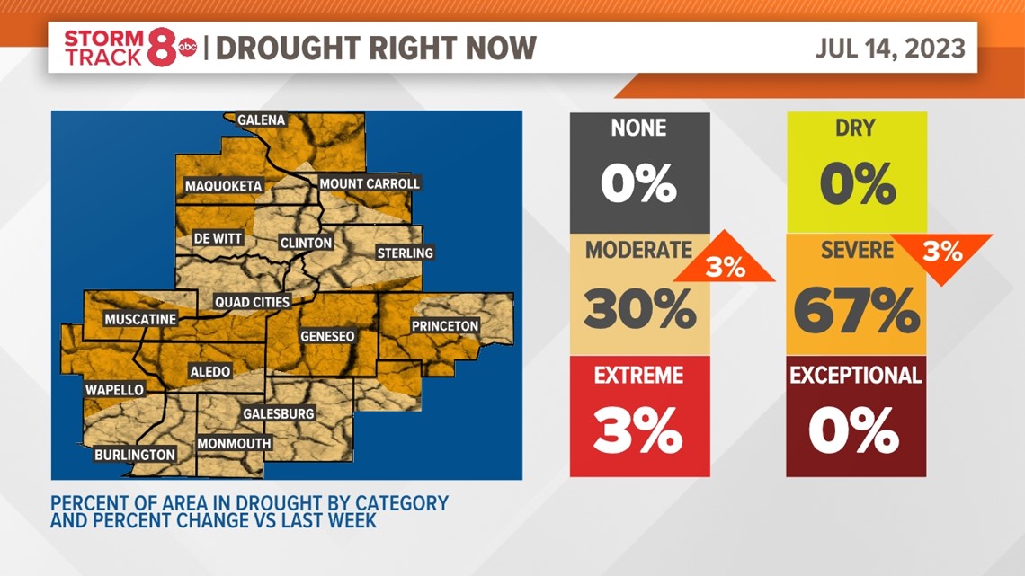
Each week a drought monitor is released that shows the various stages of drought across the U.S. The most recent one, issued Thursday morning, shows some improvement in the drought throughout our region, with a decrease in the amount of severe drought. One thing to remember, the data used in generating this graphic is about a week behind. So, it doesn't account for our active pattern here quite yet. Still, we are heading in the right direction!
What is the long-term forecast?
The expectation is that several more clusters of showers and thunderstorms will continue to traverse through the Quad Cities in the next week.


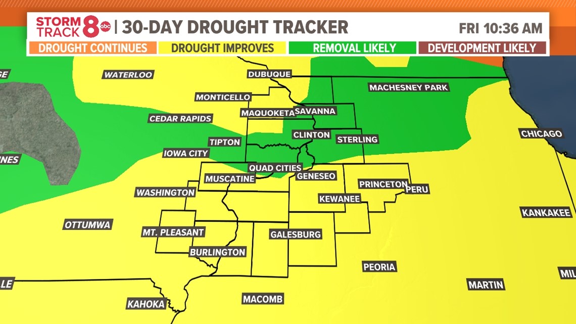
The latest drought tracker pictured above shows that many areas north of I-80 are expected to be removed from drought status by the beginning of August, while other areas will see improvement in drought conditions. Even further out into the future, we are expecting a rather robust El Nino to take over the pattern beginning this fall and likely lasting into the upcoming winter. You can read what that will likely entail, by checking out this story.

