MOLINE, Ill. — It's a Christmas miracle! After what seems like an eternity, a blanket of snow has returned to the Quad Cities just in time for the upcoming Christmas weekend.
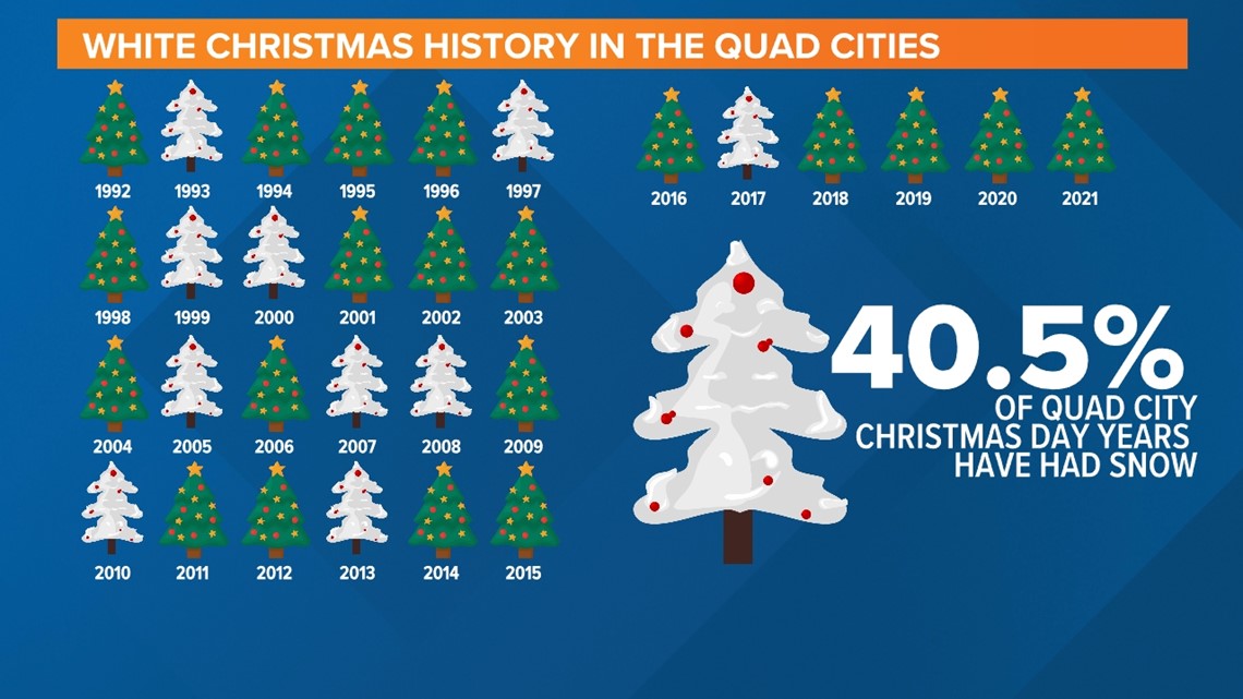
The elusive snow has somehow escaped falling on Christmas Day since 2017, and even then we only had 2 inches of snow on the ground at the time. To clarify, we are classifying a "White Christmas" as a Christmas Day that has an inch or more of snow on the ground at some point.
Some more notable snowy Christmas Day years include 2000 when we had almost a foot of snow on the ground. Before then, you would have to go all the way back to 1909 to find any similar snowfall amount!


The National Weather Service in the Quad Cities keeps official weather records in regard to snowfall amounts and depth for a given day. By their calculation, the Quad Cities has only experienced a white Christmas for less than half of all Christmas Days since records began in the early 1900s.
There are a few factors as to why that number is so low. First, as we've seen this month, the weather pattern can be highly variable. December can still produce a good amount of warmth, cutting down on the opportunity for snowfall accumulations. After all, as we have reported in the past, the winter season is the fastest warming season here in the Quad Cities when you look at the longer-range data.
So, despite the ridiculously cold temperatures that came with the snow this year, soak it up, and enjoy the beauty of the snow this Christmas Day. There's no guarantee as to what next Christmas may bring.
Watch our winter storm coverage on News 8's YouTube channel

