
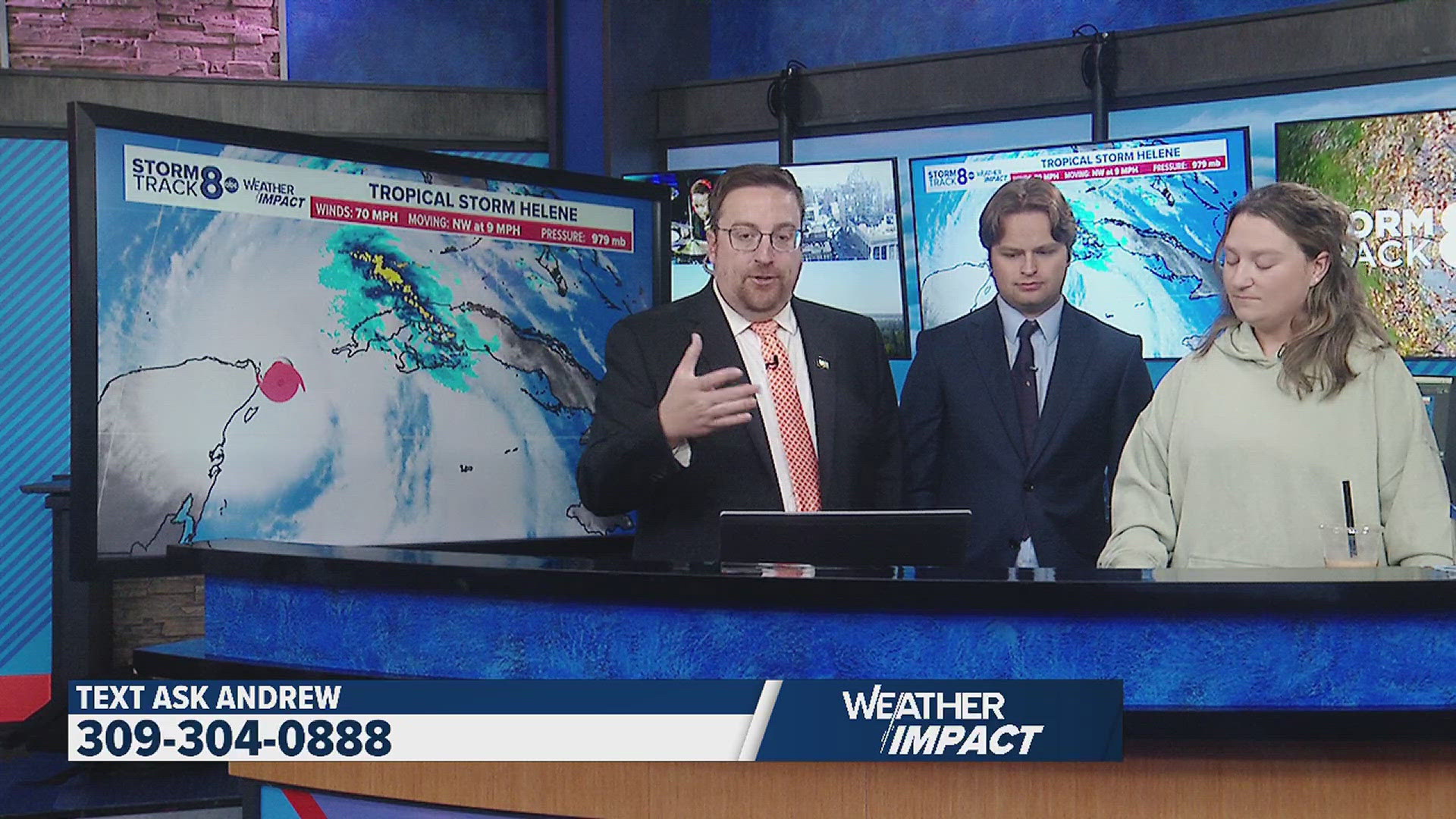
Hurricane Helene
Hurricane Helene transformed into a Category 4 storm Thursday, and while models may not show rainfall in the Quad Cities, it will still impact regional weather. This track from a tropical system hasn’t been seen for decades. Helene will bring heavy rainfall and storms surge up to 15 feet to the Florida Gulf Coast.
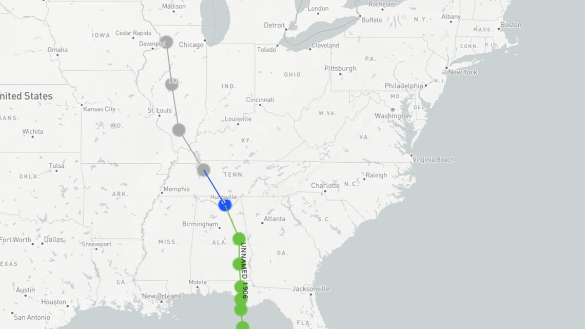
The cone projection, another word for a hurricane track, for Helene, forecasts it to the Southern Illinois-Indiana border, forming a sort of banana hook from the Florida Gulf Coast to the Midwest. This means we may see some rainfall from Helene reaching us all the way here in the Quad Cities, definitely cloud cover.
The last time a tropical system hooked from the Florida Coast to here in the Quad Cities dates back almost 120 years ago before tropical systems even received names! “Unnamed Tropical Storm” 1906 made landfall near the Florida-Alabama border on June 12, 1906, and reached the Quad Cities area on June 14, 1906.

Helene’s potential track runs to Illinois because of the Fujiwhara Effect.
The Fujiwhara Effect
The Fujiwhara Effect occurs when two areas of low pressure rotate around each other. Fujiwhara Effects are not very common and typically occur over the open ocean or as one low pressure over the ocean meets with one on land.
Hurricane Helene, it will be meeting with an area of low pressure that currently resides in Missouri that is an upper-level low, a cyclone in the upper atmosphere that contains cold air. It will grab the low pressure that is Helene moving Northwest and bring some potential rainfall here to the Quad Cities.

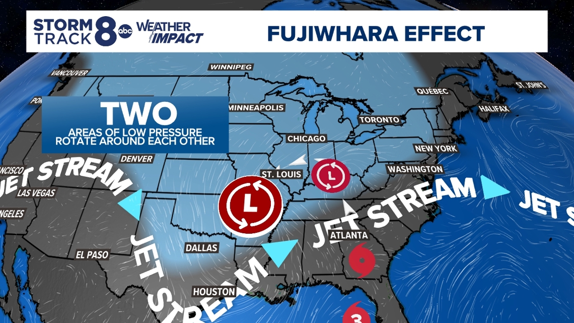
Helene is meeting with this other area of low pressure because of a Jet Stream riding down into Texas and then moving North to Northern Alabama and Georgia. This jet stream will be the catapult for Helene being sent to the Midwest, bringing cloud cover and potential rainfall from Helene here to the Quad Cities.
The rainfall we could see from Helene as it hooks Northwest looks to track South of our hometowns, but we still could see some stray showers—no sort of substantial rain in the latest forecast.
Predicting a situation like this can be very tricky. A lot of the showers we could see depend on which low absorbs the other in a sense. We could see little-to-no rain at all if the low over Missouri ends up as the “dominant” system. Most rainfall from Helene could remain South.