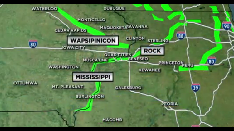
As much as a foot of rain fell in parts of Northern Illinois over the past week and all of that water has made it into the Rock River. At Moline, the water level is expected to be the second-highest in the site's history with a crest expected sometime Tuesday. That could put many roads under water.
According to the National Weather Service Quad Cities, at its present forecast crest of 16.4 feet Tuesday morning, the following areas will be inundated.
| 15.5 | Water affects the intersection of Highways 150 and 6. Steel Dam is under water in Milan. |
| 15.2 | Water affects the lowest streets on Vandruffs Island. |
| 15 | Water affects business parking lots on 52nd Avenue in Moline. Water also affects most homes on South Shore Drive and North Shore Drive. |
| 14 | Major Flood Stage. Water affects South Shore Drive and North Shore Drive in Moline west of the 27th Street bridge. Water limits access to homes on South Shore Drive east of the I-74 bridge. Water also affects portions of 60th Street south of John Deere Road. |
Upstream toward the Barstow, Joslin, and Hillsdale area, flooding will get worse by another foot and a half by this evening. A crest of 18.6 feet is expected by early Tuesday morning.
| 18.5 | Water affects the lowest sections of Moline Road east of Erie, as well as River Road. |
| 18.39 | Water affects Osborn Road at Osborn. |
| 18.3 | Water affects the railroad tracks near Osborn. |
| 18 | Water reaches the top of the Zuma Creek levee upstream of Barstow. Water also affects a few homes in Erie and Moline Road east of town. Water affects a few homes on Docia Street in Hillsdale and on the county road south of town. Water also affects a few homes in Shady Beach. |
| 17.7 | Water affects the railroad tracks south of Prophetstown. |


