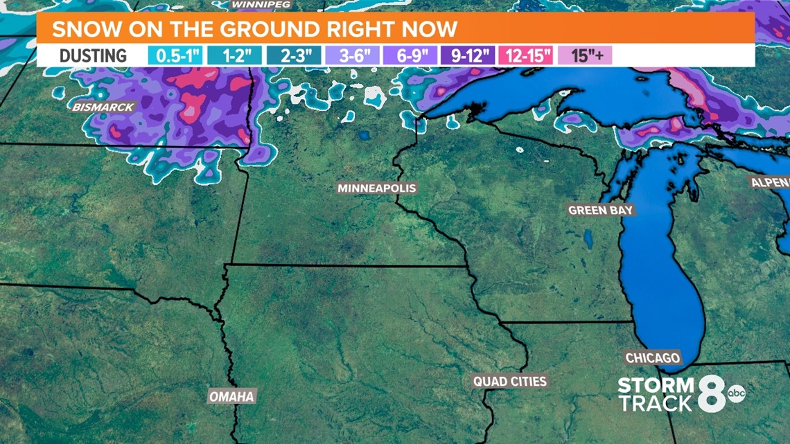
MOLINE, Ill. — The National Weather Service continues to watch the threat for flooding this season very closely. We still have an above normal threat for flooding on the Mississippi River and a near normal threat for our smaller rivers. One of the biggest concerns for flooding has been the impending melt of the heavy snowpack up north. Today there is not much of a snowpack.
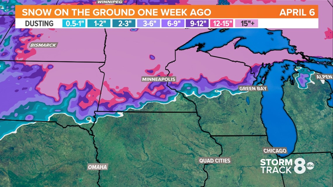
Last week the snowpack was still very deep near Minneapolis and north. A good foot or more of snow was still on the ground.


Over the past three days, warmer than normal temperatures and abundant sunshine rapidly melted the majority of the snow.


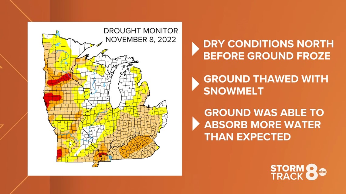
Rapid snowmelt was one of our major factors contributing to the high flood risk this season. This is where the good news comes in. Minnesota and parts of Wisconsin were experiencing moderate to exceptional drought conditions in the beginning of November 2022.


This means the ground froze with the ability to handle a lot more water. Usually we expect some mid-winter thawing with some warm spells but that wasn't the case this year as they experienced cold temperatures and abundant snowfall through the season. As the snow melted over the past few days, the ground also thawed quickly and was able to take on a lot of the snowmelt!
We are still expected to see some flooding, but we shouldn't see river levels get as high as originally forecast. River cresting is expected sometime by the end of April to the beginning of May.
In the short term, the Mississippi River at Dubuque and Burlington are expected to reach minor flood stage by the end of next week. The Mississippi River at Rock Island is expected to reach minor flood stage by next weekend. The National Weather Service will have another briefing next Thursday.
Last week's flood risk:

