
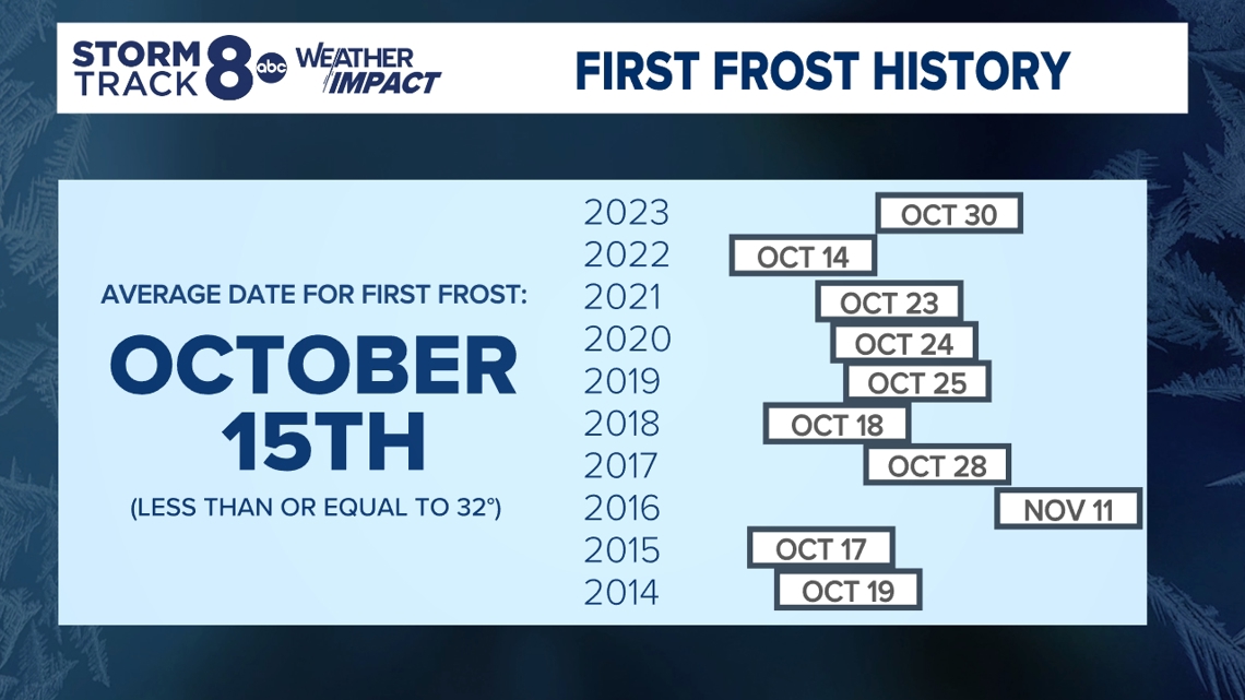
MOLINE, Ill. — As we enter the second half of October, temperatures are starting to drop and the first widespread frost is in the forecast. The average date for first frosts in the region is Oct. 15, according to data collected by our StormTrack 8 team.
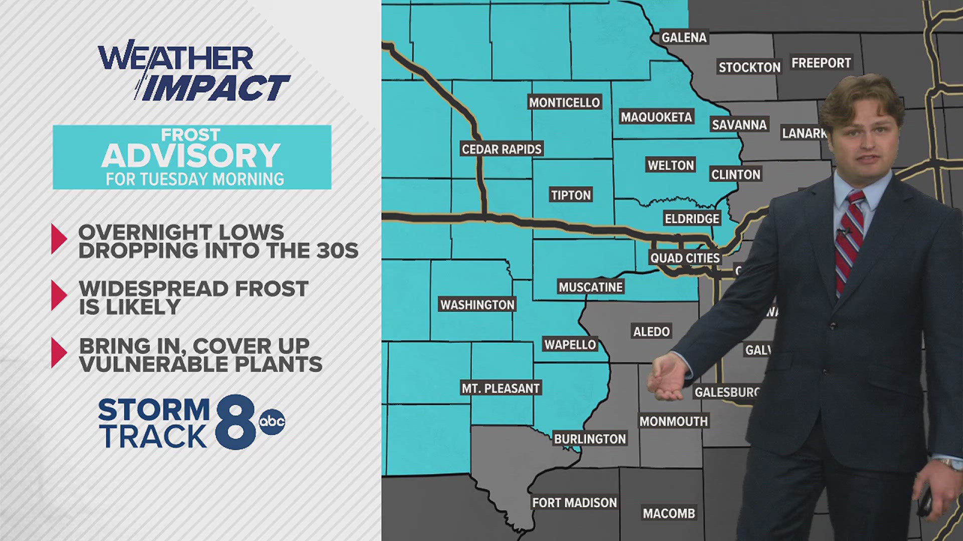
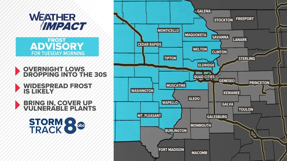
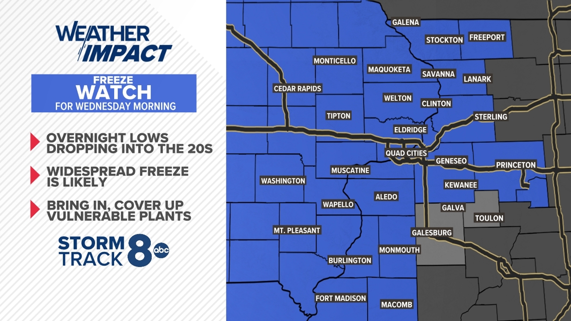
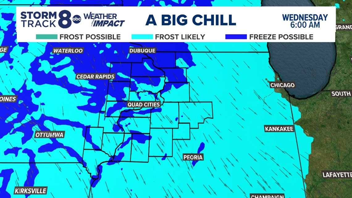
A frost advisory is in effect for much of the region overnight into Tuesday, with temperatures expected to drop to the mid-30s. Then a freeze watch is in effect overnight into Wednesday morning for much of eastern Iowa and parts of western Illinois.
Any outdoor plants that are vulnerable to the cold should be brought in or covered up. News 8 spoke with our very own plants and garden expert Craig Hignight on how to protect your plants during the anticipated frost, who recommended covering them up and making sure the plants receive plenty of water.
"You want those plants fully hydrated when the ground finally freezes, which is usually out around Christmas time," Hignight said. "A little diligence in watering now is going to pay big dividends next spring."
READ MORE: The first freeze of the season is in the forecast. Here's how you can protect your plants


When do first frosts normally happen?
Our StormTrack8 team compiled data from 2014 to 2023 to see when the first frosts took place that year — or when temperatures were less than or equal to 32 degrees Fahrenheit.
The average date is Oct. 15, meaning this year's frost is happening at a normal time compared to recent years. In 2016, it came as late as Nov. 11.

Wednesday morning outlook

____________________________________
Follow the StormTrack8 weather team on social media