MOLINE, Ill. — As meteorologists and forecasters alike follow the annual temperature cycle, March 1 is the start of meteorological spring! We start to see warmer temperatures, track in more rain than snow, and watch everything come back to life.
Astronomical spring begins on March 20 when the vernal equinox occurs. This means the suns' rays directly align with the equator. We will experience equal day and equal night on this day.
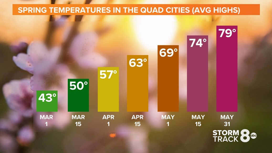
In the Quad Cities, our average high for the first day of March is 43°. By the end of the season on May 31, we will see an average high of 79°! Spring is the second season we see the biggest temperature change, following fall.

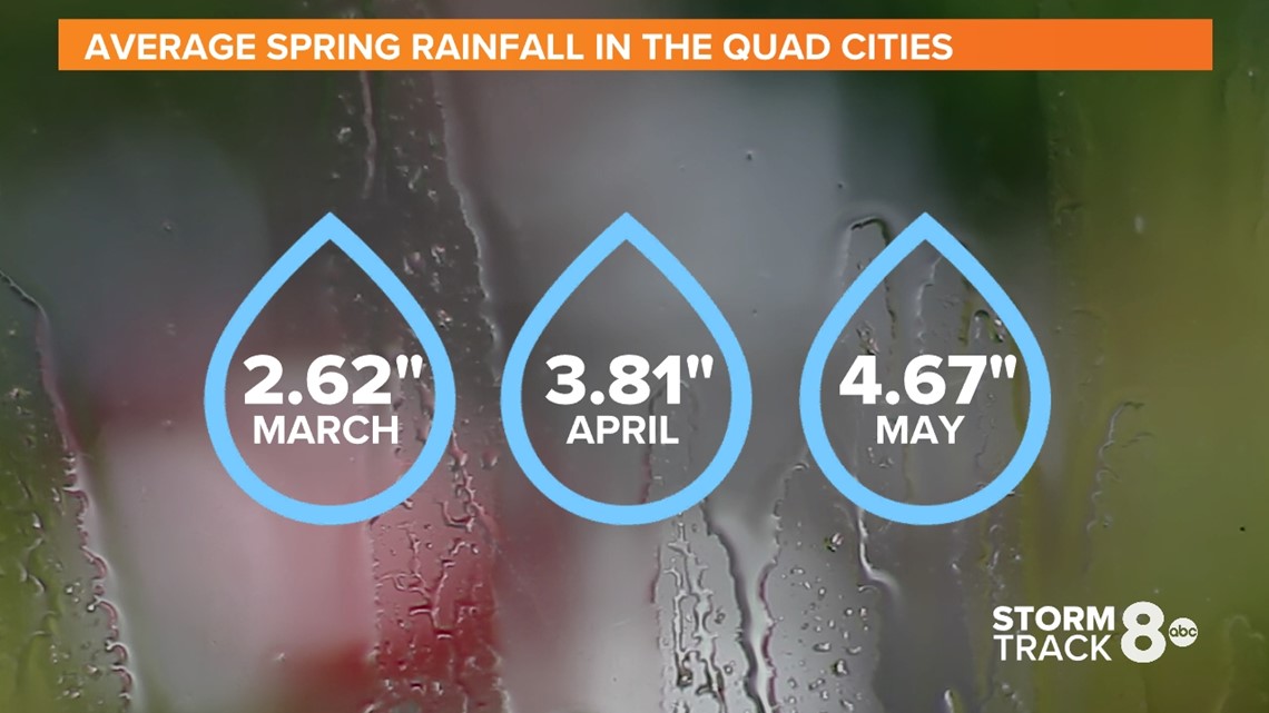
Spring is also the second rainiest season behind summer. We receive an average total of 11.1 inches of precipitation over the next three months. We also aren't done with snow. We see an average of 4.4 inches of snow during March and 1.1 inches in April.

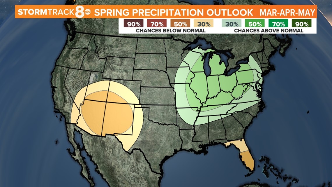
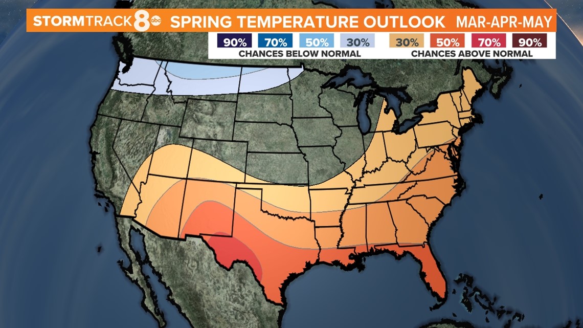
What can we expect this year? The Climate Prediction Center has our hometowns at an equal chance to experience either below or above normal temperatures. Precipitation is a different story as we see trends to above normal rainfall. That will be an important factor to determining how severe our flooding could be.


We are also keeping a close eye on the El Nino Southern Oscillation pattern as we've been stuck in the La Nina phase for the past few years. It looks like we are seeing the end to the La Nina. We are trending toward the neutral phase and possibly enter the El Nino phase by the middle of summer. It's important to note that El Nino generally brings a quieter severe weather and hurricane season to the United States. Obviously, not a guarantee!
Here are some dates to keep in mind during our summer season:
- March 12 - Daylight Saving Time begins
- March 17 - St. Patrick's Day
- March 20 - Astronomical Spring
- March 28 - Average last snowfall Quad Cities
- April 4 - Easter
- April 22 - Earth Day
- April 28 - Average last freeze Quad Cities
- May 31 - Memorial Day
► Download the WQAD News 8 App
► Subscribe to our newsletter
► Subscribe to our YouTube channel


