
The remnants of former Tropical Storm Cristobal will work towards the Quad Cities Tuesday and Wednesday. The track of this former tropical system is unusually far west for storms of this type and it will bring with it an unusually high level of moisture.
Forecasters at the National Weather Service will be keeping a close eye on where the heaviest rains fall to determine what impacts area rivers could see in the near future.
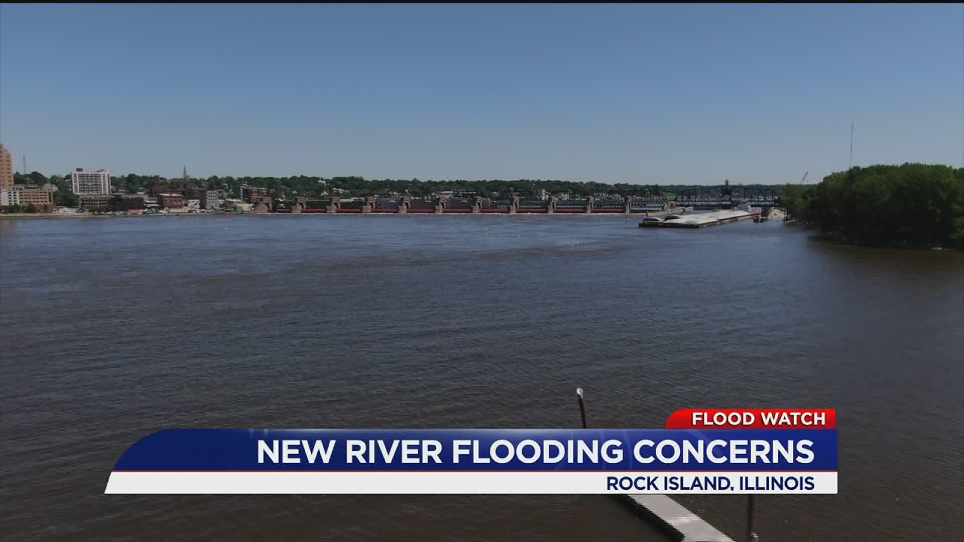
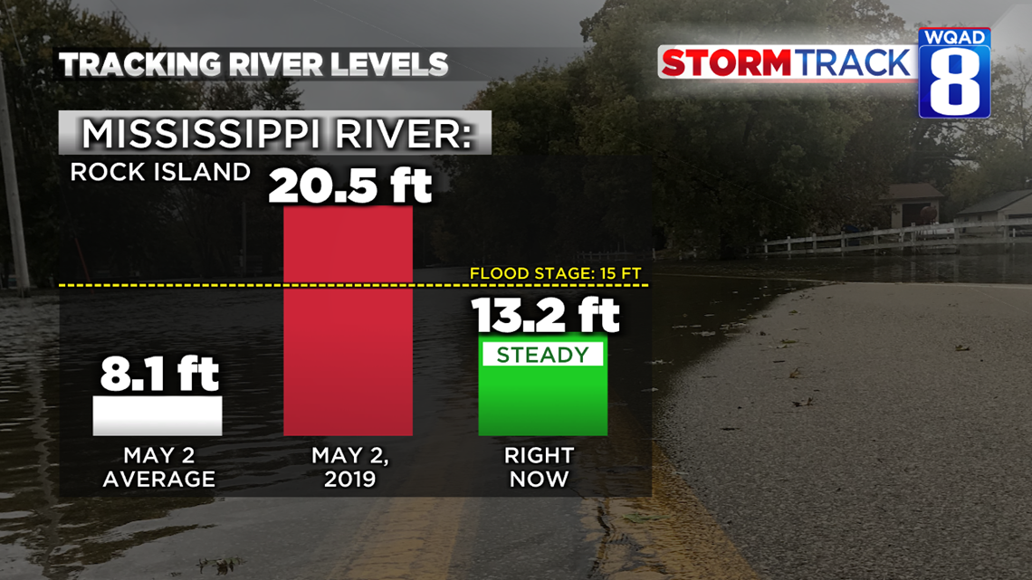
Currently, the Mississippi River levels are running higher than normal, but remain below flood stage. Typically the river would be around 8 feet, but as of the latest update, levels are hovering just above 13 feet.
Jessica Brooks, a Hydrologist at the National Weather Service in the Quad Cities, says the impacts from Cristobal are still up in the air as model solutions keep disagreeing on where the heaviest rains will fall.

Compared to last year we are in a much better situation to handle some rainfall, but with the rivers remaining elevated, any extreme rainfall will further enhance potential river flooding.
The latest forecast with Cristobal calls for the heaviest rains to fall west of the Mississippi River. That's where some of our hometowns could pick up between 2 to 4 inches of rainfall by Wednesday evening. It won't be the rainfall amounts though that have a big impact, but rather the rainfall intensity.

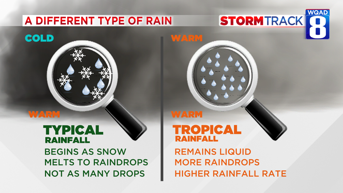
Rainfall with tropical systems is far different compared to rainfall we see with a typical thunderstorm. The process within the clouds allows more water droplets to form in tropical storm systems, thus increasing the rainfall rate. In your typical summer-time thunderstorm, a cold layer of air exists at the top of the storm clouds that keeps some of the precipitation in the form of snow before melting and falling to the ground as rain. With tropical systems, the entire depth of the cloud remains warm and open to more raindrop production. This oftentimes leads to areas of flash flooding, even if the radar doesn't look all that impressive.
Brooks says we'll get a better idea as to what impacts Cristobal will have on area rivers once we see where the storms heaviest rainfall lines up. At this time, she does not expect any of our area rivers to enter major flood stage, but some areas of flash flooding are likely where the heavier thunderstorms move through.
At this time the greatest impacts are expected along and west of the Mississippi River. That is where the heaviest rains will likely fall.