ROCK ISLAND ARSENAL, Ill. — We talk a lot about the water levels on the Mississippi River. Sometimes the river runs high, sometimes it runs low, like it has in recent days. When we communicate how high or low the river is, we use the standard height measurement in feet. Also, it wasn't that long ago when I put together a story detailing how folks at the Rock Island Arsenal measure the Mississippi River daily. It was quite eye-opening! Kirk from Muscatine had a great question in relation to water levels, asking, "With the Mississippi trying to maintain a 9 ft channel depth for barges when they say river level is 3.2 ft is that added to the 9 ft requirement?" Let's dig in!
What exactly is zero and why does it start there?
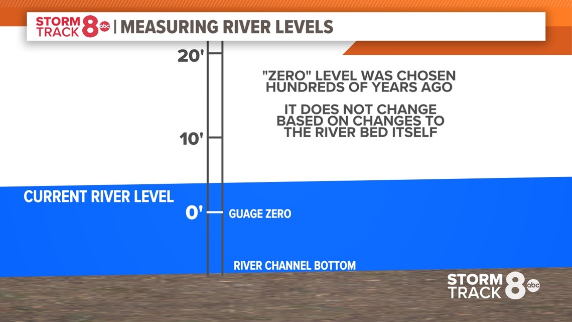
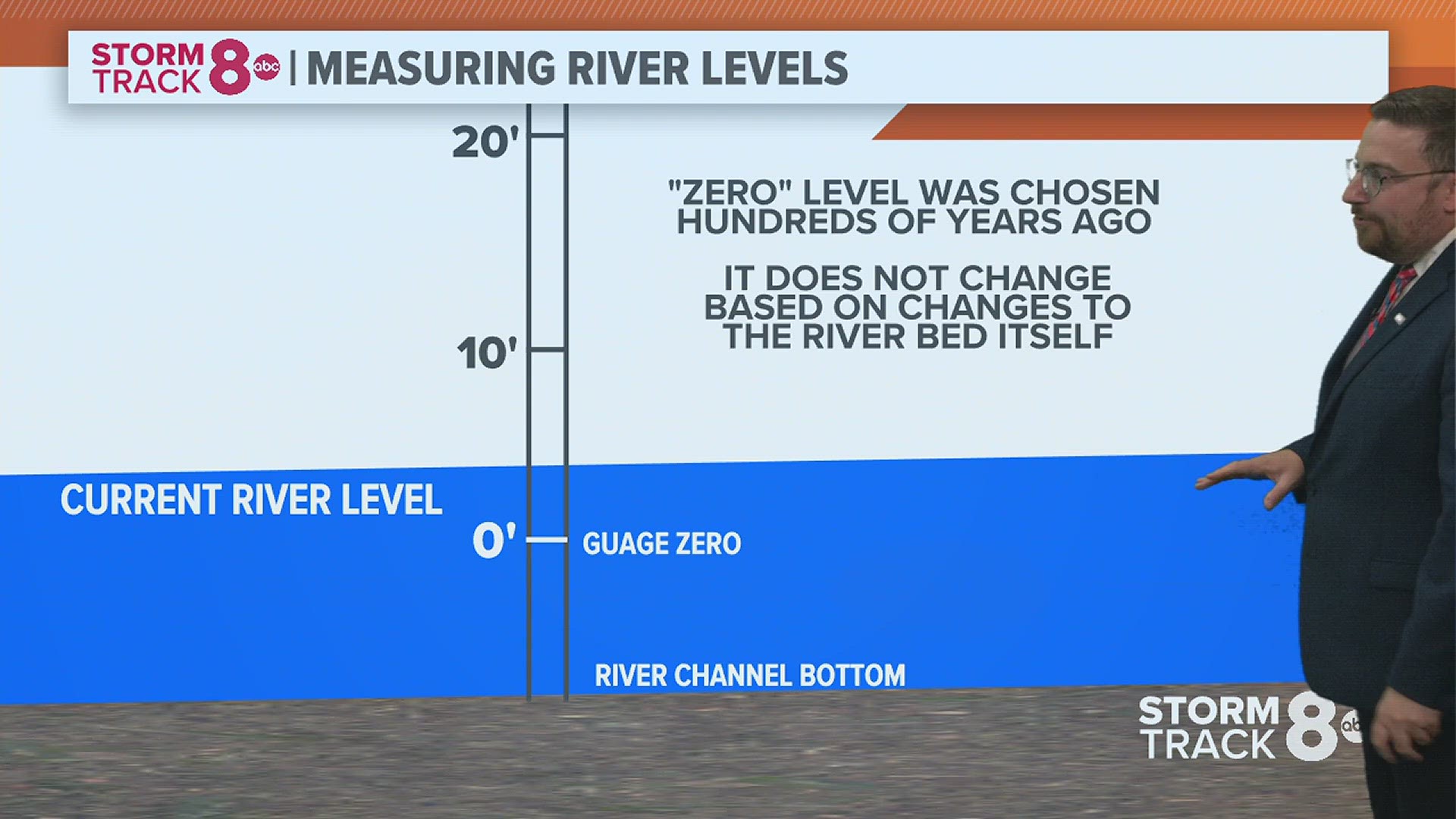
Most people automatically assume that the level "zero" is the bottom of the Mississippi River or any given river for that fact. But, it really isn't. This "zero" level was established in most cases hundreds of years ago. Changes to the riverbed, including dredging, and the settlement of mud, silt, and other debris consistently change the landscape at the bottom of the river itself.


It also makes sense to have the "zero" water level above the base of the river because, from a historical records perspective, you want records that maintain the same baseline over a long period of time. If you are constantly changing the "zero" level, you are also changing the rest of the levels, too. You can see how this would be an absolute nightmare to sort out over a long period of time.
So, the current level of the Mississippi River is sitting at 3.65 feet as of Monday morning. However, the Army Corps of Engineers is still able to maintain a 9-foot depth for shipping and other navigating activities because that three-foot measurement is not directly related to the total depth of the river, rather, just related to the previously established "zero" depth. The river is absolutely much deeper than three feet in numerous locations.
Where did these river-level numbers come from?
What about the stage numbers, what does exactly 15 feet mean? Chris Trefry is the Water Control Chief for Lock and Dam 15 in Rock Island and he explains what the numbers associated with the water levels really mean.


"Those are just arbitrary numbers that were determined at some point in time. Years ago these stage numbers were determined to get you to a certain elevation and it's unique to each site. So, 20 feet here at Lock and Dam 15 does not mean you have 20 feet of water.", says Trefry. These levels and stages were set back in the 1930s, and have changed since then. The stages are used to help communicate what levels will see more significant impacts on life and property. They vary from each measuring location greatly, so you'll want to keep tabs on what the different levels mean for your location.
Have a question you would like me to answer for an upcoming Ask Andrew segment? Submit it, here.
Watch more news, weather and sports on our YouTube channel

