MOLINE, Ill. — If you are an avid watcher of any local TV news broadcast, the temperature map looks quite familiar. You've likely noticed that some hometowns always seem to be cooler or warmer than the surrounding areas. Paul M. from Davenport was curious as to why this is, asking, "Why do the Davenport, Galesburg temperatures always read cooler than Moline?" He wasn't the only one asking! I had another similar question come in this week, so, now is a good time to tackle it. Let's dig in!
Location matters
The official observation station in Moline is located at the Quad Cities International Airport. This is very common as the vast majority of weather stations across the country are located in and around airports for obvious reasons. Real-time weather information is extremely important for aviation! Similarly, Davenport's official observation station is located at the Davenport Municipal Airport near Mount Joy. Lastly, you guessed it! The observation for Galesburg is also located at the Galesburg Municipal Airport.

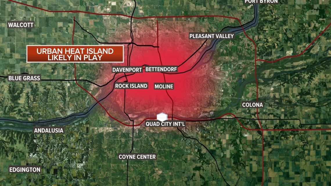
Moline typically reads a few degrees warmer than its counterpart in Davenport. My theory is there are likely a few reasons for this. On the above map, it's easy to see that the Quad Cities International Airport is extremely close to the entire Quad Cities urban heat island.
What is an urban heat island?

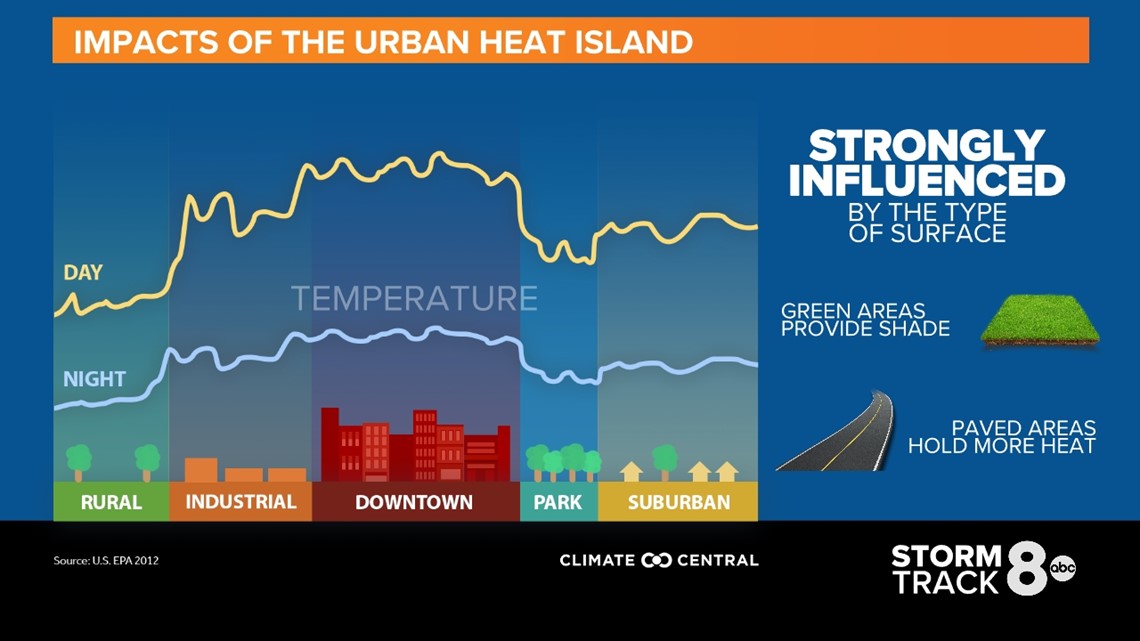
Not familiar with what an urban heat island is? Think about all of the pavement that sits throughout this region. A lot of dense housing, commercial, and of course, roadways. All of this pavement attracts and holds a lot of heat, at any time of year, but especially during the warmer seasons.
Why Davenport and Galesburg are typically cooler

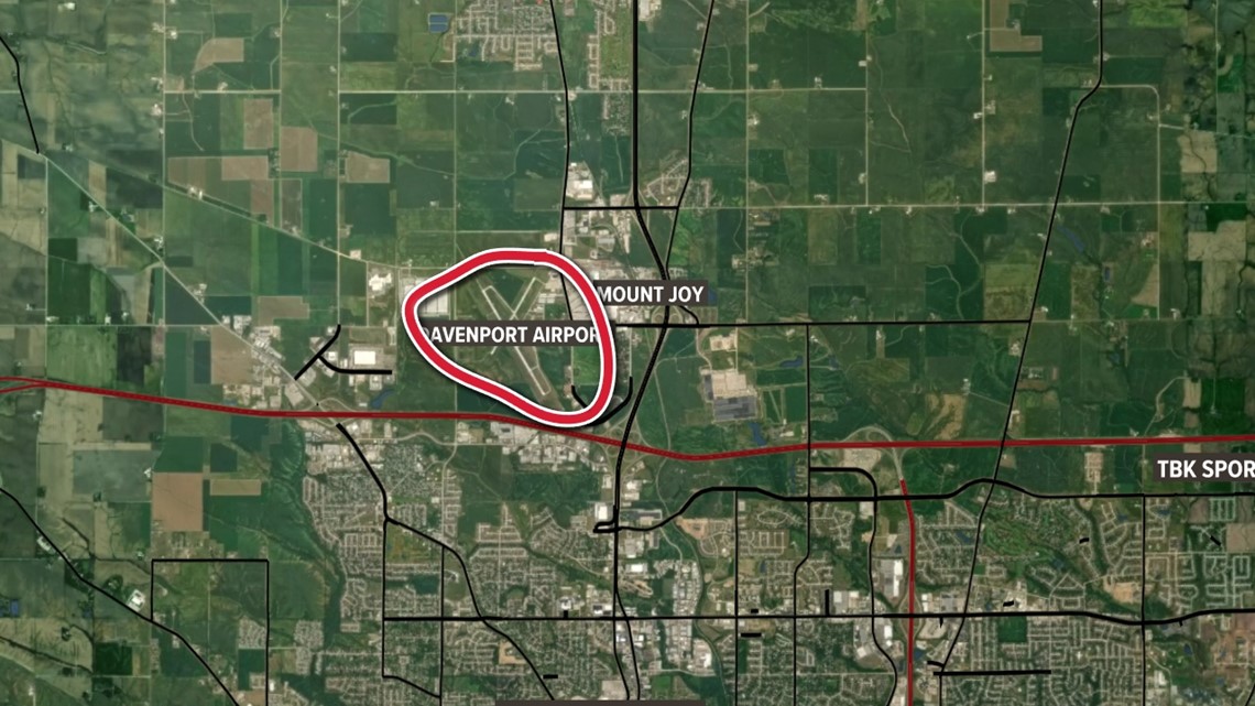
Davenport's location is also near an urban heat island, but not nearly as close as Moline. There are a few more open areas of farm fields and undeveloped property surrounding the runways. Speaking of runways, the airport here has far less runway coverage compared to that of Moline, likely leading to a slightly cooler temperature reading as well. I don't believe the Mississippi River to the south has much of an influence on the temperature here since it is pretty well removed from that feature.

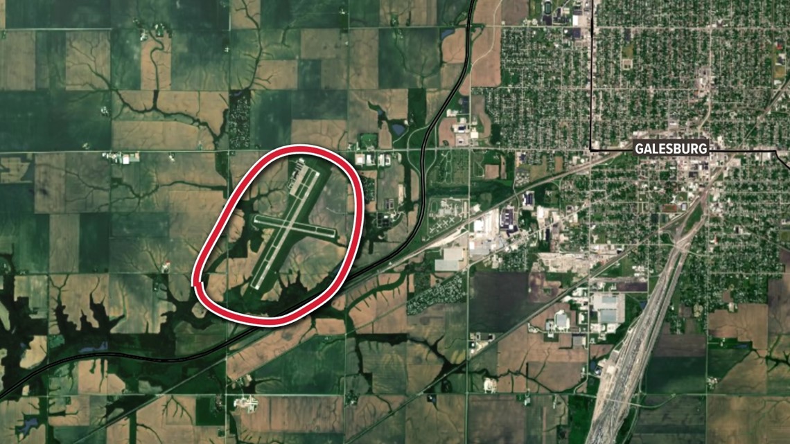
Galesburg's observation station is located in a prime spot to mitigate most urban heat island impacts, especially because it lies west of the city. With most wind patterns favoring a westerly component, that dome of warm air would likely be swept well east of this region. Also, notice how many fields and even water features lie near the airport, likely adding to the slightly cooler temperature readings.
Does elevation affect temperature?
Many of you have also asked about elevation. Is it possible these weather stations are located in a valley, which typically sees cooler readings? After all, we know cool/cold air sinks to the ground. Well, I dug into that as well, and as it turns out, between all three stations, Moline has the lowest elevation! Makes sense because of its proximity to the Rock River. The other two stations do not appear to be in valleys based on the surrounding elevation, likely dispelling that reasoning.
Have a question that you would like me to answer for an upcoming Ask Andrew segment? Submit it, here!

