MOLINE, Ill — Waters in the Eastern Pacific continue to warm as El Niño intensifies heading into the upcoming winter season. Earlier this month, NOAA, the governing body of meteorology in the United States, warned that this round of El Niño has a good probability of becoming historically strong. In fact, there is a greater than 60% probability that El Niño conditions will persist into the upcoming spring of 2024. So, what exactly is a 'super El Niño' and what does that mean for our weather pattern in the months ahead? Let's dig in!
'Super El Niños' are rare and powerful
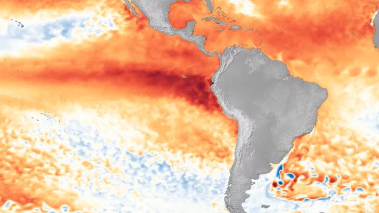
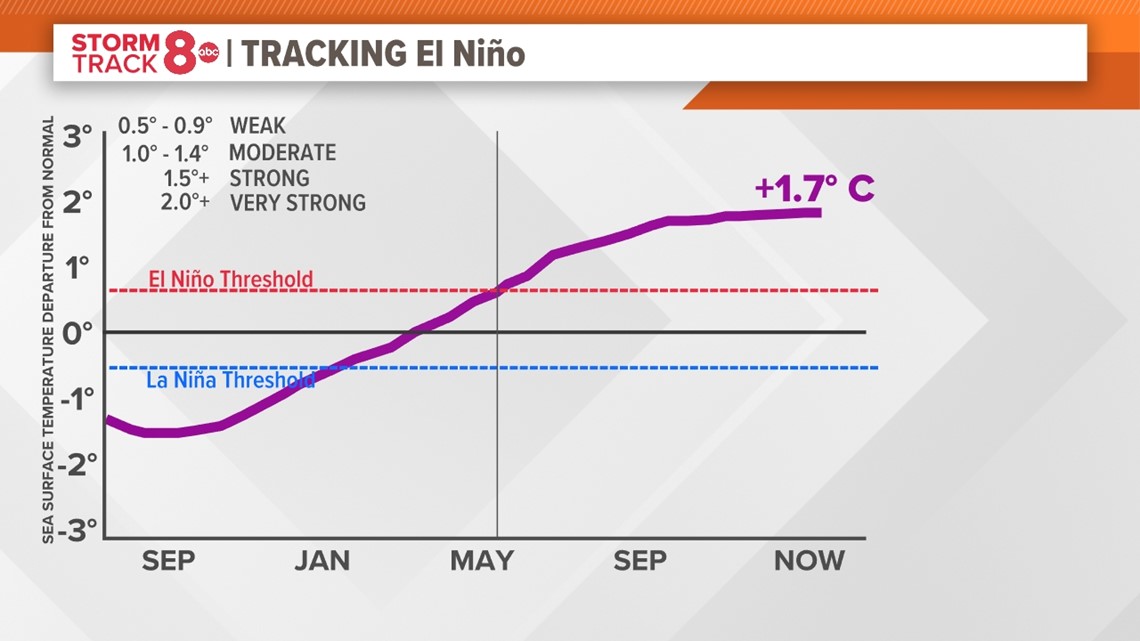
A 'Super El Niño' is defined as water temperatures in the central and eastern Pacific Ocean being at least 2° C or warmer compared to average. Right now, that temperature difference stands at 1.7° C warmer, not all that far away from the 2° C threshold. They are rare in that we've only ever recorded three of them since the satellite era began in the 1950s.

The last 'super El Niño' event was back in 2015-16. Some of the highlights include:
-A record-breaking hurricane season in the central North Pacific Ocean with sixteen storms
-500-year drought in the Caribbean
-New global temperature record set
-Biggest one-year jump in atmospheric carbon dioxide levels at Mauna Loa due to increased drought and forest fires around the globe.

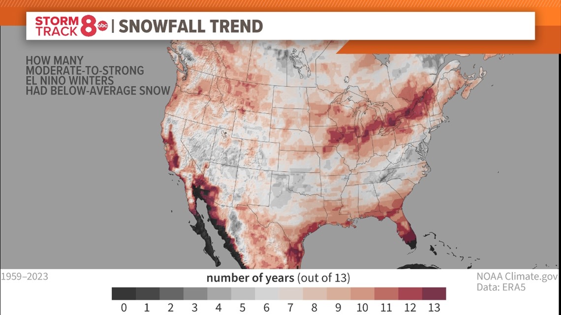
Here in the Quad Cities, this pattern brought about tornadoes in both November and December, along with the easiest winter we have seen in years. The average temperature for the winter season was 31.5° F, nearly 5° F warmer than normal. Total snowfall was also way down, with only 11.3" of snow falling for the winter compared to nearly 30" as the seasonal normal.
No two El Niños are the same
The strength of an El Niño does indeed matter as the stronger the event, the more likely we are to see changes in temperature, rain, and snow, etc. It doesn't mean that those changes will be particularly strong, for example, a bunch of snow or a bunch of severe weather, but it does mean that we are expecting more of an impact on the overall pattern thanks to El Niño. Each event is uniquely its own. There are even different flavors of El Niño, including a Modoki El Niño that features warmer water migrating more toward the central Pacific Ocean rather than just the eastern side. Talk about throwing a wrench in things!
So, we'll continue to track El Niño's progress in the coming months as its impacts are now likely to extend into the upcoming spring season.
Have a question you would like me to answer for an upcoming Ask Andrew segment? Submit it, here.
Watch more news, weather and sports on our YouTube channel