
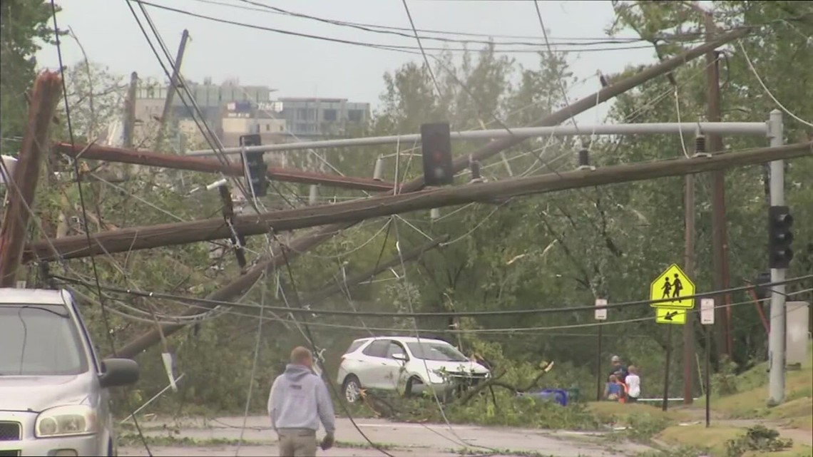
MOLINE, Ill. — The first derecho to impact the Quad Cities in 2023 is now in the books, bringing winds up to 120 mph to parts of the region. Hancock County in Illinois was especially hard hit with corn fields flattened and power to thousands knocked out. While a derecho is nearly impossible to predict days in advance, the pattern that could potentially lead to one is not. Let's dig in!
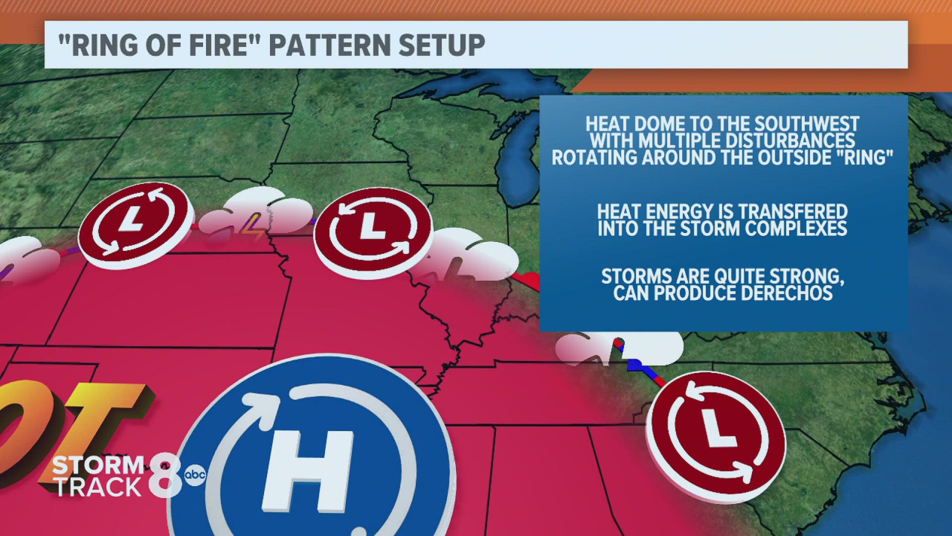
What is the "Ring of Fire" pattern?
This pattern sets up during the summer season, featuring a strong area of high pressure situated over the southernmost United States. Underneath this high-pressure system, sinking air creates a significant amount of heat. That heat also contains a significant amount of energy, storm energy.

The outer edge of this heat dome is what we refer to as the "ring" and it's also where several pieces of storm energy move around the high-pressure system. Each of these storm systems spawns large complexes of thunderstorms that can travel significant distances, in some cases more than 400 miles.

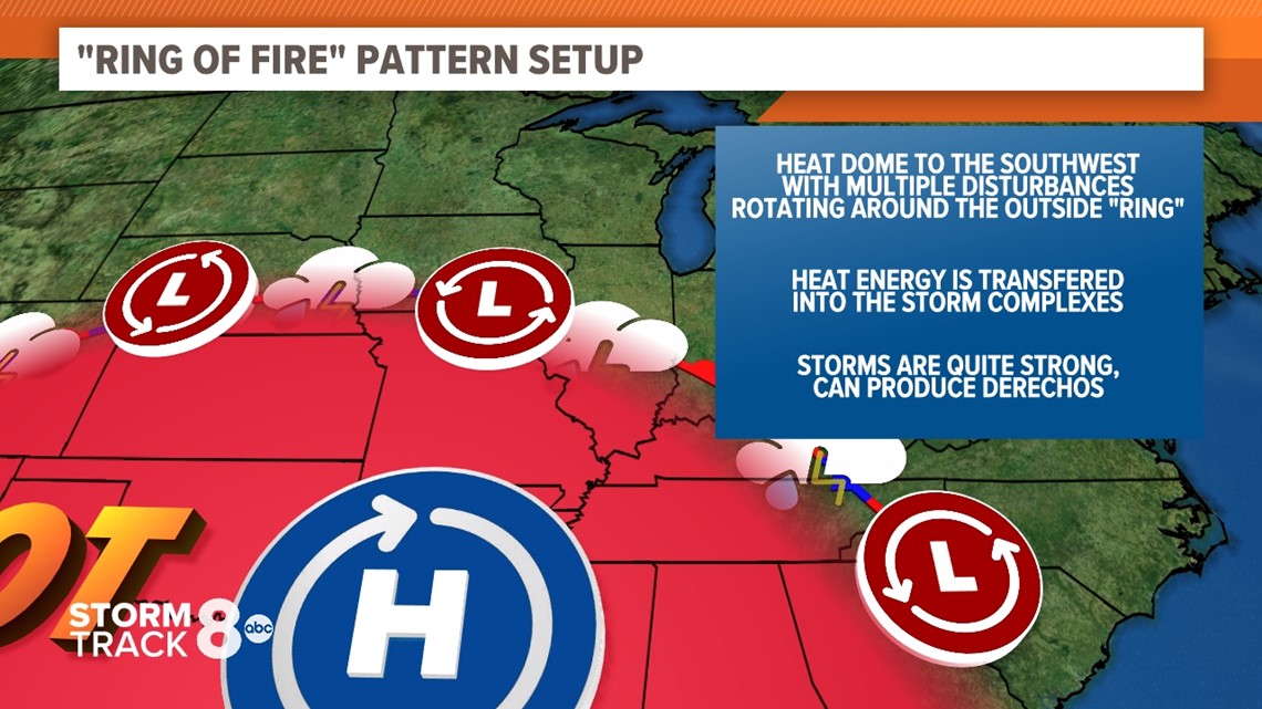
In some cases, extreme amounts of instability can build underneath this dome of heat, acting as a fuel source for these large storm complexes, and depending on a few other variables, they can even create derechos.
This type of pattern can linger for several days depending on the strength of the high-pressure system.
Have a question that you would like me to answer for an upcoming Ask Andrew segment? Submit it, here.