MOLINE, Ill. — Our recent winter El Niño phase is quickly coming to an end and a transition to La Niña conditions is still on track to arrive as early as this upcoming summer. Both of these patterns are associated with thunderstorm activity and sea surface temperature trends within the eastern Pacific Ocean. Warmer than normal waters signal El Niño conditions, while cooler waters fuel a La Niña pattern. The peak period of warmer waters has now passed, occurring this past November according to NOAA. That paves the way for a brief period of "neutral" conditions followed by a rapid return to La Niña by the summer.
Many of you have been asking what that means for the upcoming summer outlook and more specifically, the ongoing drought conditions throughout the region. Let's dig in!
Flipping the ENSO switch
ENSO or the El Niño-Southern Oscillation, is a climate pattern that involves changes in the temperature of the waters in the central and eastern tropical Pacific Ocean. Moving from one pattern, like El Niño to La Niña doesn't happen overnight. It takes months for the transition to fully evolve and its associated impacts to be felt. Right now, NOAA is forecasting a complete collapse of El Niño between April and June, with a greater than 60% probability of La Niña conditions developing between June and August.

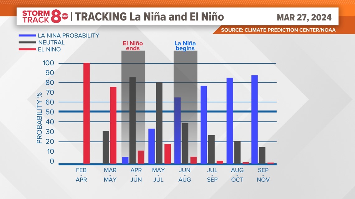
That does seem like a quick turnaround when you look at it on paper, however, it will take weeks and even months before we begin to see its influence on our weather pattern here in the Quad Cities. At this rate, it appears increasingly likely that we will start noticing those impacts by late summer, early fall, and especially next winter into early 2025. Remember, La Niña patterns tend to hang around much longer than El Niño and can last for more than a year or two.
History usually repeats itself
This won't be the first time we've rapidly transitioned from an El Niño pattern back to La Niña. It has happened numerous times before. Each of those periods has a story to tell, and for the majority of them, drought becomes a big part of that story.

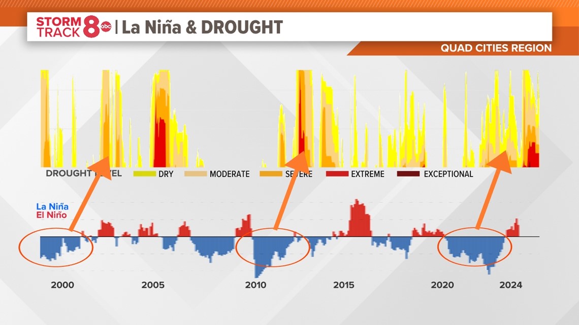
The above graphic shows two things in the period from 2000 until today; Periods that featured La Niña conditions which are in blue, and El Niño conditions in red. Above that are the periods and severity of drought in the Quad Cities region, which includes Eastern Iowa and Northwest Illinois.
I've circled a few of the stronger La Niña events and how their intensity correlated to drought conditions across the Quad Cities. Notice that in particular, those three events highlighted, widespread and significant drought often followed months after the La Niña pattern was established. This was certainly the case with our most recent La Niña visit from 2020-2023, a rare triple-dip La Niña that had many of our hometowns issuing water conservation advisories.
Given this history, it's hard to ignore the real possibility that by later this year and especially into 2025, we may find ourselves in that situation again.

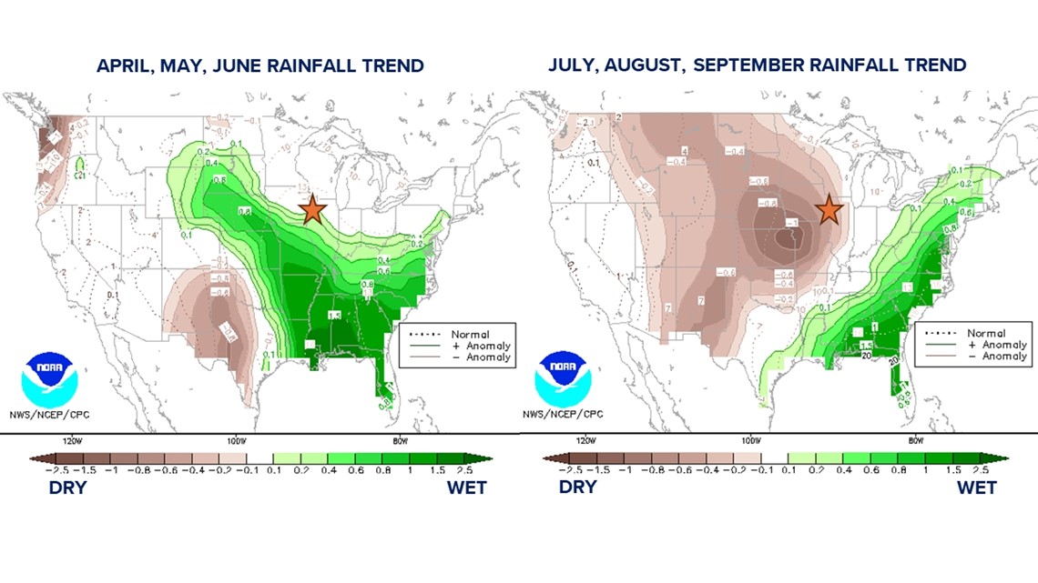
NOAA has already picked up on this trend in their long-term outlooks. We'll likely continue to see meaningful storm activity through the spring and early summer, followed by hot and dry conditions as we move deeper into summer. Both outlooks are shown above highlighting this trend.
The tropical wildcard
With a La Niña pattern comes an increase in tropical activity, especially in the Atlantic. Wind shear is much lower and already sea surface temperatures in this region are running warmer. With increased activity comes an increased threat of landfilling storm systems and if they track just right, could impact even parts of the Midwest. Should that be the case, it would throw a wrench into the above forecast.
Have a question that you would like me to answer for an upcoming Ask Andrew segment? Submit it, here!