
MOLINE, Ill — During the spring and summer months, a certain type of front often meanders across the Midwest. Not so much here in the Quad Cities, but more so in areas such as Kansas, Oklahoma and Texas. Appropriately named the dryline, this front has some really unique characteristics compared to the fronts we often experience, cold fronts and warm fronts. Hayden from Bureau County, Illinois was curious about their formation, so, let's dig in!
What makes a dryline unique
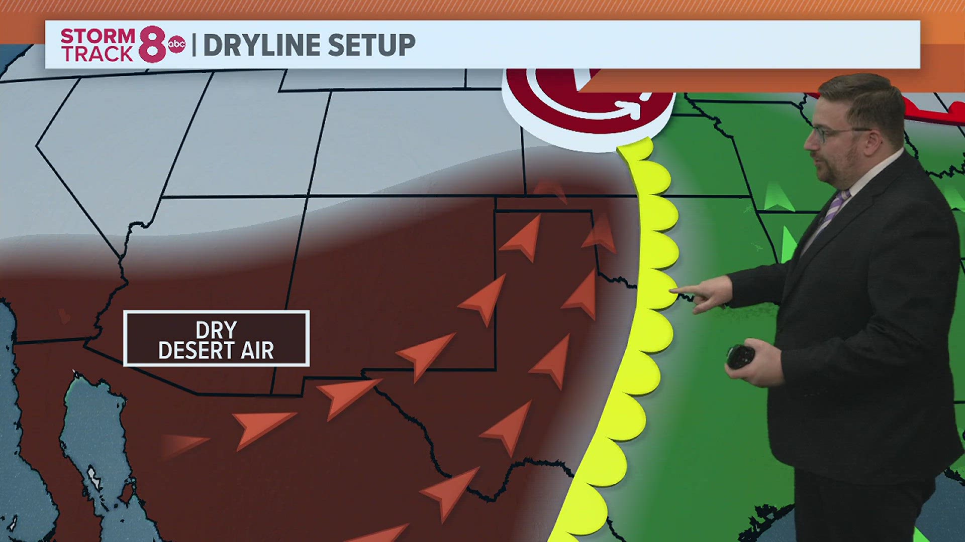
As we've covered before in StormTrack 8 University, we are accustomed to seeing warm fronts and cold fronts move through the Quad Cities. Warm fronts will bring cloudy, rainy and sometimes stormy weather along with warmer air, while cold fronts drive rain and storms followed by colder air. A dryline is unique in that the temperatures ahead of it are often cooler compared to those behind it. Uniquely, the dryline deals more with a dramatic difference in moisture levels.

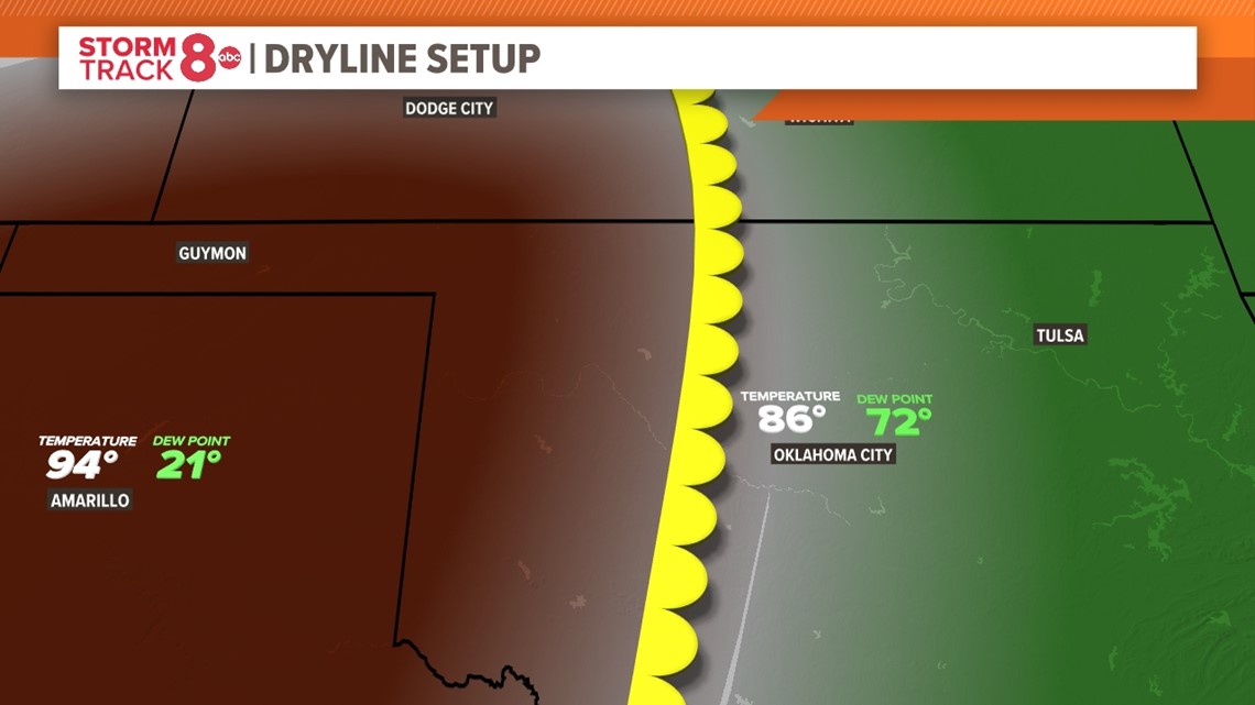
Here's an example of what a typical dryline would produce. This front is attached to an area of low pressure sitting over Nebraska. Hot and dry desert air to the southwest of that low-pressure area is drawn up north toward the low-pressure area itself. Meanwhile, a south breeze ahead of the low pressure is bringing up a much different air mass, one that is more tropical, which is to say that it's warm and very humid.
What's unique about this front is the temperature pattern. Oftentimes temperatures are hotter behind the front due to the dryness of the air. Dry air heats up much more quickly compared to humid air. Most of this is due to the downslope of the surrounding landscape with some compressional heating added in for good measure.

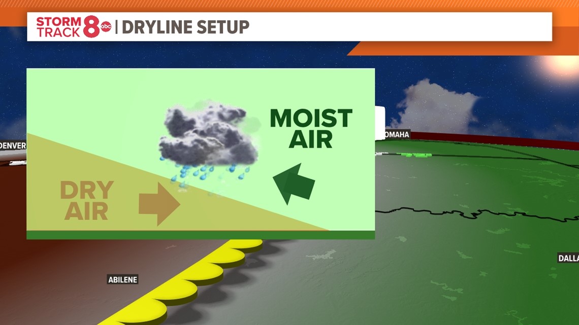
This front is a really good lifting mechanism to get storms brewing, oftentimes supercell thunderstorms thanks to the contrast in air masses. As the hot, dry air advances east, it displaces the warm, moist air causing lift. That lift translates to thunderstorms.
Drylines provide a unique viewing environment for storms
Drylines also provide a productive environment for rotating supercell thunderstorms that produce tornadoes. While cold fronts tend to have a lot more upward motion with them, storms can quickly become crowded amongst each other and interrupt themselves. In contrast, dryline storms tend to remain more discreet, allowing them ample room to develop fully. Some of the most photogenic storms and tornadoes often are produced by drylines!
Did you know? Unlike cold or warm fronts, drylines often move back and forth quite a bit! Often retreating westward at night as cooling sets in, then moving east again during the day as the surrounding air masses begin to warm up.
Have a question that you would like me to answer for an upcoming Ask Andrew segment? Submit it, here!