MOLINE, Ill — Typical winter snow and cold finally made an appearance in the Quad Cities this January and that has many asking if our recent luck with El Niño has run out. That's the subject of today's question which comes from Rhonda in Galesburg, Illinois. She asks, "What happened to the El Niño we had recently? Has it disappeared?" Let's dig in!
Yes, El Niño is still around
A few months ago, NOAA released its winter forecast which called for a strong El Niño influence, meaning temperatures would likely be warmer than normal for the Quad Cities, while the rain and snow amounts could go in either direction. So far, despite a few wickedly cold days in January, that has remained the case here in terms of average winter season temperature to date. In fact, the month of December was the fourth warmest December on record for the Quad Cities!

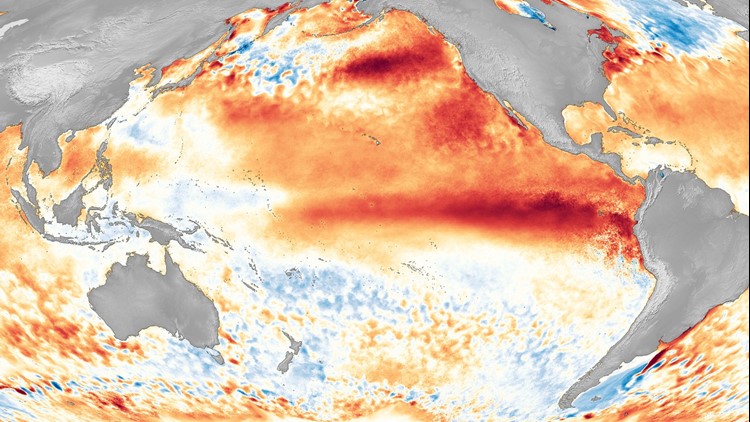
El Niño occurs when sea surface temperatures in the tropical Pacific Ocean are consistently warmer than average. You can read more about its development and behavior here.
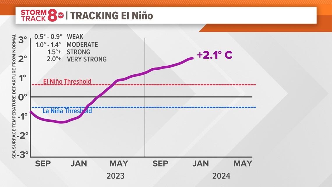
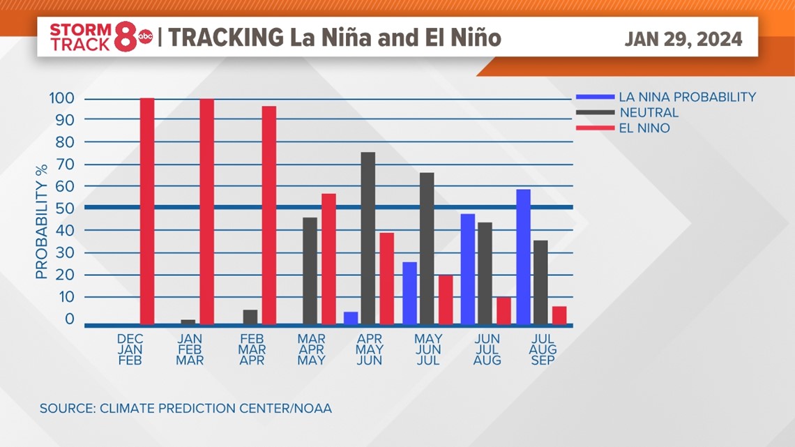
The latest data continues to show a robust El Niño in our part of the world, with the key tropical Pacific monitoring region logging a 2.1 degrees Celcius warmer reading versus average. For this El Niño to be classified as a "strong El Niño", that temperature needs to remain at least 2 degrees Celcius warmer for three months. Forecasters project that it is likely reaching peak intensity now and will begin to slowly dissipate through the upcoming spring. Even La Niña conditions are looking more likely by next winter! The graph below shows the probability of either El Niño, La Niña, or neither now through late summer. Notice El Niño will continue to heavily influence our weather pattern through at least the spring.

So, why did it get cold and snowy?
El Niño is a long-duration event, spanning multiple months. When we talked about the winter outlook back in October, we knew that the average winter temperature was going to be warmer, and that remains the case today. By average winter temperature, we mean taking all the daily high and low-temperature readings from Dec. 1 through Feb. 29. Saying that our winter will be warmer than normal doesn't mean we won't see bitter cold days. The same goes with El Niño. You can still very much have these blasts of bitterly cold Arctic air and also substantial snow and ice storms.
The thing to remember is that when we talk about an outlook or an event like El Niño and La Niña, we are talking about an overall pattern that spans multiple months. The daily weather will certainly be different, but when all that data is added together at the end of the season, or whatever timescale we are referring to, the trend should match the forecast.
Have a question that you would like me to answer for an upcoming Ask Andrew segment? Submit it, here!