
MOLINE, Ill. — Winter is quickly winding down here in the Quad Cities and so is another weather-related event, La Niña!
We have been in the midst of a rare triple dip La Niña, which has managed to influence the last three winter seasons throughout the U.S. Other triple dip La Niña years include 1954-1956, 1973-1976, and 1998-2001.
Although our current La Niña pattern has been fairly weak, it has been unusually long. That begs the question, how much longer is this type of pattern going to last? Let's dig in!
How much longer is the La Niña pattern expected to last?
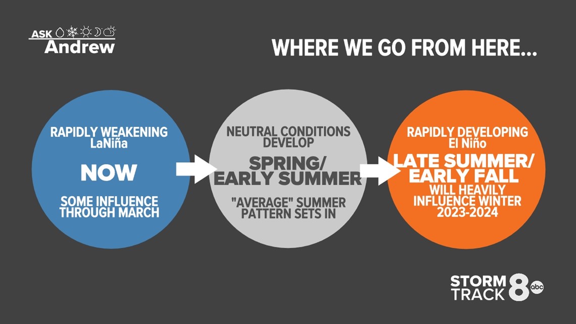
All signs are pointing to a very quick change as we head into the spring and following summer seasons. Many of our longer-range computer models are indicating a quick return to neutral conditions by the upcoming spring, meaning neither La Niña nor El Niño will influence the global weather pattern.
Meteorological spring officially begins on March 1, and by then there is a nearly 90%+ probability that neutral conditions will be observed in the eastern and central Pacific. That type of pattern is expected to continue through the early summer months.

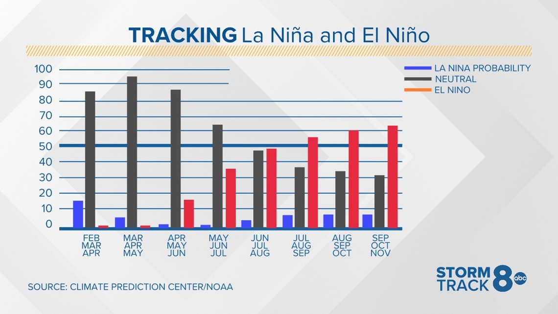
By late summer and especially the fall, El Niño conditions are expected to quickly develop, with warmer water taking over parts of the eastern and central Pacific. That is likely what will influence our next winter season for 2023 and 2024.

So, what does that mean for the upcoming spring, summer, and fall seasons?
While the spring season can be extremely difficult to forecast, especially given the fact that it's considered a "transition season" from cold to warm, we can get a good idea of what to expect during the summer months.
First, a lot will depend on the strength of El Niño that develops. So, let's break those down based on past El Niño history.
Temperature trends in the summer
Weak to moderate El Niños tend to produce slightly cooler than average temperatures during the summer months in the Quad Cities. Strong El Niños tend to give us near to slightly above-average temperatures.
Rainfall trends in the summer
Weak to moderate El Niños will often give us slightly drier conditions through the summer season and can lead to drought development/intensification. Strong El Niños can be a mix of slightly dry and slightly wet.
Hurricane season impacts
El Nino seasons have been known to greatly reduce the amount of hurricane activity in the Atlantic. This is due to an increase in the stronger winds aloft that tend to either prevent storms from rapidly developing.
The Atlantic Ocean water temperatures also tend to be slightly cooler than average, leading to a more stable atmosphere. This, however, does not mean we won't see any hurricanes at all, or that the U.S. will be immune to any landfills for the upcoming season.
There have been past seasons, especially 2018 and 2019 that both featured an above-average hurricane season in the Atlantic.
Have a question that you would like me to answer for an upcoming Ask Andrew segment? Submit it, here.