
MOLINE, Ill — A robust El Niño pattern continues to dominate the weather pattern across the United States, including right here in the Quad Cities where we are experiencing our fourth warmest December on record so far. While this particular El Niño has not obtained 'Super-Niño' status, forecasters at NOAA still give it a 54% chance of reaching this level.
NOAA forecasters recently released their thoughts regarding where things will likely go from here leading into the upcoming spring and summer months. The main takeaway? They are expecting El Niño to rapidly decline heading into the spring with neutral conditions returning by summer 2024. What does this all mean? Let's dig in!
El Niño's rapid decline
Earlier this summer we discussed how things were quickly heating up in the eastern Pacific Ocean. In June of 2023, NOAA declared that El Niño was well underway, the first one in four years! Sea surface temperatures were roughly 0.5°C warmer than average in this region of the Pacific, further warming by 1.9°C by November. For this El Niño event to be considered a 'Super-Niño', that reading would need to be at 2.0°C or warmer.

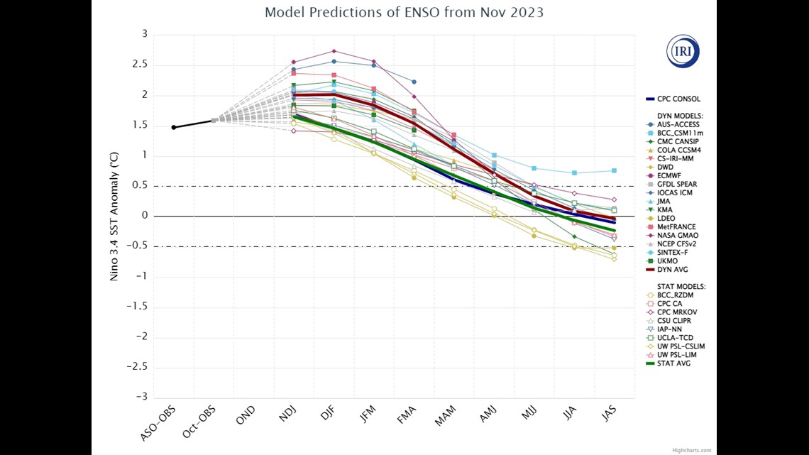
While sea surface temperature departures from normal are an important thing to look at, forecasters also look deeper into the ocean water. The deeper the warm water can go, the more robust the pattern will be. The latest indications show that a large area of cold water has formed near the international date line and is moving towards the surface.

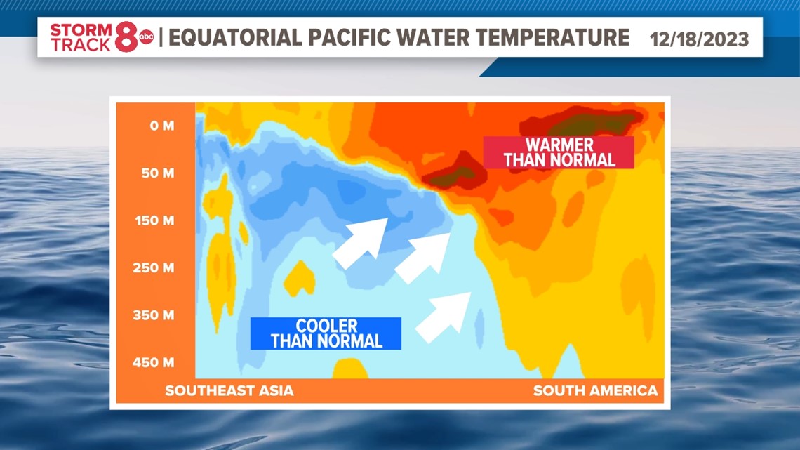
The graphic above clearly shows this expanding area of cooler water and how it continues to expand to the east, reducing the depth of the warmer water as it continues to move. Many long-term climate models are also in agreement that this area of cooler water will continue to expand and intensify as it takes up more space in the eastern Pacific Ocean.
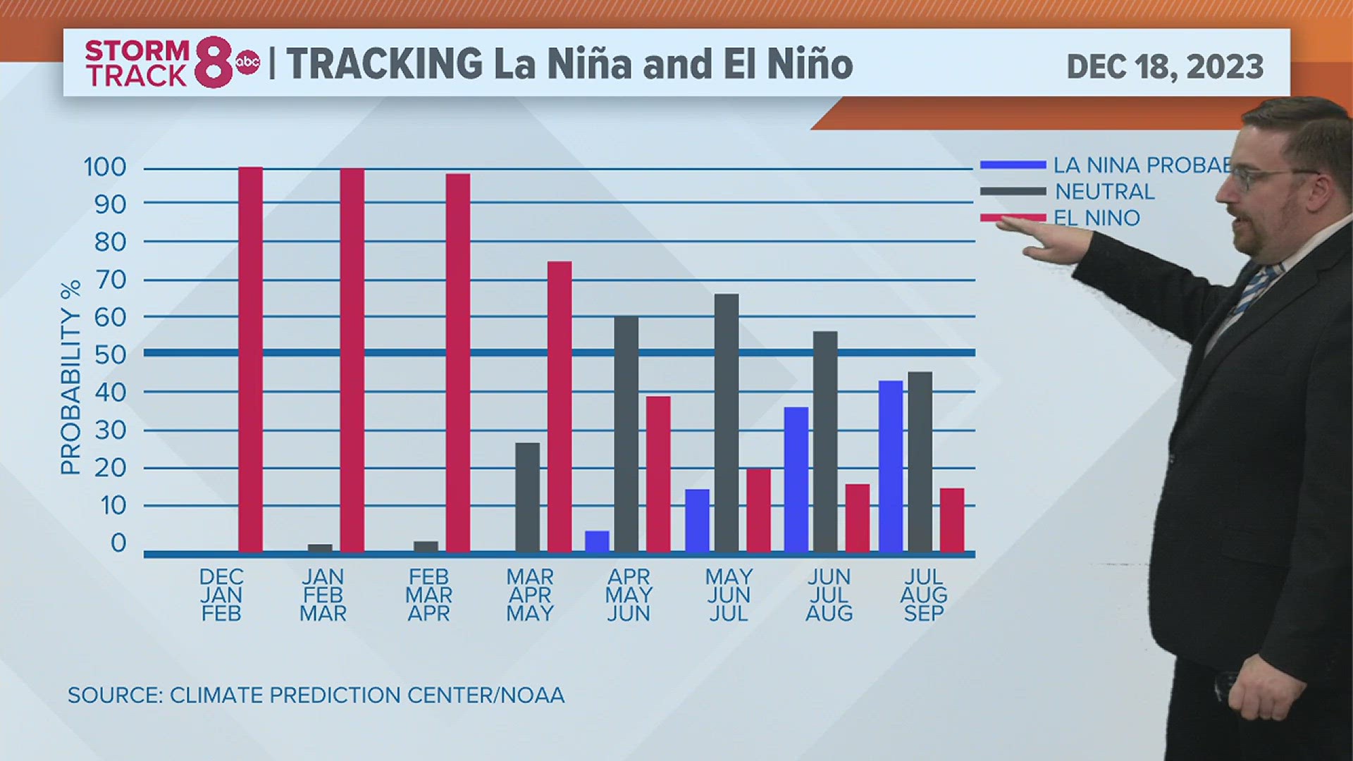
Neutral conditions by summer
With El Niño expected to quickly weaken through the upcoming spring, neutral conditions are expected to then takeover with the possibility of a La Niña developing for the fall of 2024.

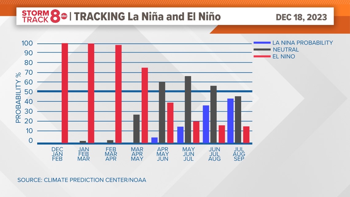
Forecasters continue to keep high probabilities of El Niño conditions going through May, followed by a better probability of seeing neutral conditions for the summer and early fall.
Impact on severe storms and hurricanes
The timing of this pattern flip will be crucial in determining what the spring severe weather season and even the hurricane season will hold. A later transition would mean less of an impact on the spring severe weather season, but more of an impact on a busier hurricane season.
El Niño patterns tend to bring about less severe weather for the Quad Cities in the spring, concentrating the bulk of the activity to the southwest and southeast United States.
Have a question that you would like me to answer for an upcoming Ask Andrew segment? Submit it, here!