MOLINE, Ill. — Happy New Year, Quad Cities! As we start out in the new year, let's take a look back at the weather, we experienced in 2022.
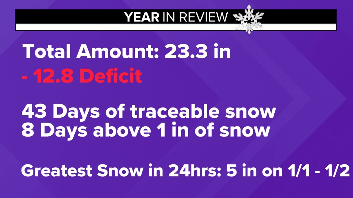
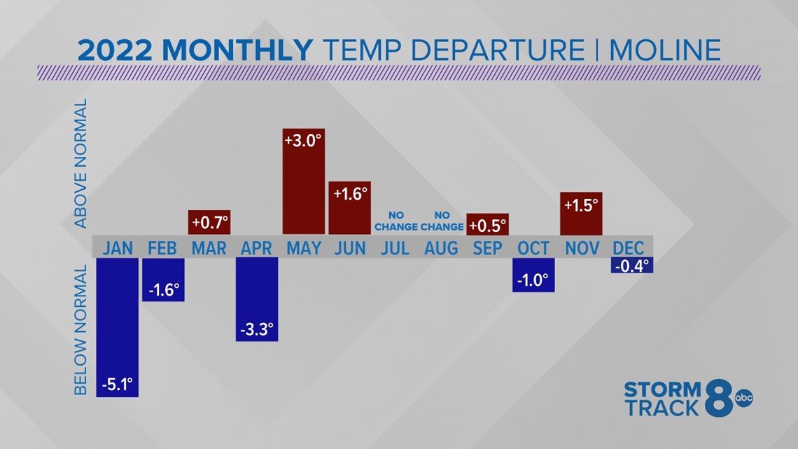
The start of 2022 looked different from the first couple of days of this new year. We had the most snowfall in 24 hours from Jan. 1st to Jan. 2nd with a total of 5 inches of snow. Temperature-wise, we were off to a cooler start, and for the first month of 2022 temperatures, we were five degrees cooler than normal. With a warm start to 2023 and temperatures remaining above normal for the short team, we're on track to have the opposite, with above-average temperatures for January.
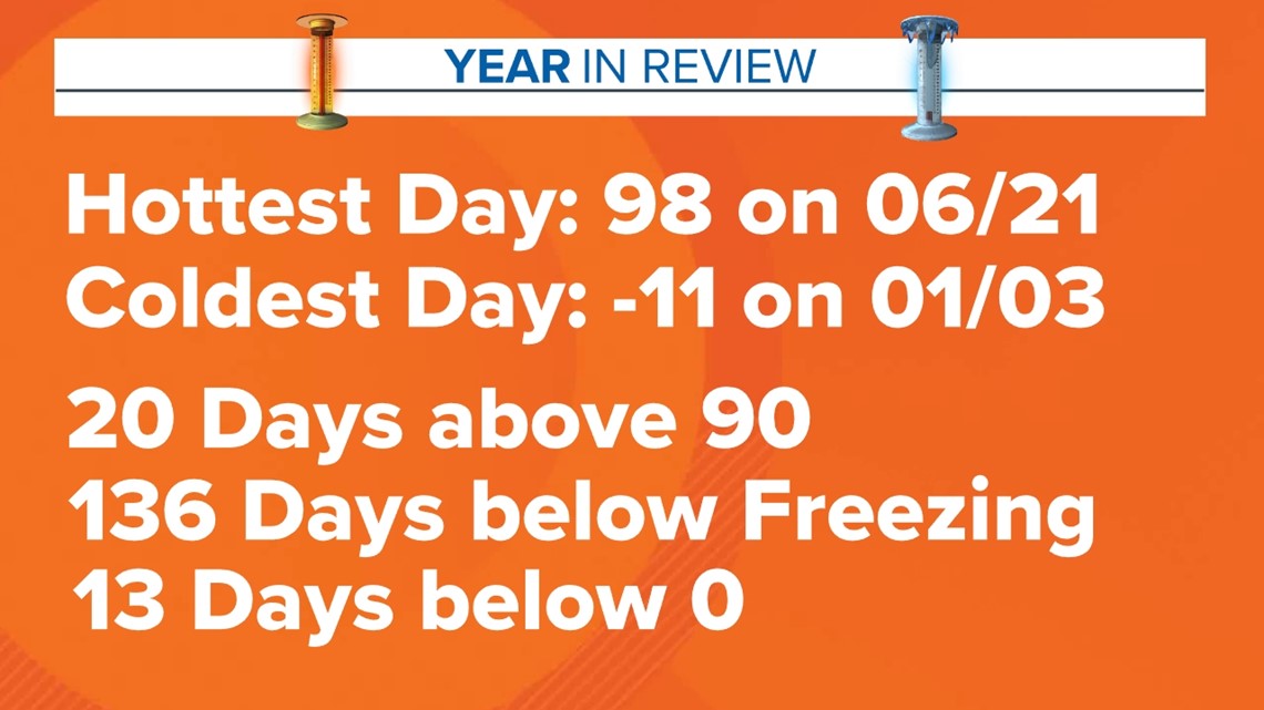
2022's overall temperatures were just slightly warmer for the year by 0.3 degrees. That is not surprising when looking at the temperature departure; there were five months with temperatures above normal and below normal, with two months of no change in temperature The warmest day with a high of 98 degrees occurred on June 21, the summer solstice.
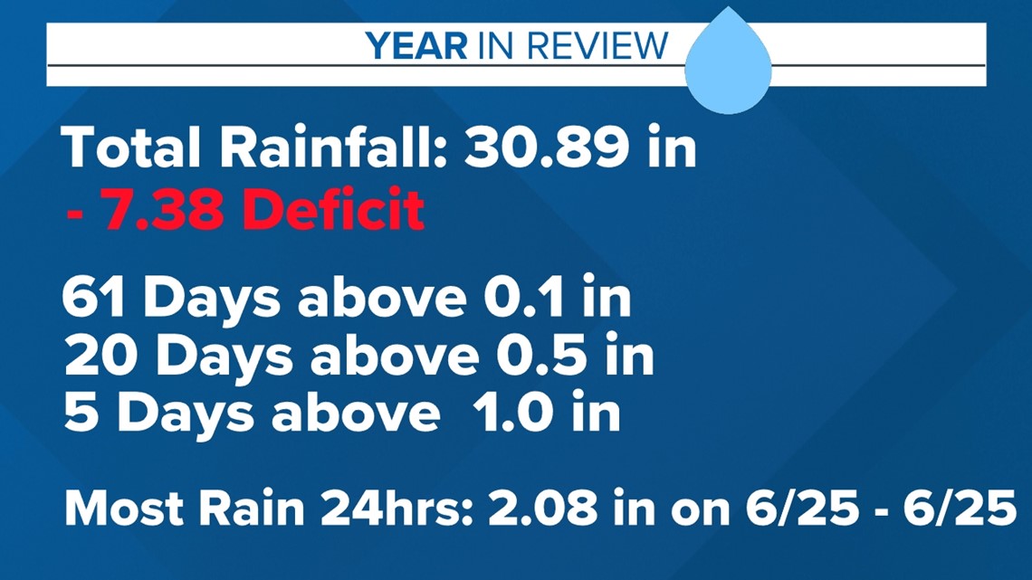
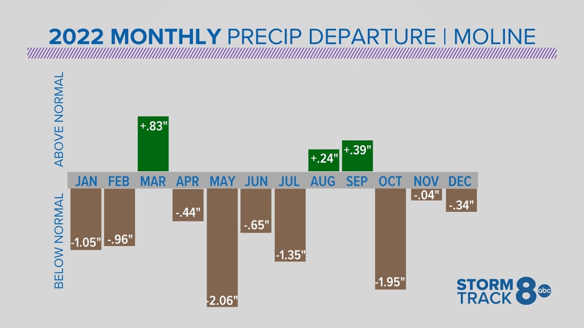
The biggest headline of 2022 was how dry it was. For the year overall, we were below average precipitation by 7.38 inches. That is not surprising, as we only had three months of above-average precipitation and nine months of below-average. In the winter, we were 12.8 inches below normal in snow, which is a major component in our overall precipitation for the year. The first day of the year was the snowiest day of the year.
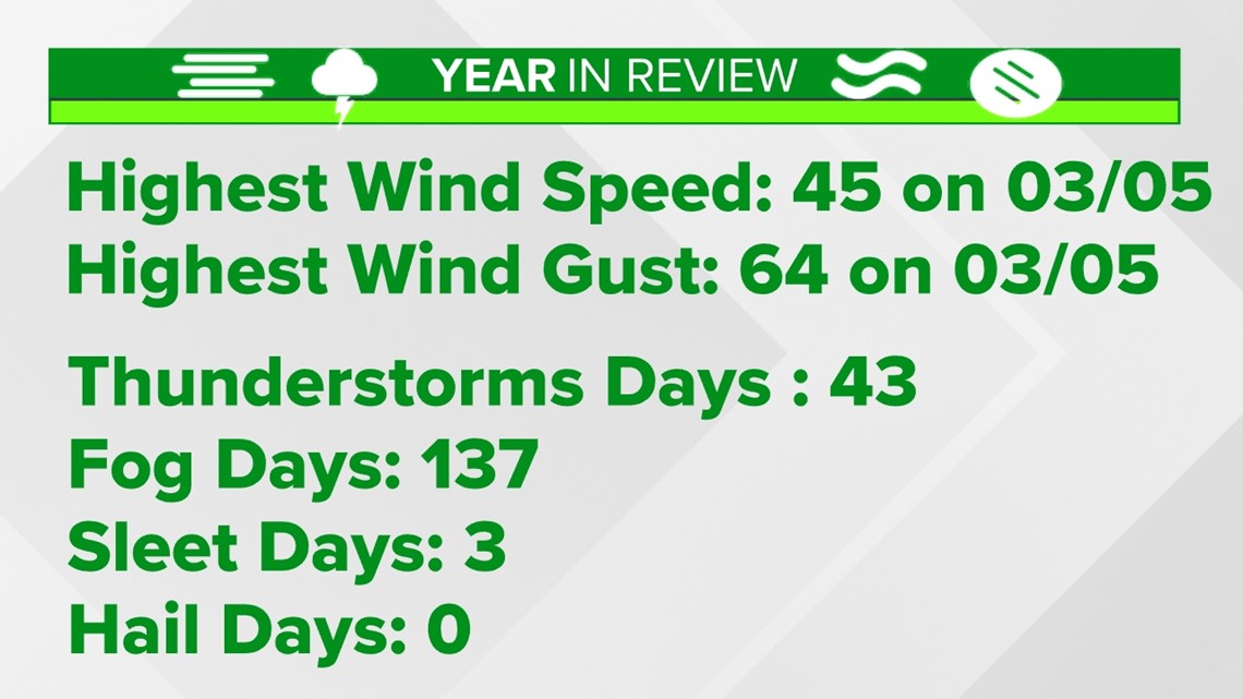
The strongest winds occurred on March 5th with speeds of 45 mph and gusts of 64 mph. That day, we had strong and severe thunderstorms roll through the area and a tornado warning had been issued.
Looking forward to tracking the weather we'll experience in 2023!

