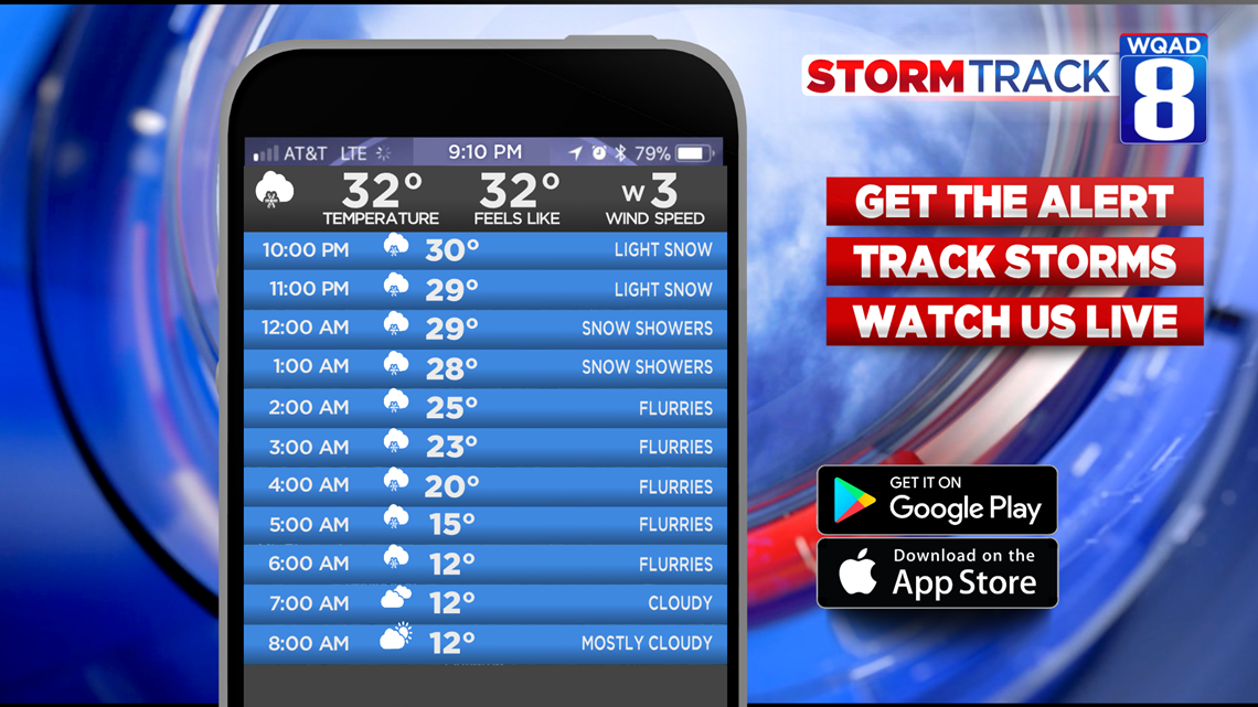
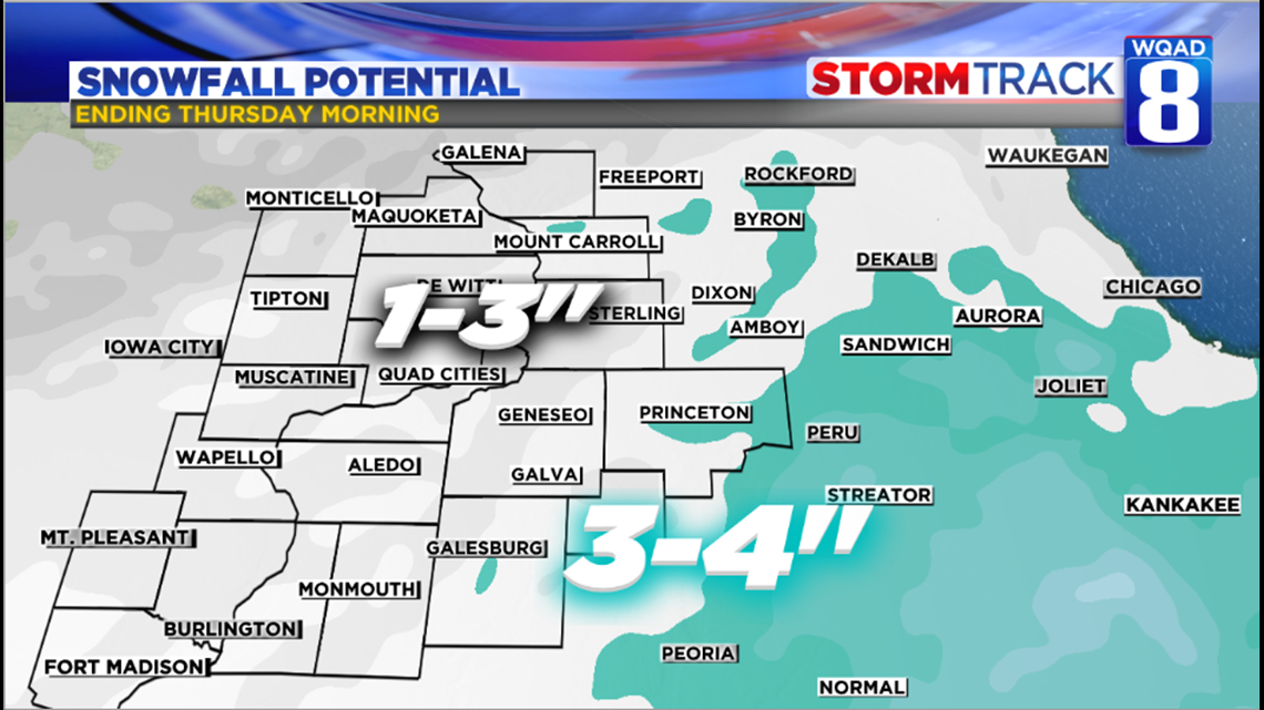
Snow, briefly mixing with rain at the start has been slowly advancing from south to north and will continue to overspread the area into the evening hours. Some of the snow will be heavy at times for areas just south and east of the Quad Cities where a Wintry Weather Advisory is in place.

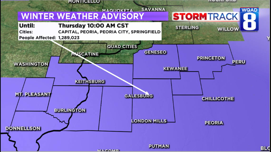
Snow will taper to flurries after midnight leaving behind several inches in those advisory areas with 1-3″ elsewhere. In the immediate Quad Cities a good 2 inches I’m looking at.

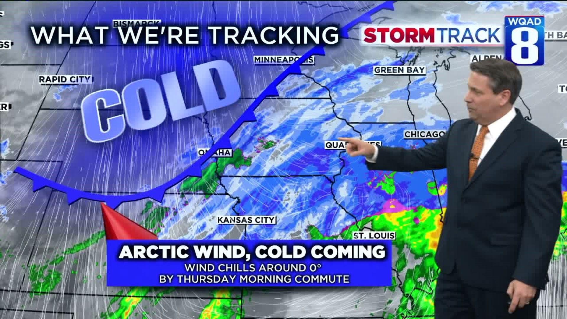
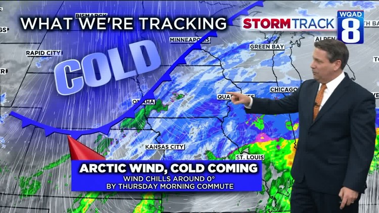
Before the snow begins to taper will be the time when the strong arctic front blows across the area. Blowing snow will be anticipated especially in rural areas with wind gusts around 30 mph and thus traveling even more hazardous.
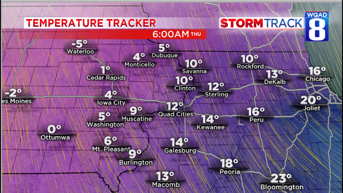
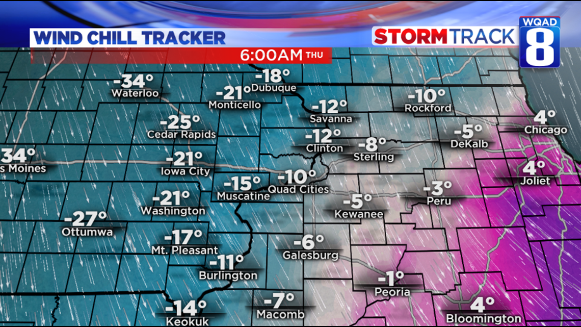
By midnight, temperatures will be around 30 degrees before plummeting near 10 degrees by Thursday morning. With winds remaining brisk out of the northwest, temperatures will remain steady with below zero wind chills.


Skies on Thursday will also remain cloudy before slowly clearing later in the day. The core of this arctic air will be felt that night with lows below zero and wind chills as cold as the minus teens in spots by Friday morning.
After seeing a bright and cold Friday with highs struggling to reach 20 degrees, comes a quick recovery in temperatures with upper 30s Saturday replaced with lower 40s on Sunday. Possible rain/snow mix is still possible on Saturday.
Chief meteorologist James Zahara
Here’s a look at the hour-by-hour forecast from the StormTrack 8 Weather App!