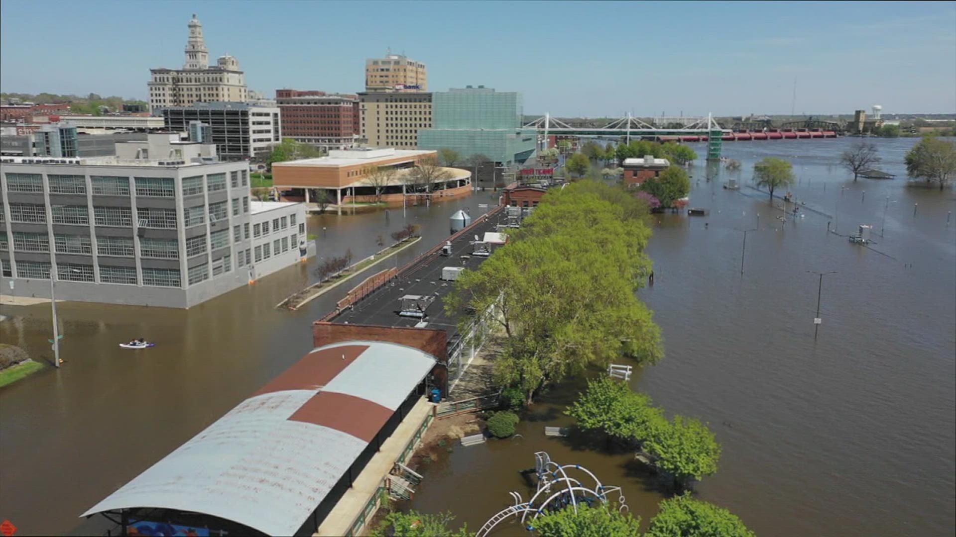
DAVENPORT, Iowa — Editor's Note: The featured image is from a Downtown Davenport area flood in 2019.
Rivers in the Quad Cities Area are not at risk for serious flood events this spring, according the the National Weather Service (NWS).
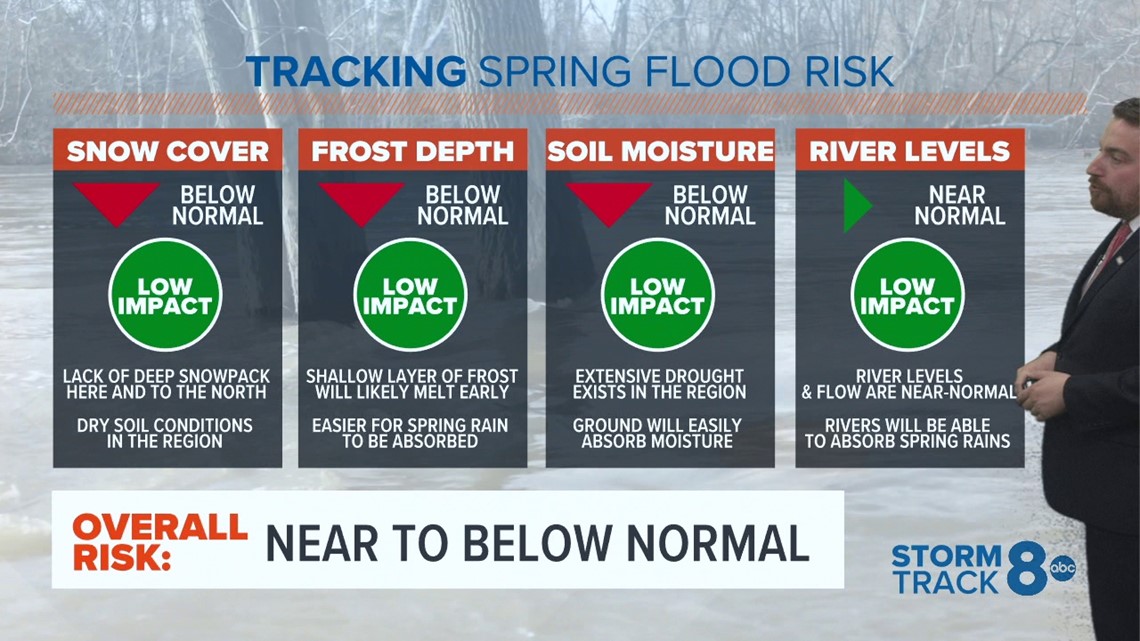
The NWS said a majority of local rivers are at a below-normal risk of reaching levels to be considered a moderate or major flood. The threats of spring flooding are determined by the amounts, location and frequency of spring rain and any extra snowfall. The pace of melting snow can also be a factor.
Right now, QC soil moisture and winter precipitation are measured at near to below normal and the area hasn't gotten much snow — leading to the current river levels.
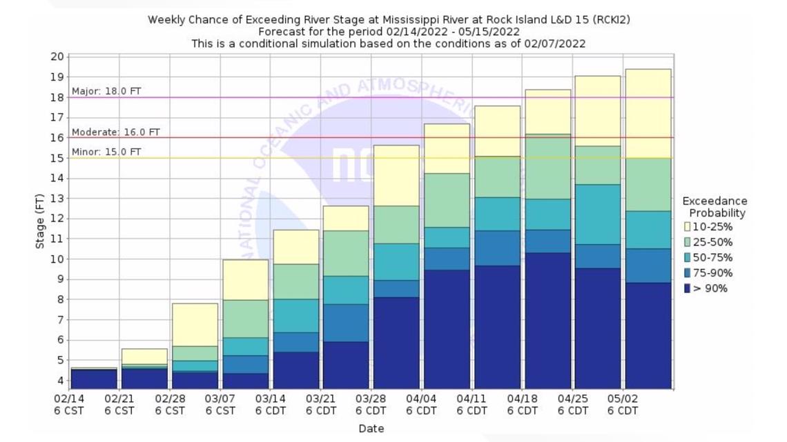
Rock Island Mississippi River levels


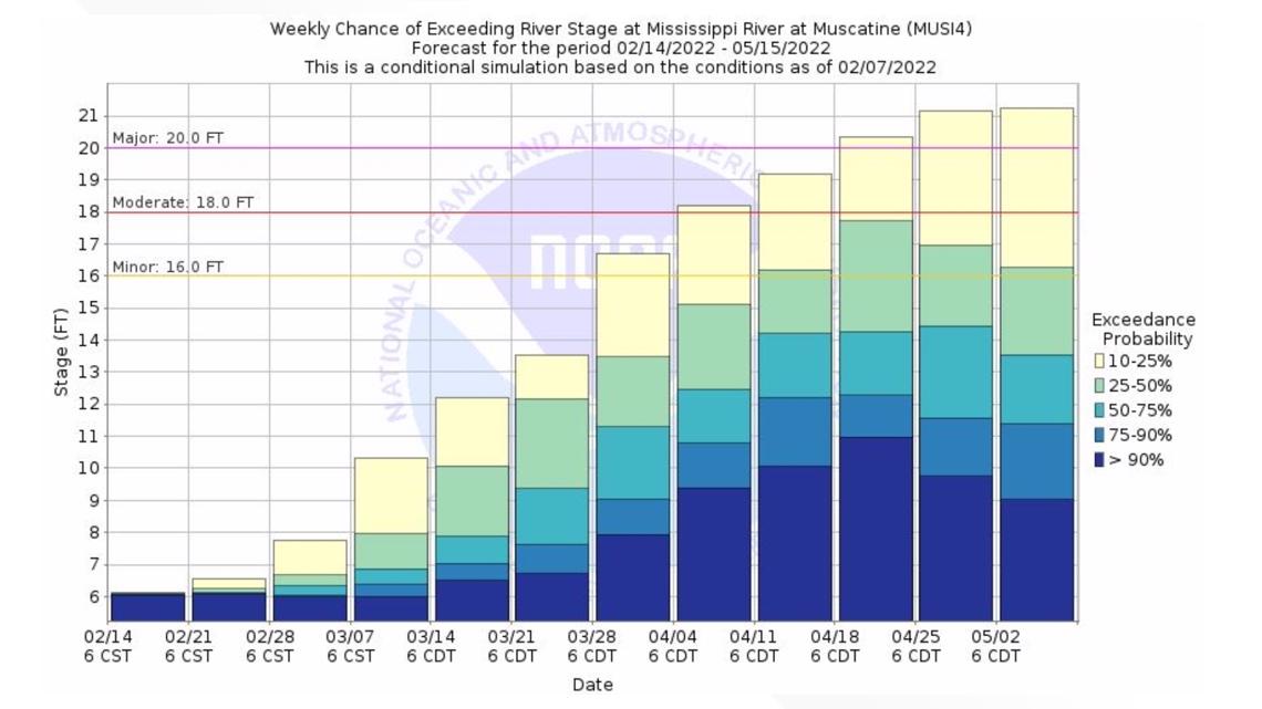
Muscatine Mississippi River levels


The flood risks will remain low if there continues to be abnormally dry or moderate drought conditions. This lowers soil moisture levels, freeing more storage for any extra spring rain or snow.


NWS expects the weather pattern to stay active, and any additional precipitation could change the spring flood outlooks.
The City of Davenport unveiled a $165 million flood resiliency plan on Nov. 18, 2021. This came less than three years after the Mississippi River flood peaked at 22-feet in the city's downtown area, costing nearly $3.5 million to fix the extensive damages.
Plans for 5-foot walls, which Davenport officials say won't impact river views, would be built along the railroad tracks on River Drive.
The first phase of the project could take between 5 to 10 years for completion.

