
A slow-moving storm system will bring a fresh round of accumulating snow to the Quad Cities for the second-half of the workweek.

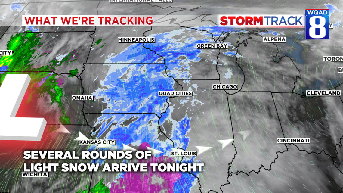
The low-pressure system spinning over parts of Nebraska Wednesday evening will slowly move to our south spreading widespread light snow over the region through at least Friday.

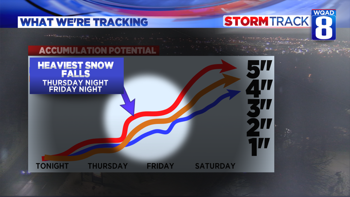
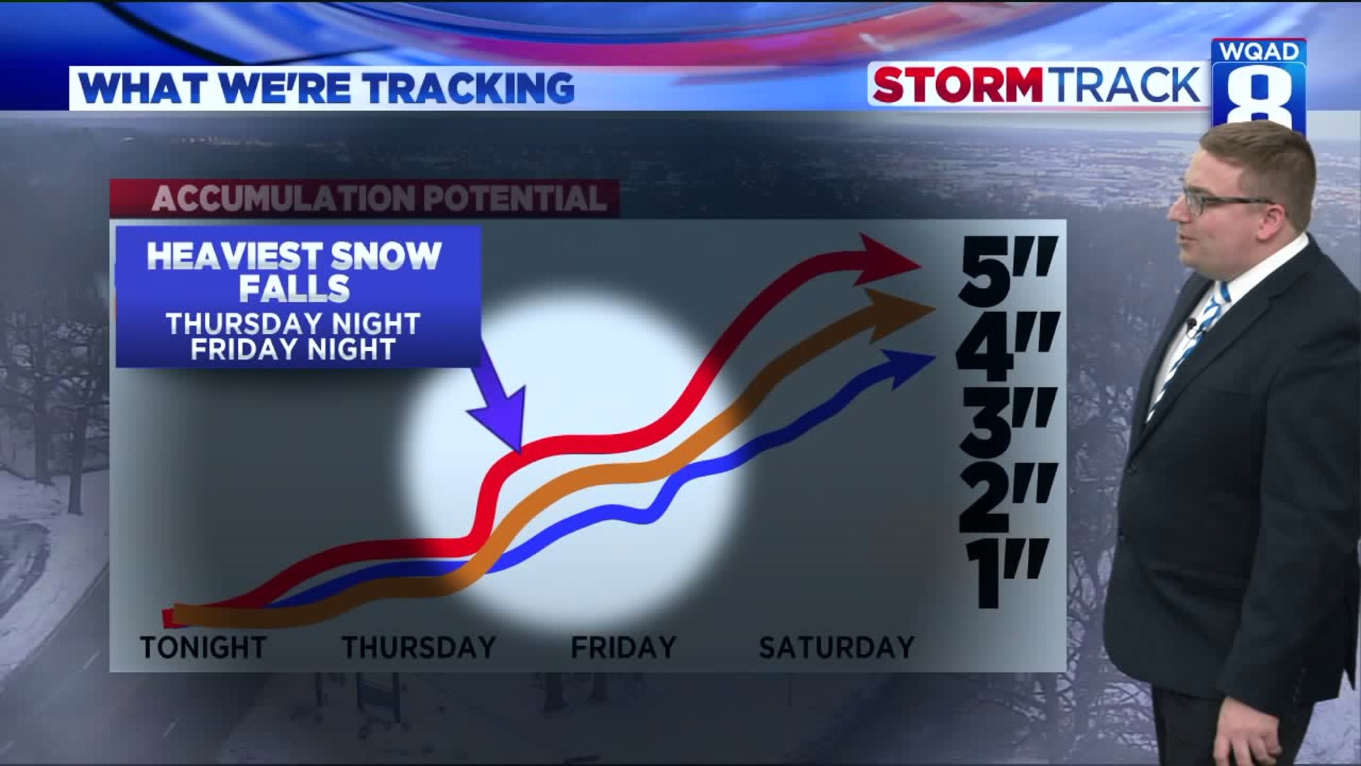
This storm system will be quite different when compared to our more recent systems in that it will be a long-duration event. The snow will not fall all at once, rather it will be spread out in different batches over a three day period. The first round arrives tonight into Thursday morning where accumulations are expected to be around an inch or less here in the Quad Cities.
The second round will be arriving Thursday evening and overnight where an additional one to two inches will fall.
The third round arrives Friday evening into the overnight with another one to two inches possible.

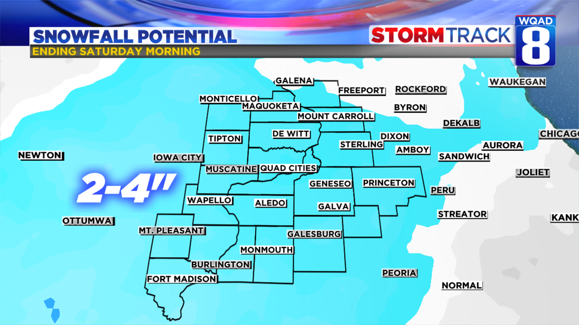
In total, much of the area will pick up between two to four inches of snow by Saturday morning. Some localized five-inch amounts are possible in the heavier bands. As of right now, those higher totals look more likely west of the Mississippi River.

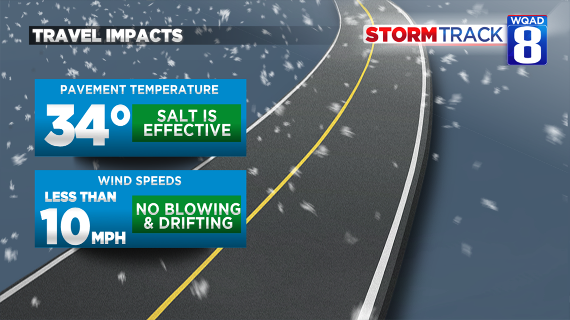
While we will see some travel impacts from this new storm system, they won't be nearly as bad compared to what we saw last weekend. Pavement temperatures have warmed closer to freezing which means some slush is likely to develop on our roads, but the salt will be more effective thanks to the warmer temperatures.
Winds won't be much of an issue either, staying below 10 mph through much of this event limiting any blowing and drifting snow.
I would still plan ahead some extra travel time for your Thursday and Friday morning commutes as there will likely be a few slick spots, but certainly nothing like what we saw last week.
Meteorologist Andrew Stutzke