

We have an area of high pressure situated over us this morning keeping it rather chilly still. This will progress off to our east and return a flow of southerly winds to finally get temperatures to rebound.
Highs today still remain below freezing with highs in the mid 20s. Lots of sunshine is expected but increasing clouds will come overnight tonight as a new system pushes into the area.
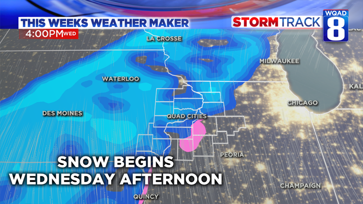
Tomorrow we will see temperatures finally rise above 32°. It will be mostly cloudy through the afternoon but tomorrow evening we will see snow return. Light snow with light accumulations are possible into Thursday. Right now, 1-3″ of snow are expected by Thursday morning, so expect some slick roads with the slushy and wet snow.
Just like last weeks system, we are expecting two waves of precipitation.
System track and amounts are low in confidence as we could see some rain on Thursday as temperatures rise above freezing. We will be able to fine tune what will happen Thursday afternoon and Friday in the next 24 hours and will be sure to continue to bring you updates.

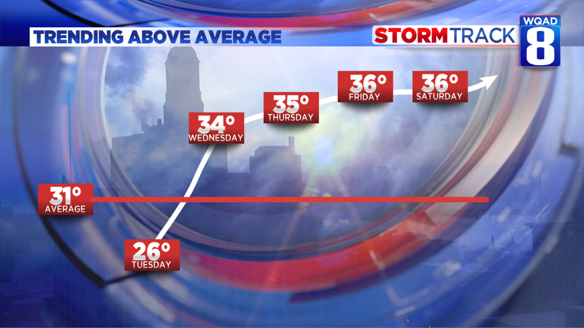
After that, quiet weather returns but this time we won’t see temperatures drop like last week’s system. We will finally see those icy driveways and parking lots get some relief!