
UPDATE: The National Weather Service has issued a Winter Storm Watch that will be in effect until 6:00 AM Sunday morning.
Are you ready for a winter wallop? Confidence is building that we will have both ice and snow accumulations beginning Friday night.

In all actuality, you'll probably wake up Saturday with no snow on the ground. Instead, some areas could see a significant accumulation of ice... especially on elevated surfaces.
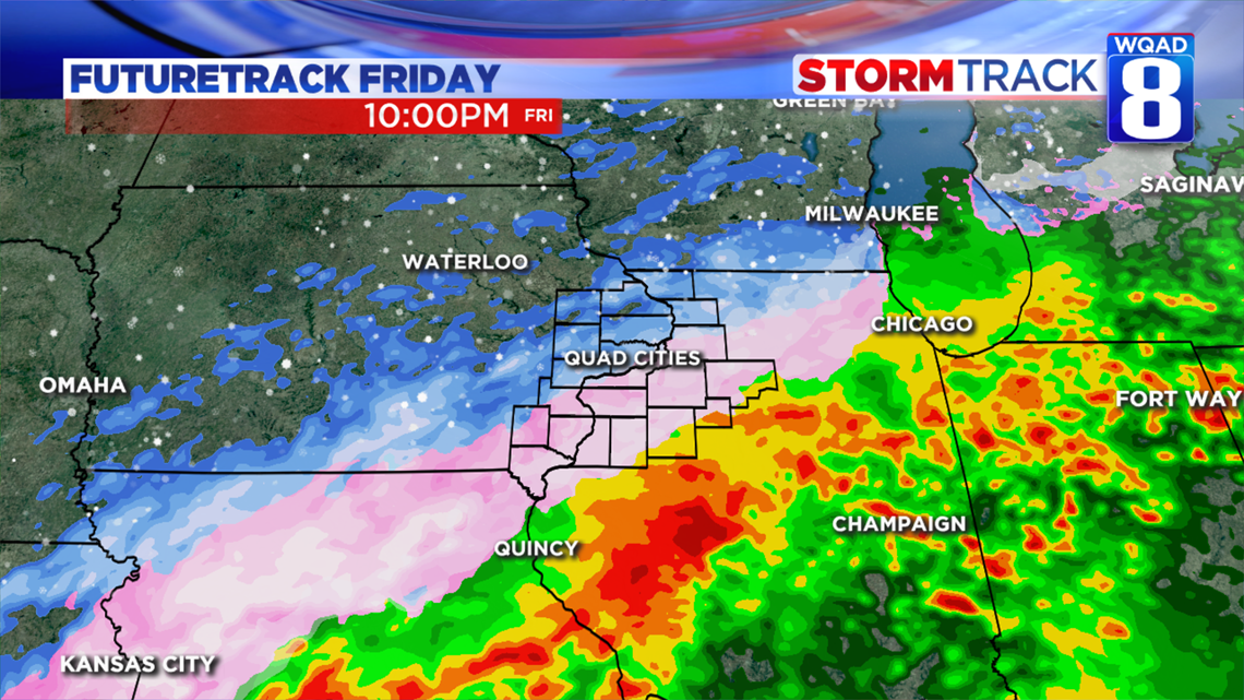
We will transition to snow late-morning Saturday with heavy snow possible into the afternoon and evening. That's when we could have white-out conditions.

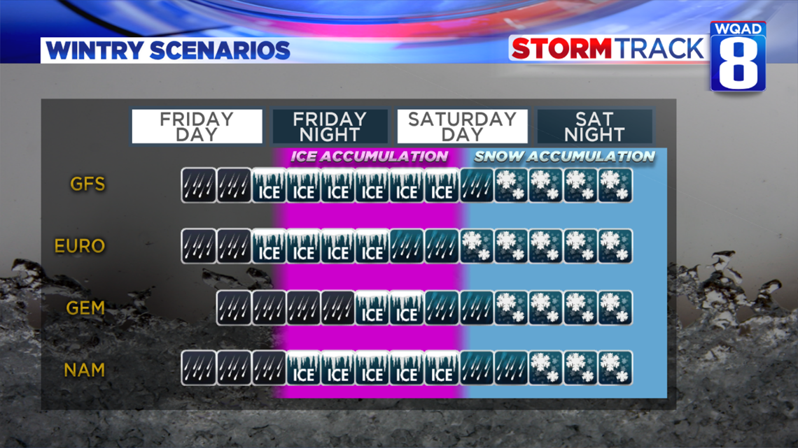
Models are in pretty good agreement on the ice-to-snow scenario. That lends us more confidence in big travel impacts for Friday night into Saturday. Because dangerous travel is anticipated, any plans you may have on the roads Saturday should be moved to Friday and Sunday.

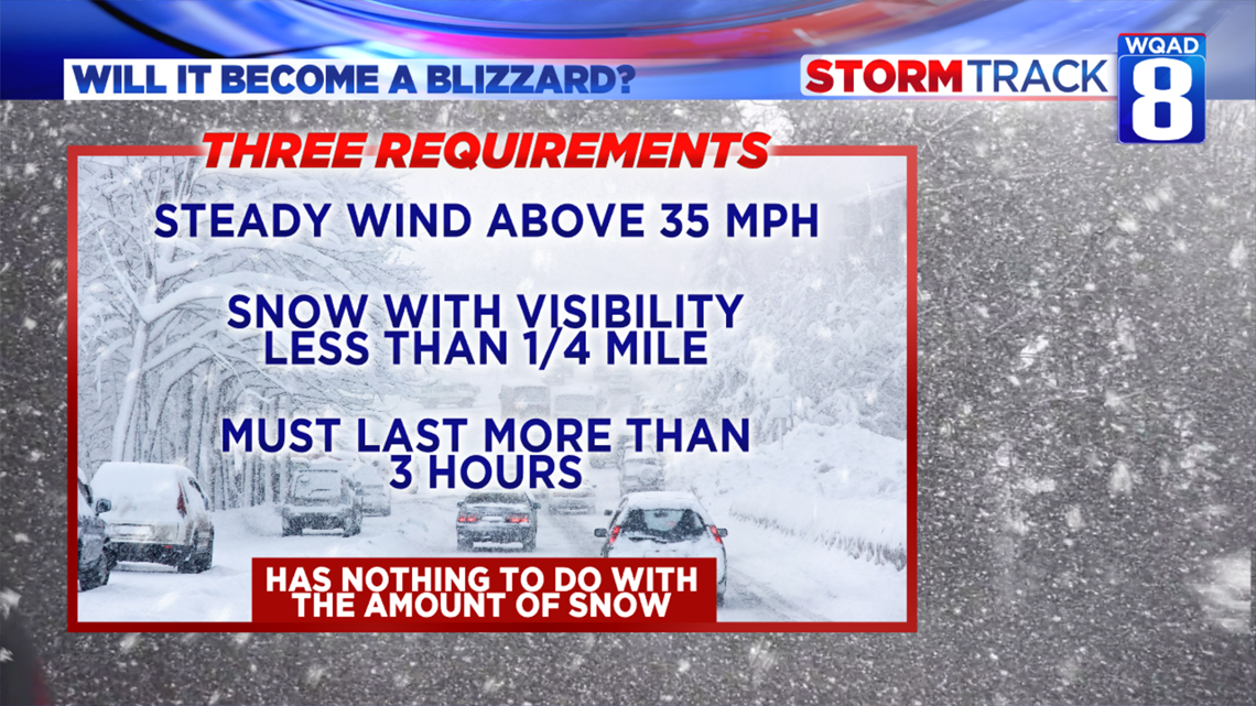
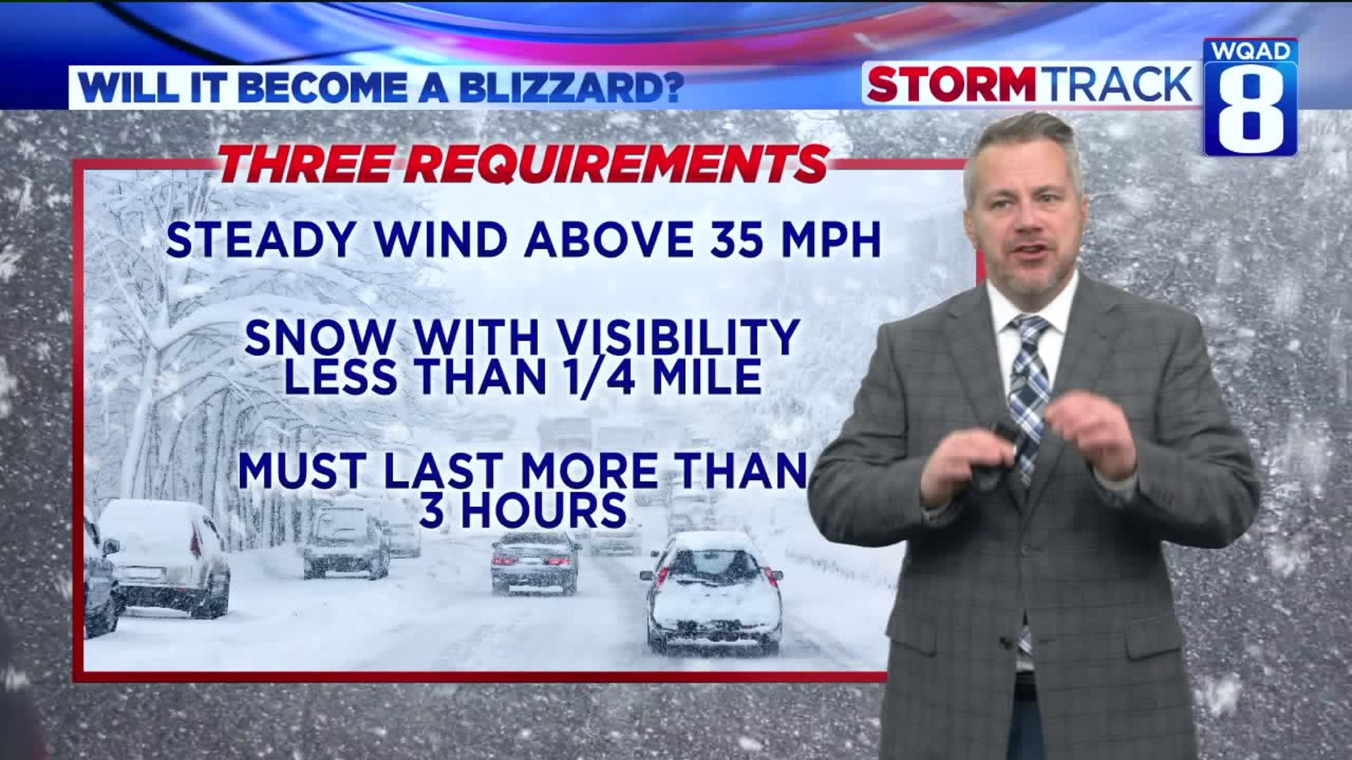
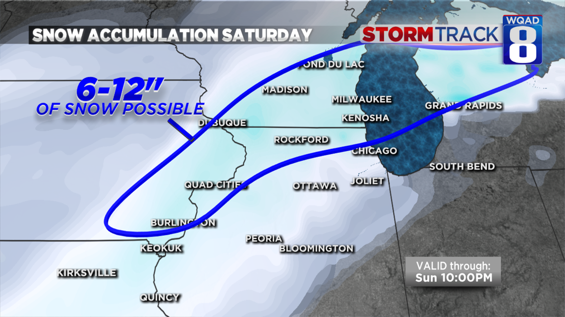
Where there is heavy snow, blizzard conditions are possible Saturday afternoon and evening. Keep in mind, a blizzard has nothing to do with the amount of snow. Rather, it's the conditions that come with snow and wind.

Full forecast:
Thursday: Mostly cloudy, windy and warmer. Gusts could approach 45 mph, especially south of the Quad Cities later today. For that reason, a Wind Advisory is in effect for areas south of I-80. A few showers will be possible through the day as well.
Thursday night: Temperatures should remain slightly above freezing with scattered showers likely. From Cedar Rapids to Dubuque, Iowa things could get a little slick with some mixed precipitation.
Friday: Mostly cloudy with a few showers from time to time. Travel should be fine during the daylight hours with highs around 37 degrees.
Friday Night: Freezing rain is expected. That's where rain falls onto surfaces below freezing. A glaze of ice is expected after midnight with dangerous driving conditions through the night. Some power outages are possible in the worst-case scenario, especially east and south of the Quad Cities (Princeton to Galesburg, Illinois).
Saturday: Freezing rain will change over to snow in the morning with heavy snow possible into the afternoon and evening. With winds, possibly gusting above 35 mph, there's a chance of white-out and blizzard conditions. Snow and wind will decrease by 10pm Sunday evening when some areas could deal with more than 6 inches of snow.
Extended: Sunday will be sunny and chilly with highs around 30 degrees. A light snowfall is possible Sunday night into Monday morning with more snow Wednesday. After that, a cold pattern should last a few days.
-Meteorologist Eric Sorensen