
Sunshine is finally making a return to the region Tuesday, but it won't last all day as we track our next system that promises to bring a rain and snow mix overnight.

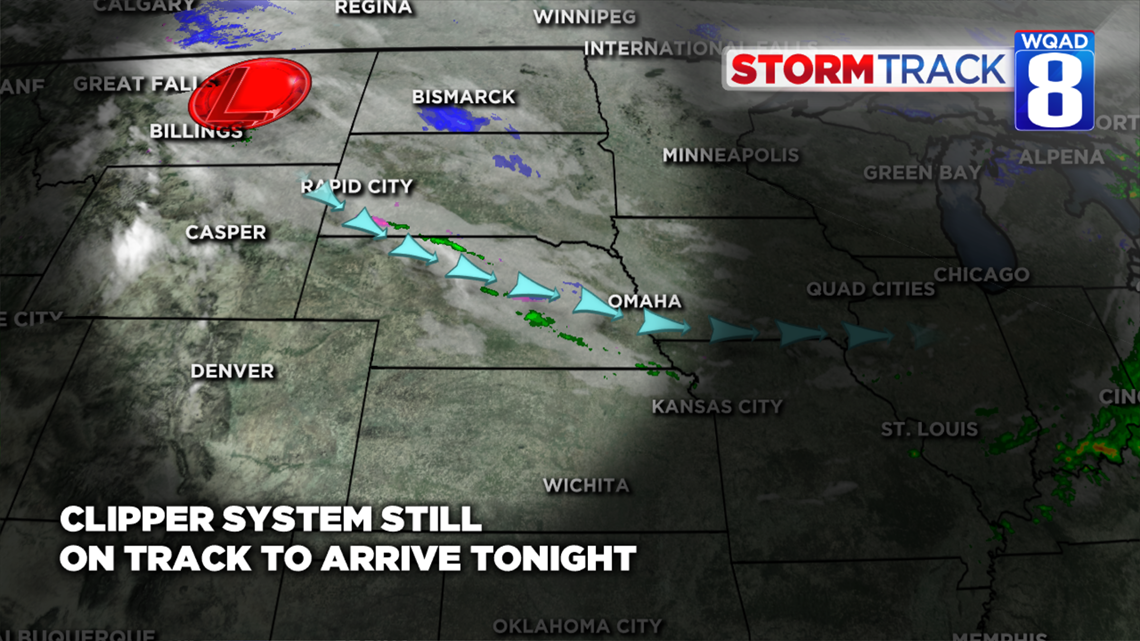
An area of low pressure that is currently across parts of Montana will quickly race east spreading more clouds across the Quad Cities by Tuesday night. We'll remain dry until around 8 p.m., when a mix of rain and snow is expected to develop.

Most if not all of the precipitation with this system will be limited to areas north of the Quad Cities Tuesday night.
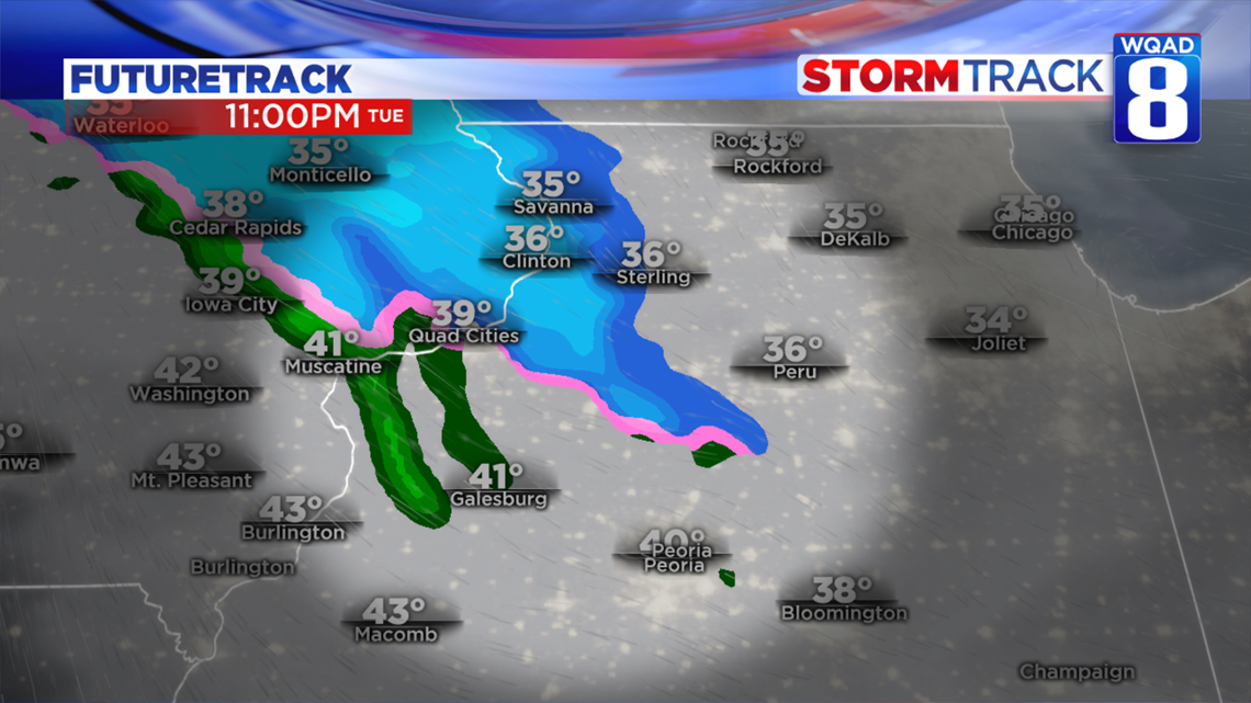
Temperatures will be above freezing in the south where a few light rain showers are possible.
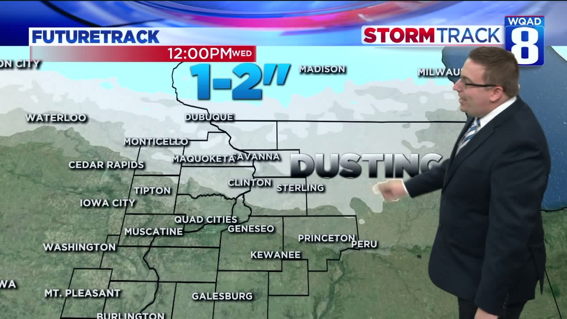
Further north, where temperatures are a little closer to freezing, some snow will begin to mix in from the Quad Cities and points north. The area that has the best potential for accumulating snow will be closer to U.S. Route 20.

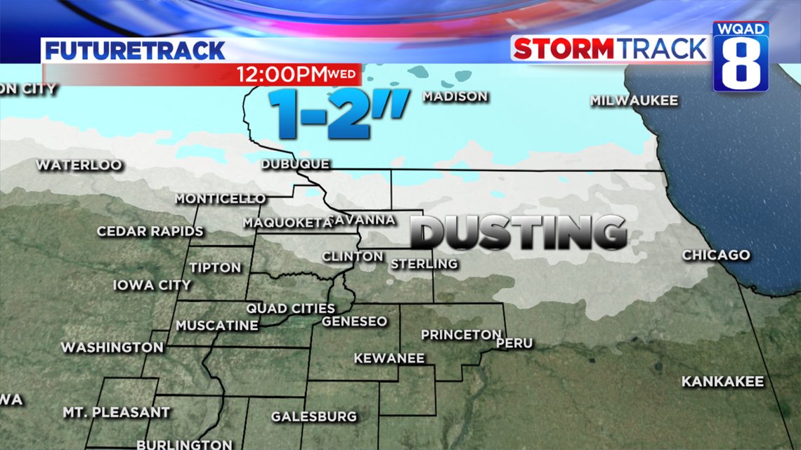
A dusting of accumulation is likely in a line running from Monticello to Clinton to Sterling and Rock Falls.
Further north of this line, accumulation up to half an inch is possible, with higher amounts once you cross the Illinois-Wisconsin border.
Winter Weather Advisories have already been issued for areas farther north where travel impacts are expected to remain.

Once this clipper system passes we'll actually see a warmer day for Wednesday as a strong arctic front approaches the area. This will allow temperatures to warm back up into the 50s.
It will be the last of the 50s for a while though, so make sure to enjoy the warmth!
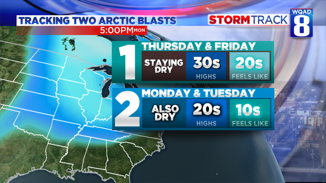
By Thursday and Friday, the front will have passed and we'll experience quite the cold shot straight out of Canada. While we won't see any precipitation with this, the winds will be gusty at times and send highs in the 30s with wind chills into the 20s.
After some moderation by the weekend, temperatures will crash even harder early next week as a stronger punch of colder air works south. This will knock our afternoon high temperatures down into the upper 20s and send wind chills into the teens and even some single digits.
At least there isn't any snow to talk about, yet.
- Meteorologist Andrew Stutzke