
Sunday's 60 degree temperatures will quickly vanish as our pattern turns more wintry for the week ahead. We're tracking not one, but two opportunities for accumulating snow this week.
A cold front working through tonight into Monday morning will usher in the colder temperatures needed to start creating an environment favorable for snow production, especially by Monday night as moisture streams into the region.

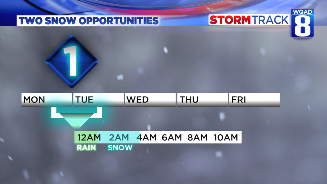
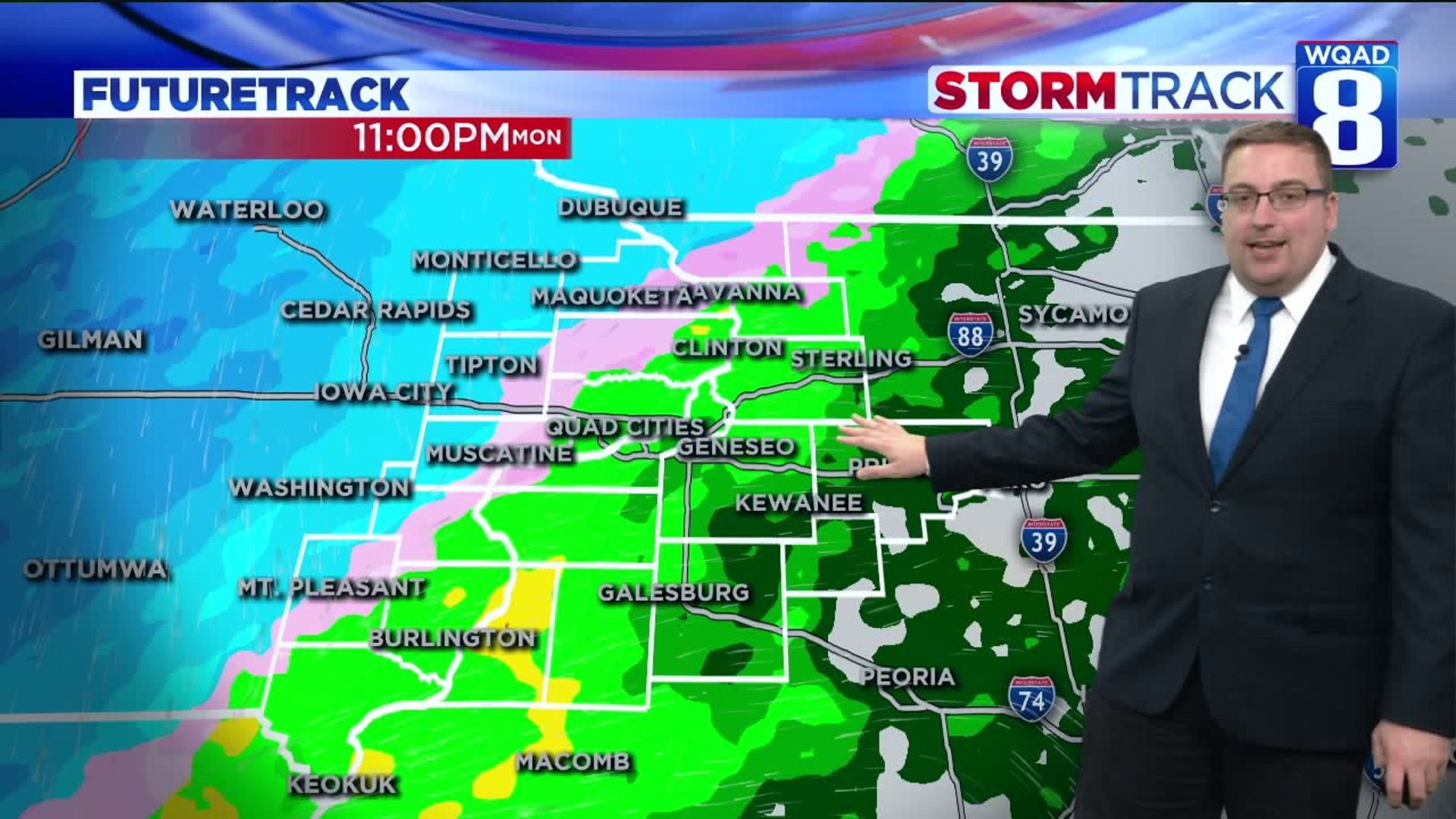
Storm system #1 brings rain initially after 6pm Monday evening that will eventually switch to all snow sometime after midnight before completely ending around 4/5am Tuesday morning.

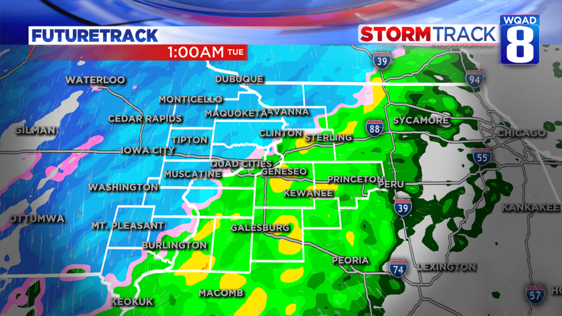
The transition from rain to snow is going to significantly impact which areas see accumulation and which areas see hardly anything in terms of snowfall. Our in-house model shows that most areas west of the Mississippi River stand the best chance for seeing some light snowfall accumulation, especially on grassy surfaces by Tuesday morning. Meanwhile, areas east of the Mississippi River will see mainly rain with a few snowflakes mixed in towards the end of the event.

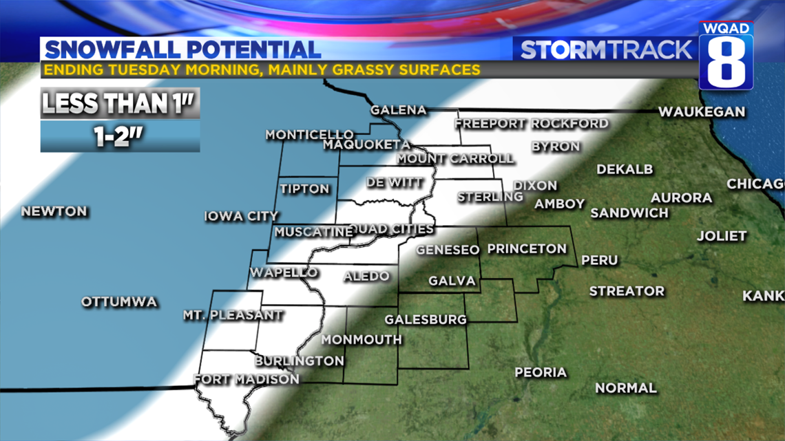
Here's how I think the accumulation totals will layout. Heaviest amounts of at most two inches will be found west of Maquoketa, DeWitt, Muscatine, Wapello, and Mt. Pleasant. Areas east of the Mississippi River, including much of the Quad Cities, will see less than one inch total. Nearly all of the accumulation will be limited to grassy and elevated surfaces. Significant travel impacts are not expected on area roadways, but reduced visibility at times will be likely.

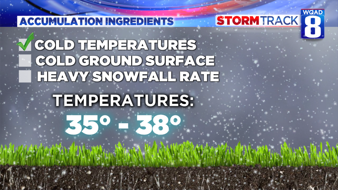
With this being our first snowfall accumulation event of the season, it's always good to refresh ourselves on what ingredients we need for a decent snowfall accumulation event. These include cold temperatures, a cold ground or elevated surface, and snowfall rates.
While temperatures here at the surface will be just above freezing, temperatures aloft will be well below freezing allowing the snow to continue it's the journey to the surface here.

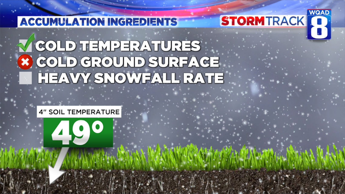
Our ground or soil temperatures, on the other hand, have been running well-above freezing, despite several sub-freezing nights lately. Looking four inches down into the soil, temperatures are running in the upper 40s. Not an ideal cold surface for the snow to stick on, but, these conditions can be overcome by heavy snowfall rates.

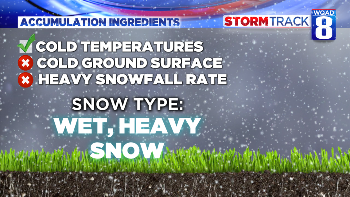
That's where our last element comes in. The type of snow falling will be wet and heavy with temperatures in the middle to upper 30s. It won't be light and fluffy, meaning it won't accumulate as easily compared to if temperatures were much colder.

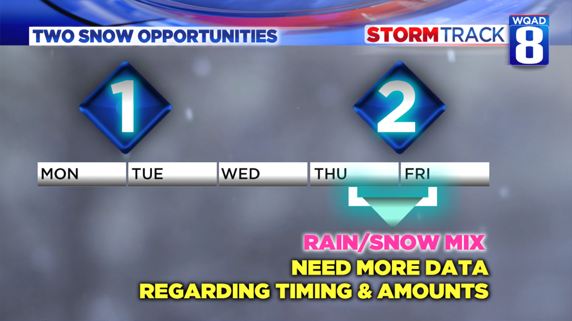
System #2 will be arriving on Wednesday into Thursday. We're still needing some good model data to make the picture a bit clearer. It appears right now a mix of rain and snow is likely, transitioning to all snow by Thursday. How much we see in terms of accumulations will vary greatly depending on the track. This is something that will be better resolved in the next 23 to 36 hours. Stay tuned!
Meteorologist Andrew Stutzke