Happy Saturday! We are starting your morning on the dry side, but the big story comes with the showers to our south.
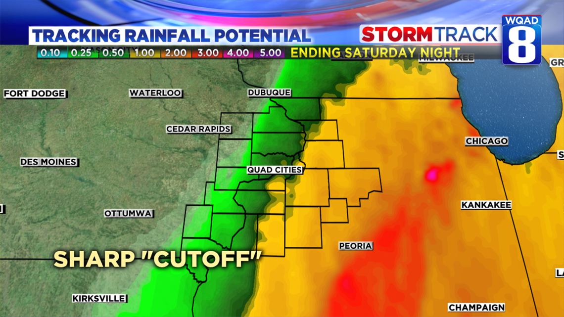
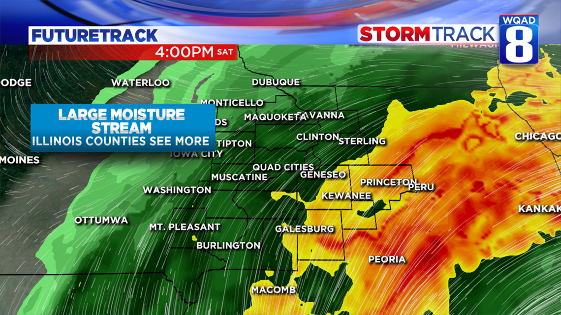
This system is beginning to push to the north and east rapidly this morning. The Quad Cities is on the very edge of where the heaviest rain could fall. The cutoff is so sharp that some of us could be dry for the day! When looking at how much precipitation we could see, it is clear that the heaviest rain will stay just east of the Mississippi River. Some of our hometowns in Illinois could see up to an inch of rain today.

Timing for the rain will come in the afternoon, but we may see some sprinkles in the later morning. Once showers move in they will likely stick around for much of the evening before tapering off tonight. Decreasing clouds tonight will set us up for a beautiful day tomorrow.

Your Sunday is looking like the weekend’s best! Temperatures will be nearing 60° with mostly sunny skies. I highly recommend trying to get some last minute outdoor fun in before we get a strong cold front Sunday night. This is going to bring highs in the 40s all of next week.