
Get ready for a wild weather roller coaster over the next few days!
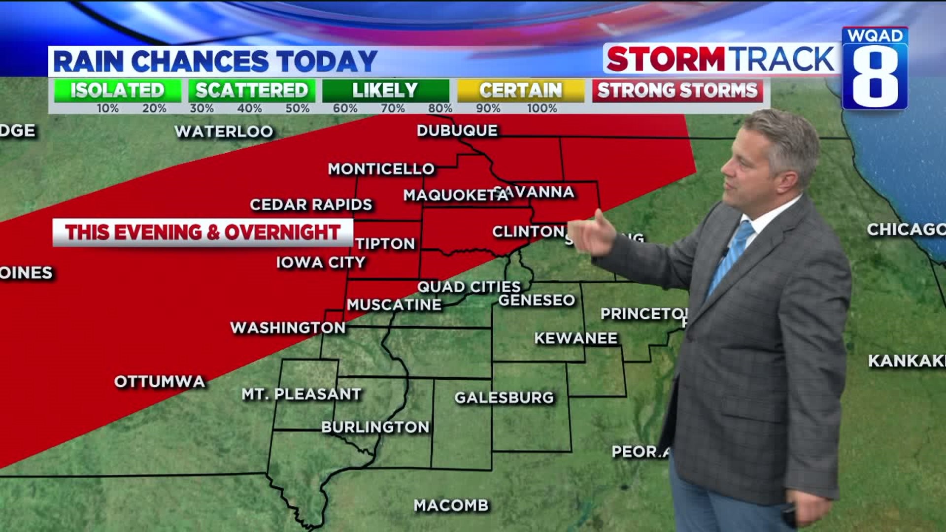
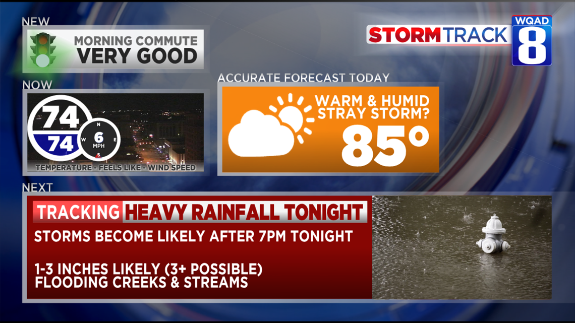
Today will be the last of Summer's heat and humidity. We'll have highs in the middle 80s with heat index values up into the upper 80s. A few rogue thunderstorms are possible from Muscatine, up to Dubuque today.
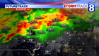

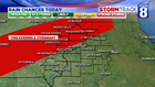

Thunderstorms will become likely as the night goes on tonight.
A few storms could be a little feisty with some winds up to 60 mph and torrential rainfall. Parts of the area are in a red-zone for possible severe weather.
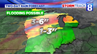

Rainfall will be the big story over the next 24 hours as some spots could receive more than 3 inches of rain. For that reason, a Flash Flood Watch is in effect for the US-20 corridor for heavy rain potential.
Temperatures will fall into 60s tonight and stay there all day tomorrow with some occasional rainfall.
River levels will be rising over the next few days, especially with extreme amounts of rain coming for Northeastern Iowa and Western Wisconsin. This will cause dramatic rises of the Mississippi, Maquoketa, and Wapsipinicon Rivers by late-week.
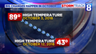

When it comes to big drops in temperature, there's nothing like October weather!
Last year, we went from near 90 degrees down to 43 degrees for a high in a week and a half.
-Meteorologist Eric Sorensen