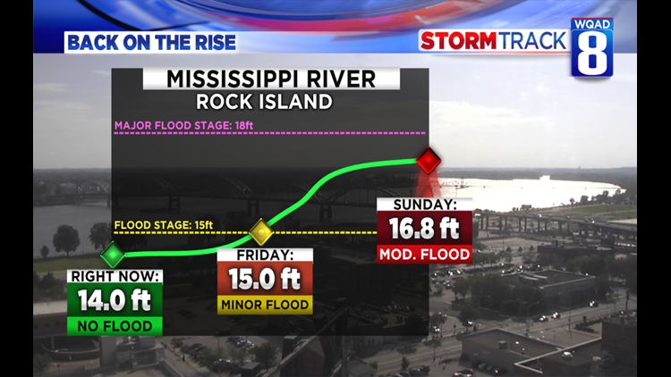
The National Weather Service is predicting the Mississippi River will rise once again close to major flood stage by the upcoming weekend as more heavy rainfall is expected for the Quad Cities region.


Right now, the Mississippi River is at 14 feet. It is expected to reach flood stage by Friday afternoon and continue rising to around 16.8 feet by Sunday morning. At this level, water begins impacting parts of Le Claire park, Credit Island lane, and Moline’s River Drive in the 4700 block.


The amount of rising water we see on the Mississippi River and other tributary rivers can still change in the days ahead. We won’t only be tracking the amount of rain we receive here in the Quad Cities, but we’ll also be watching our neighbors to the north. Several tributary rivers in Wisconsin and Minnesota that directly feed into the Mississippi River are expected to rise as well. Looking at rainfall projections through the entire week, nearly the entire region is in line to see some form of heavy rain. Where the heaviest band lays out looks to run from northwestern Iowa through south-central Wisconsin.


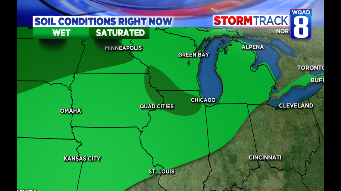
Soil conditions will also play a big role in how much water is moved to the river system. Current soil conditions are nearly 100% saturated to the north of the Quad Cities, while much drier conditions exist further downstate into Illinois. What this means is any rainfall that happens to target these saturated areas will quickly run off and head for the rivers since the ground is already full. This is a very similar setup to what we observed this spring in terms of the ground moisture.


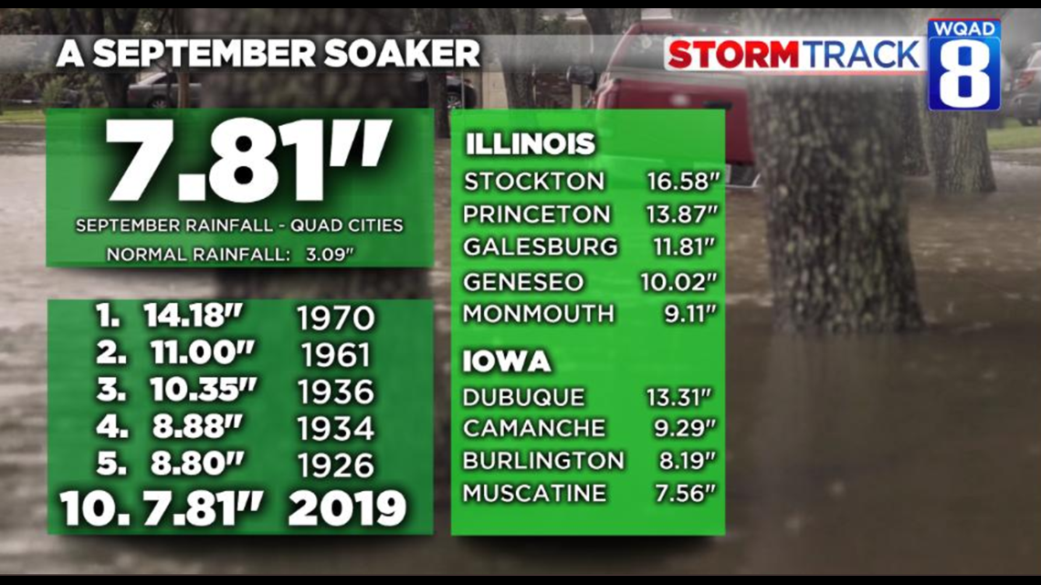
To get an even more in-depth look at which areas are currently saturated, look no further than the current rainfall tally for many of our hometowns this month. Stockton in Jo Daviess County alone has racked up more than sixteen inches of rainfall for just September alone. Princeton and Geneseo are not far behind with amounts exceeding or approaching a foot. Even the Iowa side of the river has seen significant rainfall. All of these factors coming together just right to keep area water levels elevated.
OTHER RIVERS IN FLOOD: The Rock River will also reach moderate flood stage by the upcoming weekend in both Joslin and Moline. Meanwhile, the Green River near Geneseo will rise again by Thursday and Friday but remain below flood stage through next weekend.
Click here to check river levels in your hometown.
Meteorologist Andrew Stutzke


