
Our early fall preview comes to an abrupt end on Thursday as an approaching front builds the heat and humidity back in. All three of these ingredients will come together by the afternoon to produce showers and thunderstorms. A few of the storms could be on the strong side.
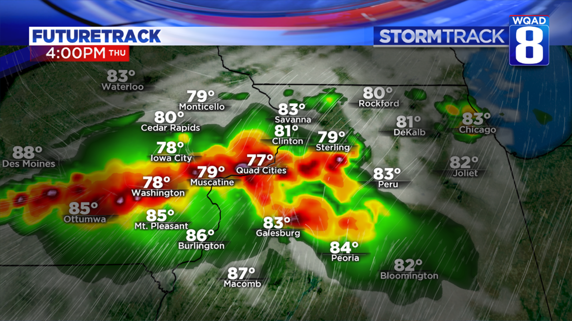
The front itself will be moving through during the prime heating of the day, when our atmosphere usually has the most available energy. Temperatures will climb well into the middle 80s with heat index values rising close to 90 in some locations by mid afternoon. As the front runs into this unstable and moist air mass, scattered thunderstorms will develop along I80 by 2 to 3 pm and quickly dive southeast.
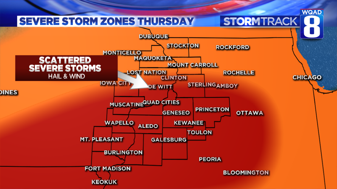
It's these areas that will be under the threat for some severe storms with mainly a wind and hail threat. This includes Clinton, Sterling/Rock Falls, the Quad Cities, Galesburg, Princeton IL, and Burlington.
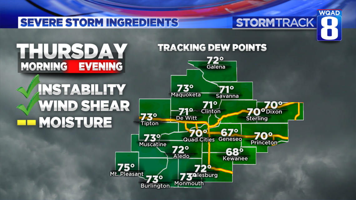
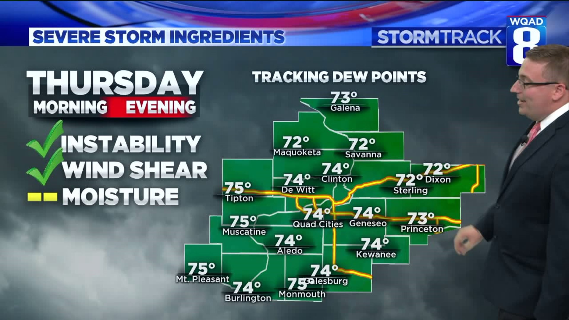
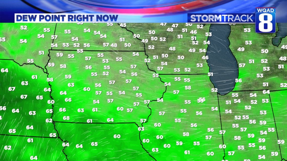
One key ingredient that remains in question this evening will be the amount of available moisture. We currently have dew point temperatures sitting in the lower to middle 50s. Some of the latest computer guidance tries to bring dew point values of lower to middle 70s into the Quad Cities by tomorrow afternoon. I have a hard time accepting that our atmosphere is going to change that drastically in the span of 18 hours or so. While not impossible, I'm leaning more towards dew point values staying in the 60s, somewhat limiting the coverage of the more severe storms.

Looking at a regional view of the moisture this evening, you can see the moist air mass is trying to move north and west, currently following the wind pattern stretching from Nebraska through Iowa where dew point temperatures are rising into the middle and upper 60s. If this moisture can continue quickly advancing overnight, the threat for scattered severe storms will be on the rise for Thursday afternoon and evening.
We'll continue tracking these ingredients overnight. Meteorologist Morgan Strackbein will have the latest threat analysis on Good Morning Quad Cities.
Meteorologist Andrew Stutzke
Download the News 8 Weather App — for iOS, click here and for Android, click here
Download the free News 8 App — for iOS, click here and for Android, click here