
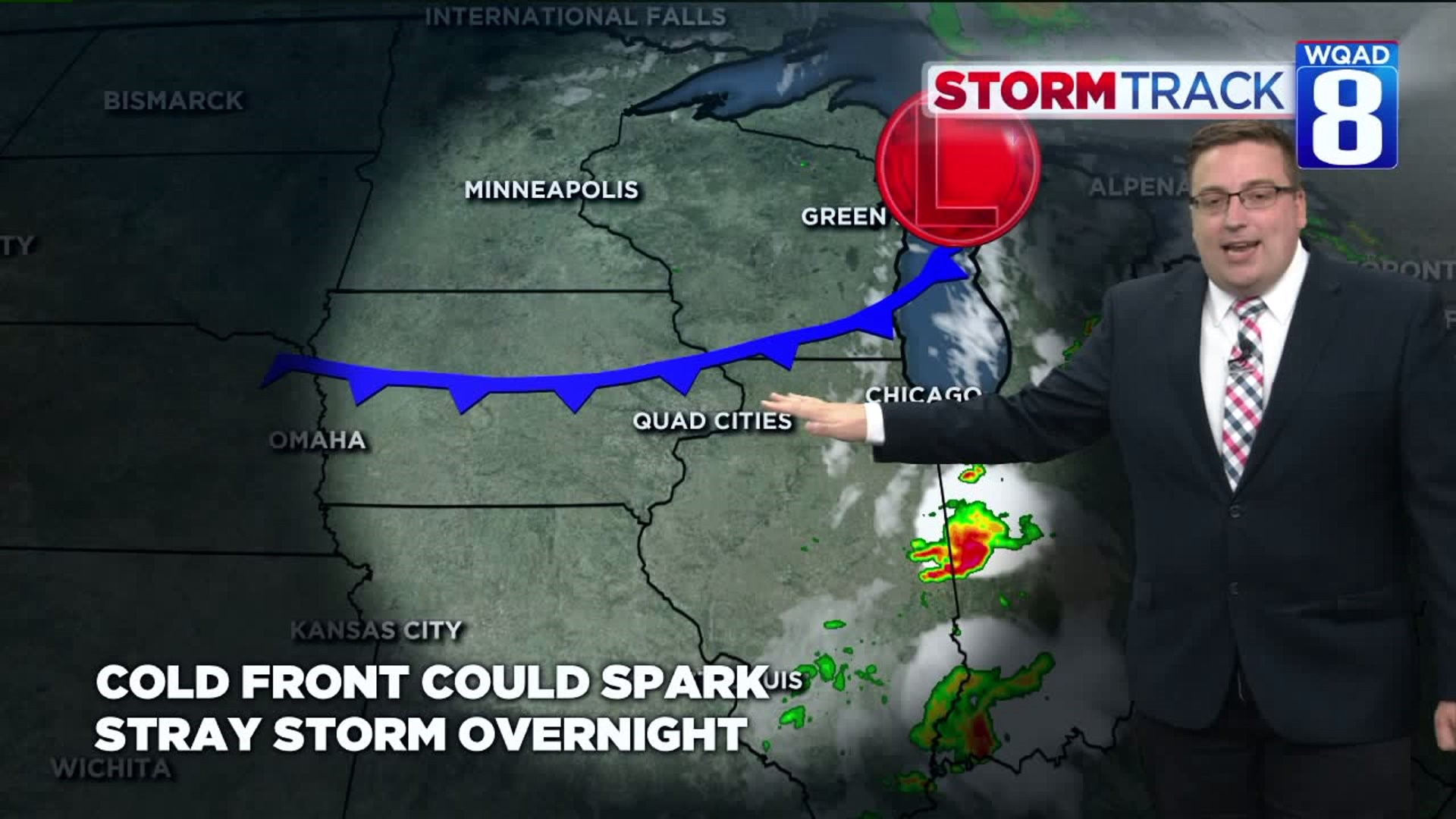
Another nice pocket of beneficial rains greeted the Quad Cities Sunday morning, along with plenty of lightning and a few strong wind gusts. Many locations, especially north and west of the Quad Cities saw anywhere from one-half inch to nearly two inches of rainfall. Not too shabby!
A cold front sweeping through Sunday evening will end the storm chances, but it will only somewhat scour out any remaining humidity depending on where you live.

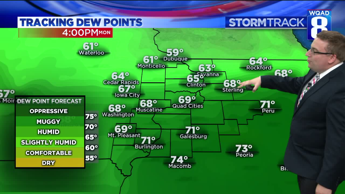
By Monday afternoon the front will have cleared much of eastern Iowa and Northern Illinois, with the exception of areas around Burlington down towards Peoria. This is where dew point values will still rise into the 70s making for a rather humid afternoon. Meanwhile to the north, these moisture levels will be much lower keeping things comfortable.
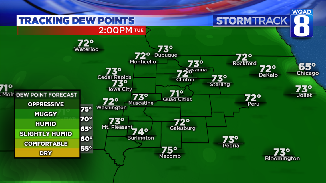
By Tuesday everyone of us will be feeling the increasing humidity along with warmer temperatures ahead of a disturbance working in from parts of Iowa. This will switch winds to the south again and draw up higher dew point values well into the lower 70s. Combine this with daytime highs in the low 90s and we are easily looking at heat index values near 100 degrees by the afternoon.

The one challenge for Tuesday remains the timing and placement of potentially severe storms. Several ingredients will be coming together to support strong storm development, including ample instability and wind shear. If storms can hold off until the afternoon hours, then our severe weather threat will increase. However, if they come through during the early morning hours like the above model indicates, the severe weather threat would be more isolated in nature. We'll continue to track this threat in the next 24 hours.

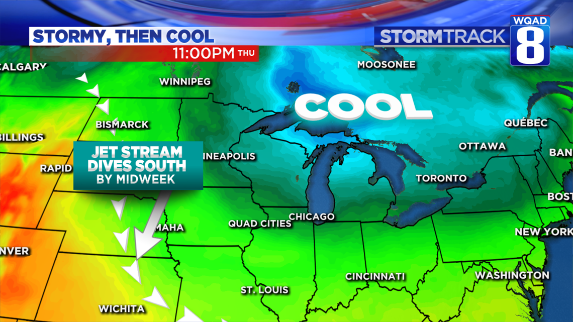
Once these storms clear out by Tuesday evening we'll be welcoming in a refreshingly cooler and less humid air mass to carry us through the rest of the week. The strength of the cool air is quite impressive as the core of it lingers just north of the Great Lakes. The jet stream will be pushed substantially south allowing the cooler air to keep highs limited to the upper 70s and low 80s by Wednesday. No major warmth looks to return until the end of next weekend that coincidentally that will be our next chance for widespread rain beyond Tuesday.
Meteorologist Andrew Stutzke
Download the News 8 Weather App — for iOS, click here and for Android, click here
Download the free News 8 App — for iOS, click here and for Android, click here