
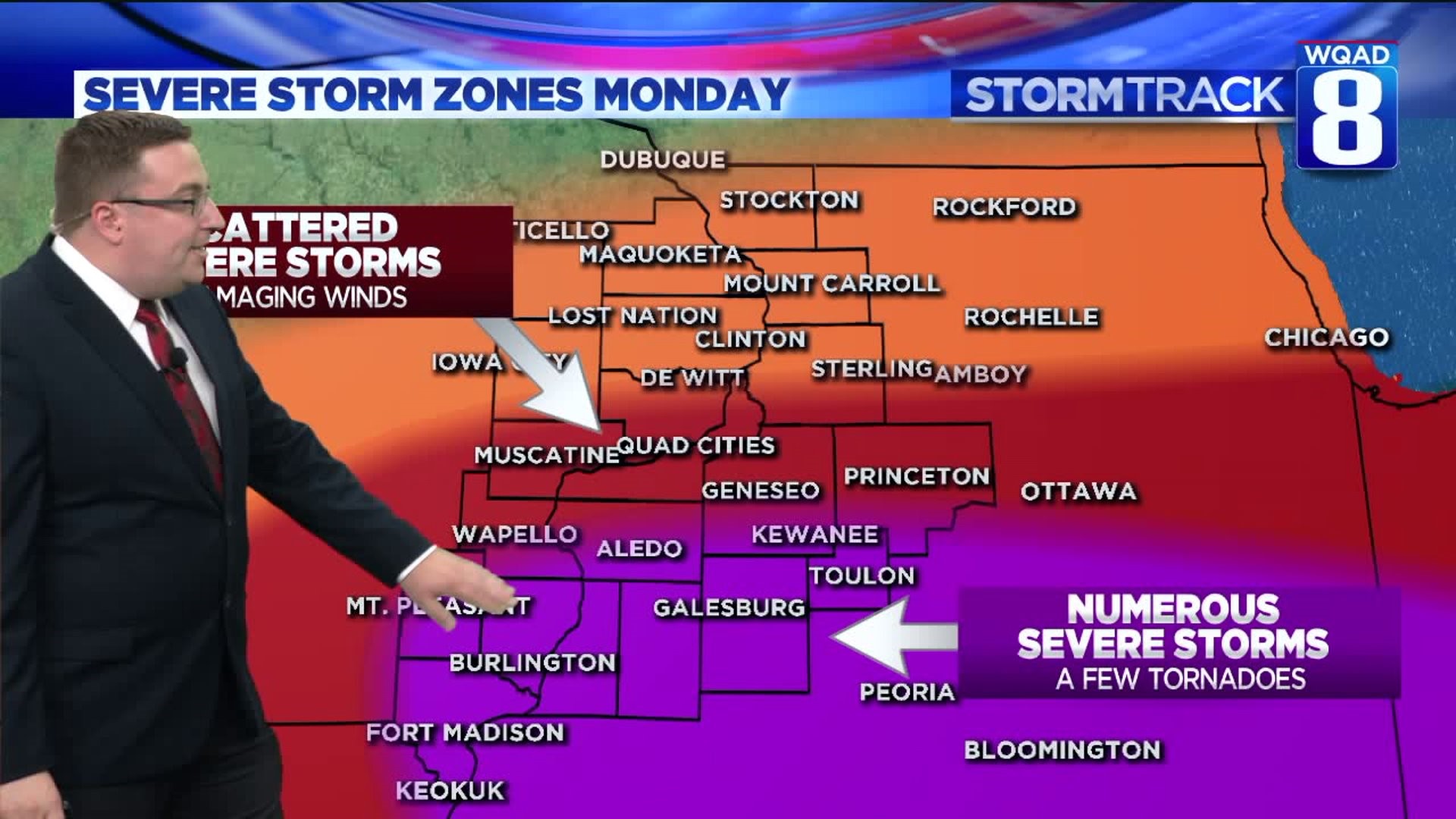
Severe weather is something we haven't seen for a number of days now, but that will likely come to an end by the time we reach Monday evening. We're currently tracking the potential for strong to severe thunderstorms in the Quad Cities that will bring the threat of damaging winds, heavy rainfall, and a few isolated tornadoes.
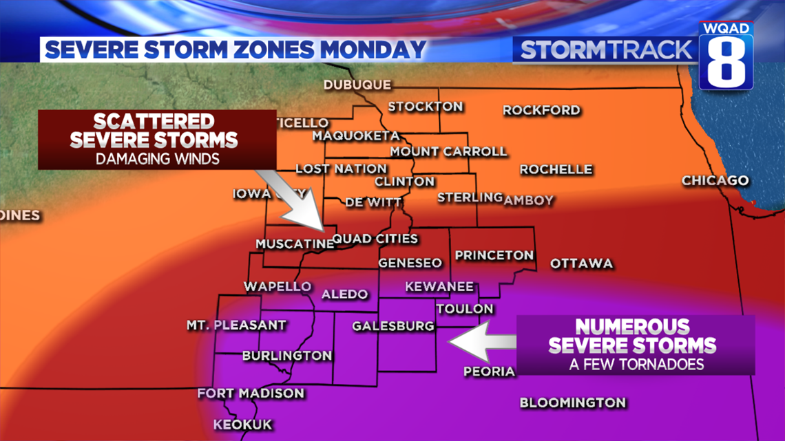
Risk areas include locations along and south of I80 on both sides of the river from 4-10pm Monday evening. A more elevated risk for a few isolated tornadoes will run along and south of a line from Wapello Iowa to Kewanee Illinois.
The setup involves a complex of severe storms forming in the central plains this evening and then racing east overnight. This complex is expected to enter eastern Iowa by mid-morning Monday in a weakening state. While heavy rain and gusty winds will be likely, the overall severe threat appears it will hold off until later in the afternoon and especially the evening.
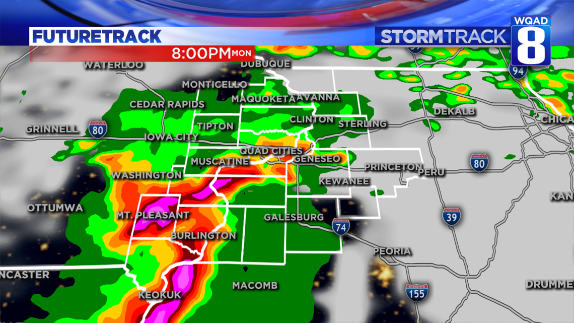
The amount of severe weather we see will depend on a few things. 1) The location of the warm front. 2) The amount of instability, or storm energy we can build. 3) The track of the disturbance produced by the morning round of storms. If all three of these ingredients can come together, a few severe storms will be likely with the main threats being damaging wind gusts up to 70 MPH and heavy rainfall. An isolated tornado or two can't be ruled out either, especially in the higher risk area outlined above. Large hail will be a secondary threat.
If we manage to remain cloudy and stuck in the rain for most of the day, the severe threat will be considerably lower and concentrate itself more downstate toward central Ilinois. There are still many details to be worked out.
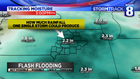

These storms will also be efficient at producing heavy rainfall in a short period of time. The precipitable water levels, something we look at to determine the threat for flash flooding, are quite high by Monday afternoon. Anytime this value rises above two inches, heavy rainfall is a given. While our dry ground can definitely handle a good amount of rainfall, what it can't handle is an extremely high rate of it at any given time. Areas that see the storm activity will be most vulnerable to areas of flash flooding. Rainfall amounts could approach three inches or more in isolated areas that see the heaviest storm activity.
We'll keep an eye on this system as it continues to track in our direction. Keep an eye to the sky and your Stormtrack 8 weather app Monday!
Meteorologist Andrew Stutzke
Download the News 8 Weather App — for iOS, click here and for Android, click here
Download the free News 8 App — for iOS, click here and for Android, click here