
It's the last thing we want to think about now that the Mississippi and other tributary rivers are finally getting back into their banks, but the next couple of weeks hold the potential to renew the risk for more flooding.

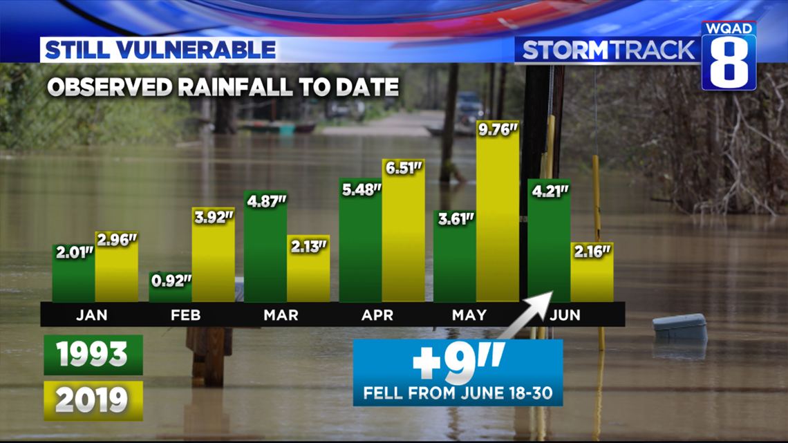
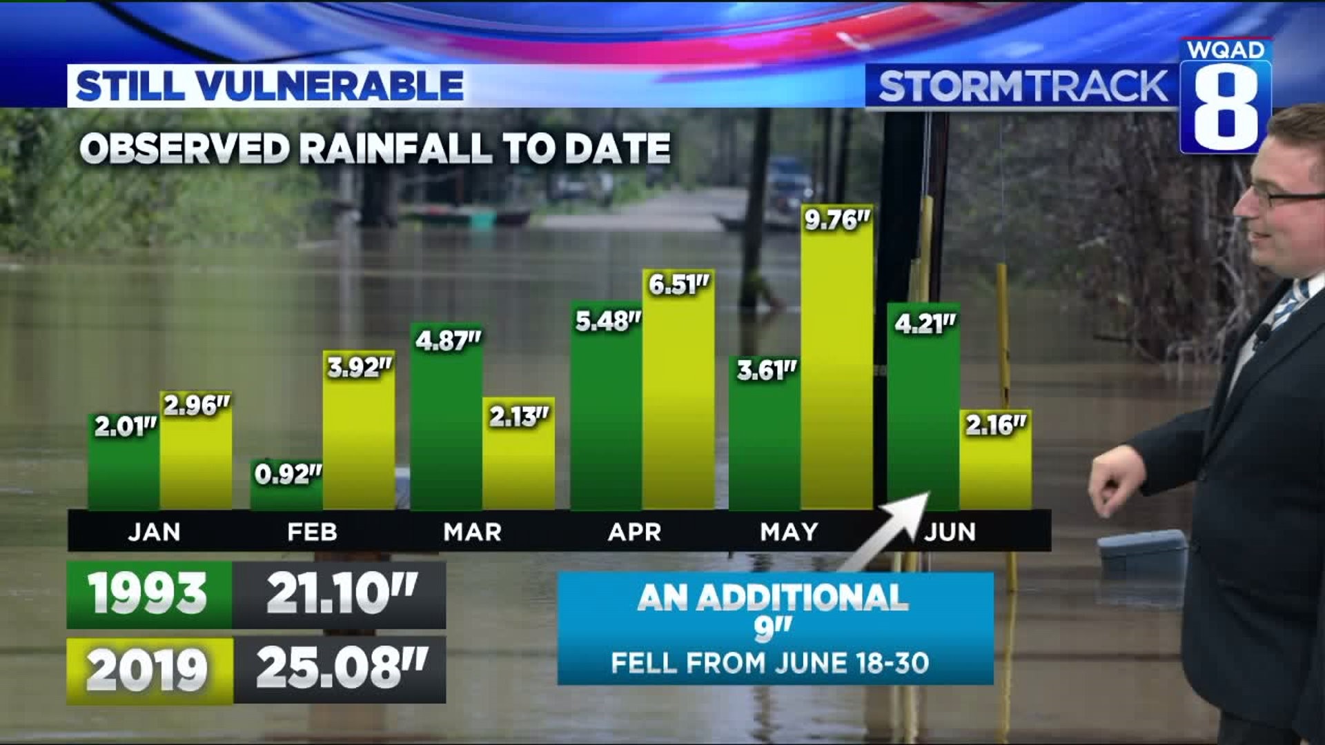
If we go back to the now second historic crest on the Mississippi River back in 1993 and compare the rainfall data, it really is astounding where things stand right now. With the flood of '93, it was the combination of saturated soils and extremely heavy rainfall in both June and July that brought record flooding to the Quad Cities. Looking at the rain to date rainfall comparison, you can see only 4.21 inches fell from June 1-17, but what you can't see is an additional nine inches of rain fell between June 18-30th putting the rainfall total for the month at a staggering 13.21 inches! That's a lot of water in a short period of time that had nowhere to go. The heavy rain came from repeated rounds of showers and storms that continuously moved over the same areas. This rainfall wasn't limited to just the Quad Cities either. It stretched as far north as Minnesota and Wisconsin along with many parts of Iowa and Illinois.

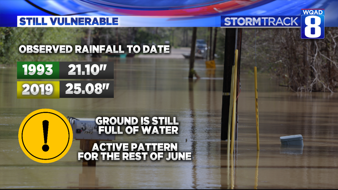
When you compare this year to 1993, notice how four of the five full months we have observed more rainfall on average compared to '93. With this in mind, we know the ground remains full of water and the actual water table itself remains quite elevated. For the year as a total, we've seen 25.08" of rainfall versus only 21.10" to date in '93. This, of course, does not include the additional 9 inches received towards the end of June, but it shows just where we stand quite well.

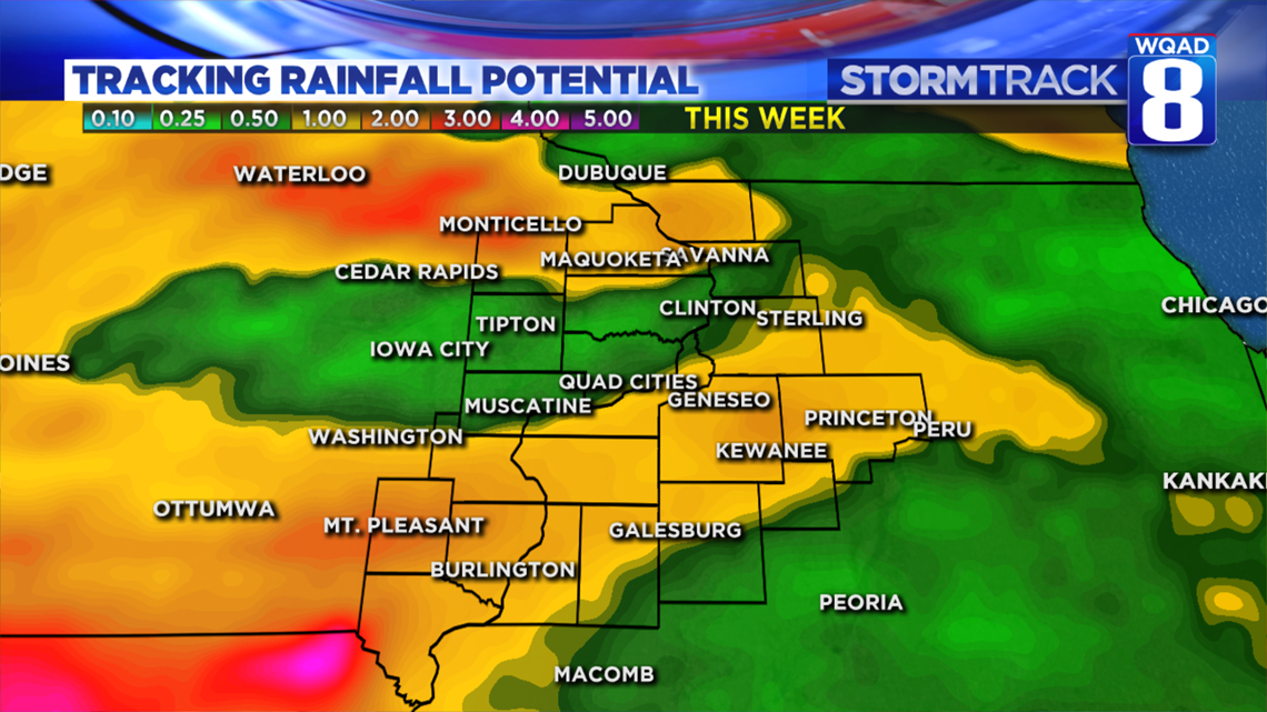
With a highly active pattern expected to persist through the end of June, we'll need to keep a close eye on the river situation closely. We are fortunate that levels are continuing to recede, but depending on how much rain we receive between now and the next few weeks, we could be right back where we started. The incoming pattern change is quite favorable of heavy clusters of thunderstorms that can lay down copious amounts of rainfall. It is also favorable for a few rounds of severe storms as well. It isn't all that uncommon that June is typically our heaviest rain producing month. July ranks right up there, too, which is why the threat for flooding will likely remain elevated through the rest of summer.
BOTTOM LINE: I wouldn't celebrate the fall of the Mississippi River quite yet. As we have talked about all winter and now all spring, the threat for more flooding is far from over. If you have interests along the river, be prepared to take action in the weeks ahead should the waters start rising again.
Meteorologist Andrew Stutzke