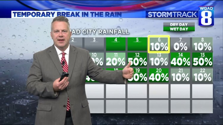
This is certainly not optimal. While we have a temporary break in the rain, long-range computer models point to a higher likelihood of heavy rain in the June 15-20 timeframe. While that's a ways off and subject to change, the day-to-day rain chance is what is worrisome.
Cooler, but wetter weather pattern setting up for the Midwest during the June 13-19th timeframe. pic.twitter.com/I5i4zDY7J5
— EricSorensen☈ (@ERICSORENSEN) June 6, 2019
River levels will level off and slowly fall into next week with a more sporadic pattern of wet weather.
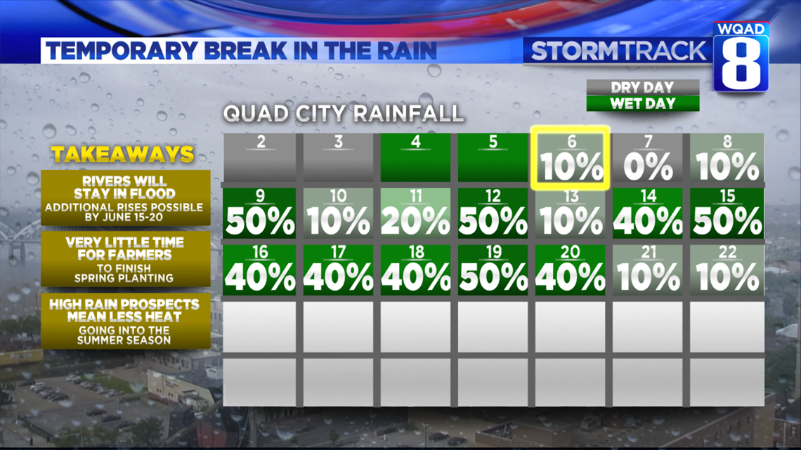
However, the pattern becomes active in the Midwest for the 8-14 day time frame. What we really need to see is more of a pattern with three days of dry weather in between each day of wet weather.
While we'll have that for the next week, it's not looking like the overall hemispheric pattern will change much. It's hard to say how long it will be before rivers fall below flood stage, but there's now a good chance flood conditions will stick around through at least the beginning of Summer on Friday June 21.
-Meteorologist Eric Sorensen