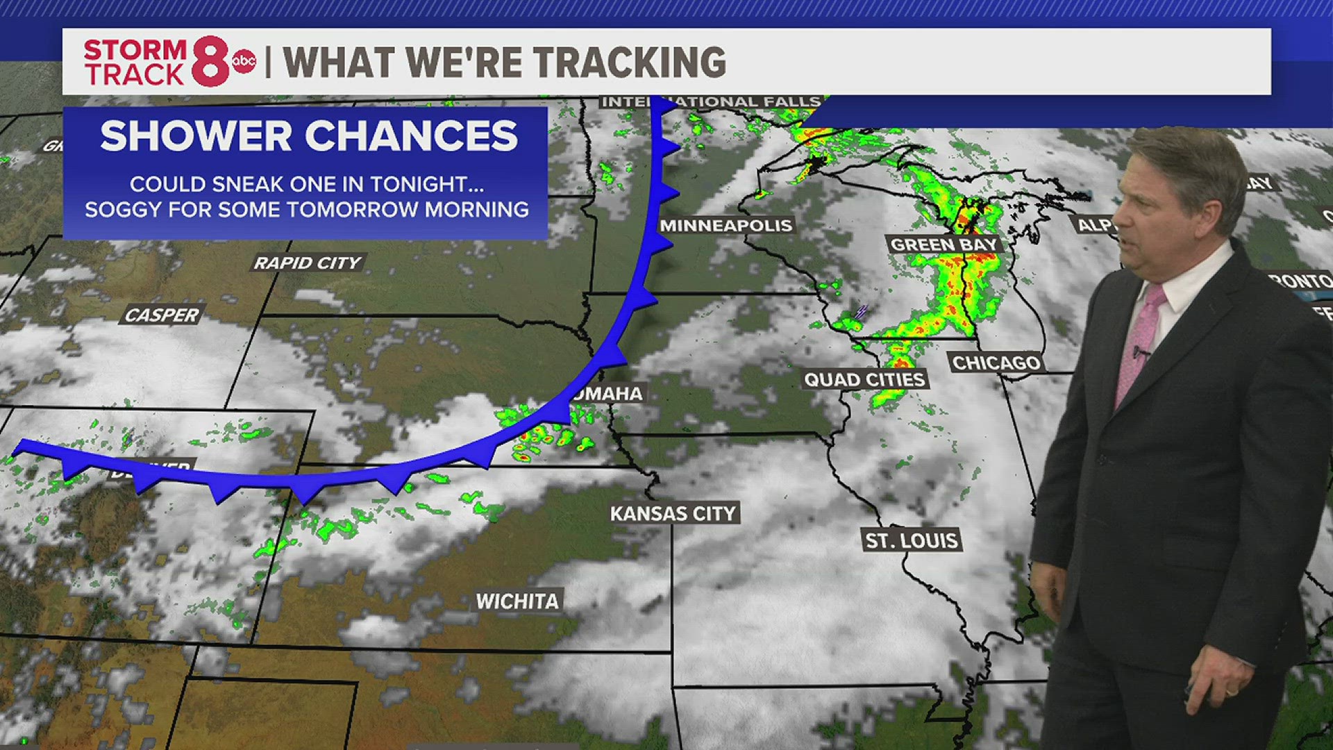
Dry conditions will be moving in for Sunday night as we finally get a break from the recent rainfall. Even a few breaks in the clouds are looking likely which will keep temperatures cool, with lows settling into the 40s. You may just want to close the windows tonight with temperatures that cool!
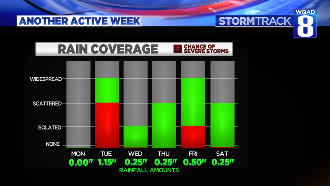
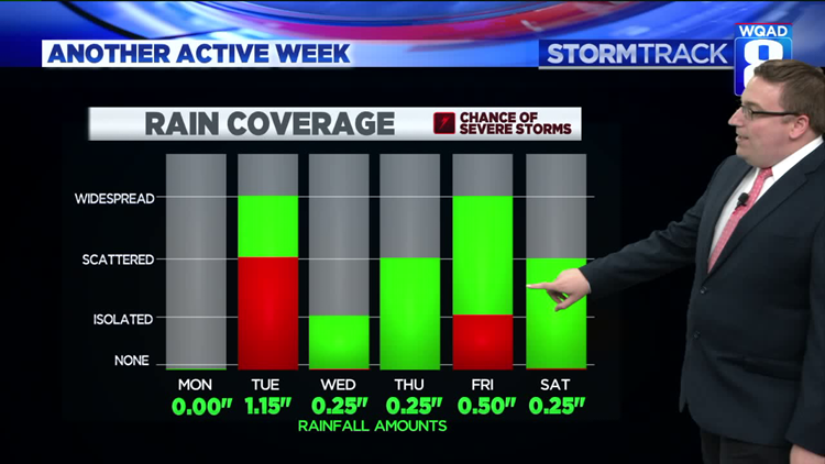
The week ahead is another active one filled with numerous opportunities to see additional heavy rainfall and severe weather. The most widespread and heaviest rains look to fall on Tuesday and then again Thursday through early next weekend. There will also be some severe threat days thrown in, too. Tuesday looks to have the best potential for a few stronger storms depending on what the early morning activity does. We'll keep tracking this potential. You can see rainfall amounts are fairly heft most days as well, with the possibility that one to three inches of additional rain could fall this week.

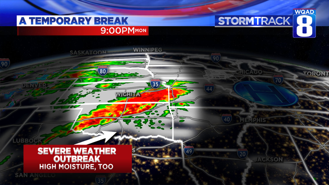
While Monday will be dry, the stage is already set for copious amounts of moisture and forcing to return by Tuesday morning. First, a large severe weather outbreak with strong tornadoes is forecast for parts of Kansas, Texas, and Oklahoma. Flooding is also a good possibility in these same areas on Monday afternoon and evening.

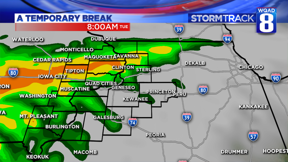
All that energy and moisture will then transition northeast and reach the Quad Cities by Tuesday morning bringing a round of heavy rain and gusty winds. The severity of the storms will be tampered down by the time they get here, but heavy rain certainly looks likely. Then, we wait and see what happens Tuesday afternoon and evening with any leftover boundaries. If we can manage to build enough storm energy with the help of some sunshine, we will likely see another good round of storms form in the afternoon and evening.

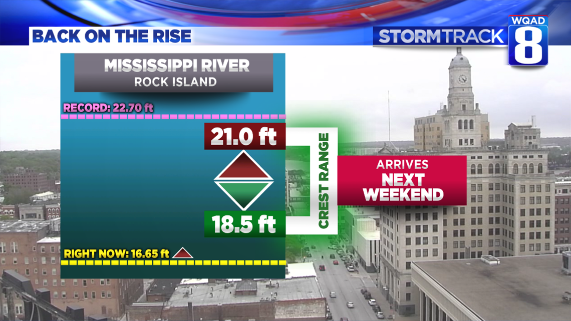
This potential for at least a few days featuring heavy rain is currently being factored into the next crest projections for the Mississippi River. That next major rise is expected to arrive by Memorial Day weekend. Right now the range is anywhere between 18.5 to 21 feet. The previous crest, which topped an all-time record, was 22.70 feet. At this time the river is not expected to reach that level, but any further significant rains that fall outside of the current forecast could certainly raise these numbers a bit further.
If you live along the river or any flood-prone area, you'll want to keep close tabs on the forecast this week.
Meteorologist Andrew Stutzke
Download the News 8 Weather App — for iOS, click here and for Android, click here
Download the free News 8 App — for iOS, click here and for Android, click here