
Our nice, quiet pattern that we enjoyed this weekend will be coming to a quick end by Sunday evening as we see our first of many chances for showers and thunderstorms.
A slow-moving cold front is moving down from Iowa and Wisconsin, driving some scattered showers and thunderstorms Sunday evening. Most of this activity is going to remain to the north of Interstate 80 on both the Iowa and Illinois side. Meanwhile, as the front itself continues to remain in the region, additional chances for scattered shower and storm activity will remain in the forecast through at least Thursday morning.

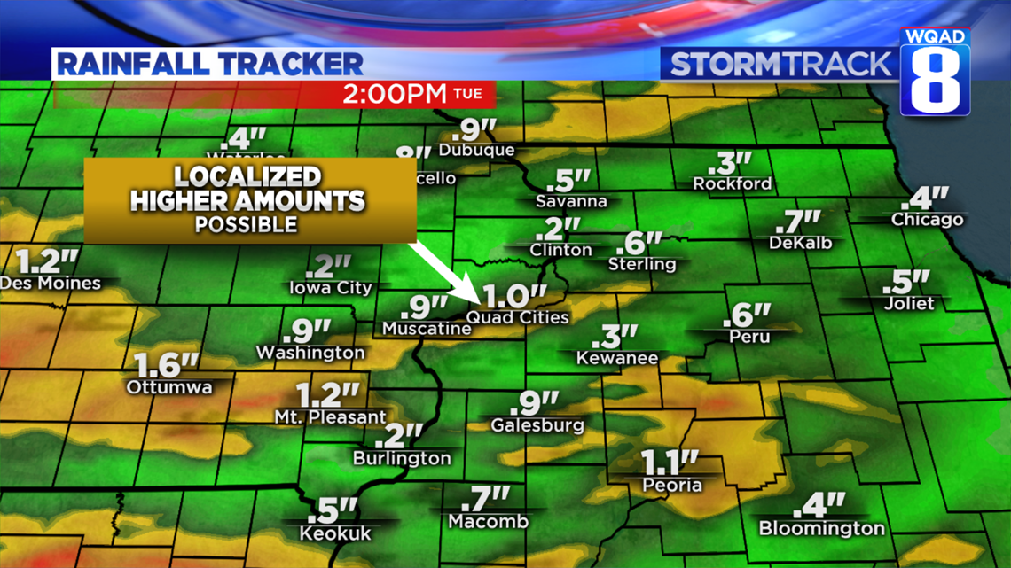
The rainfall up until Tuesday night will vary from town to town, with isolated pockets of heavier rains where the thunderstorms move through. On average, many locations will see at least a quarter of an inch with localized amounts of an inch or more.

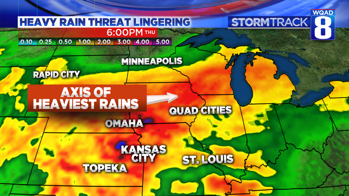
Once we reach Wednesday and Thursday, an area of low pressure will move along the front itself driving more widespread shower and storm activity. Sadly, much of the region will once again be in line for heavier rains, with even some solutions pointing to heavy rains falling here and to the north. This scenario is certainly one that is cause for alarm with the ongoing flooding. These are the two scenarios that will play out this week. Each one will affect the ongoing river flooding differently.
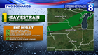
Scenario one keeps the heaviest rains to the north of the Quad Cities, over parts of northern Iowa and southern Wisconsin. Should this scenario play out, another crest will work south down the Mississippi River in the days following the rain. The height of that crest will greatly depend on how much rain falls. The ground here and to the north remains saturated, meaning much of the rain will run off into the river.
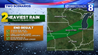
Scenario two puts the heaviest rains right over the Quad Cities, which would lead to a much quicker rise again on the Mississippi River. The crest would also depend on how much rain has fallen. Both scenarios would prolong the ongoing flooding even further.
We’ll be tracking how much rain falls in the next 72 hours to determine when and how high the river will be rising. Many tributary rivers are also rising at this time, and additional heavy rains could cause them to rise even further.
Meteorologist Andrew Stutzke