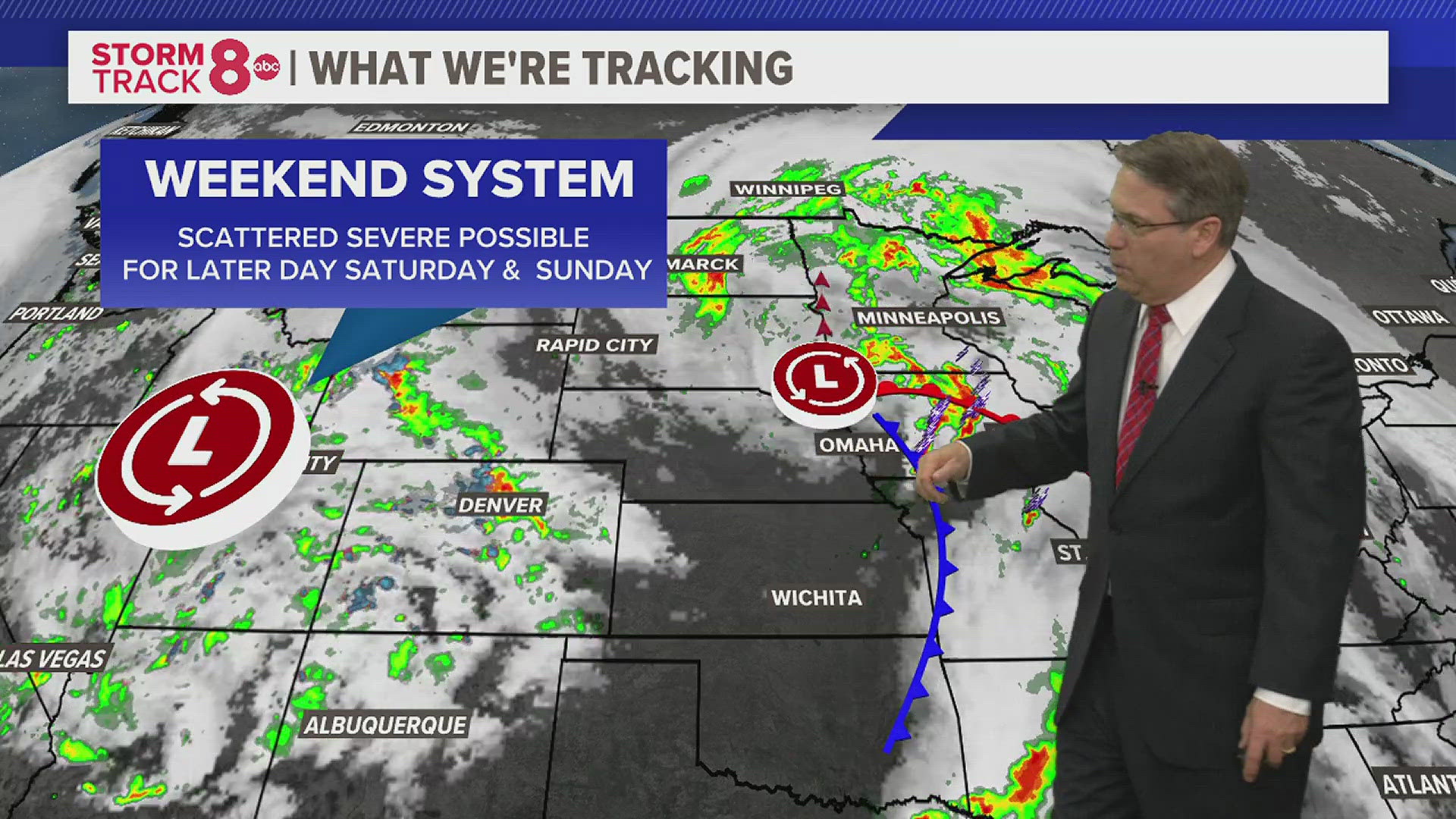
It may be just a few days before we jump into the month of May, but Mother Nature has a few tricks up her sleeve as a potent storm system impacts the Quad Cities on Saturday bringing heavy rains, gusty winds, and heavy snow.

A Winter Weather Advisory has been issued for Carroll and Jo Daviess Counties in Illinois and Jackson County in Iowa until 10pm Saturday night. Rain Saturday morning will quickly change over to all snow, heavy at times, across these areas. Accumulation on grassy surfaces is likely.
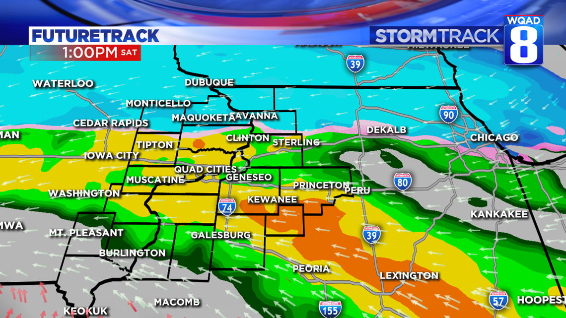
That change to snow expected to take place by 3pm Saturday afternoon and then continue to remain all snow before coming to an end by around 8pm Saturday evening. As pictured on our Futuretrack model above, you can see there will be a very sharp cutoff between who sees snow and who sticks with just rain.

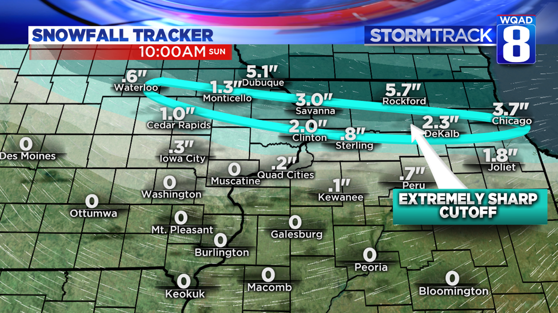
The snowfall amount forecast with this system comes with extremely low confidence. Spring snow events are even more complicated than winter season storm systems because you have to factor in the temperature of the ground. We’ve been above freezing for a number of weeks now which means the majority of the initial snowfall will be melting as it impacts the ground. We have to wait for heavier bands of snow to overcome the warm ground and then accumulate. This process will likely take some time and really adds to the uncertainty of the snowfall amounts. In reality, places along and just north (20 miles or so) of I88 on the Illinois side will likely see nothing in terms of snow accumulations, even though our model says less than an inch for Sterling and two inches for Clinton.
The cutoff in snowfall amounts is going to be extremely sharp in the area highlighted. You could go from an inch near Savanna to 7 inches in Galena, that’s how sharp this gradient is going to be.
The heaviest totals will likely be contained to the US 20 corridor on the Illinois side.
This will be a heavy, wet snow and will be difficult to shovel if it accumulates on driveways and sidewalks. I’d resist the temptation to remove it quickly because, in reality, it will start melting away on its own, especially by Sunday.
We’ll continue tracking this winter storm throughout the afternoon.
Meteorologist Andrew Stutzke