
Winter made a spectacular return to parts of the Quad Cities region on Sunday with a few heavy swaths of snowfall! While we didn't see any flakes here in the metro, just travel an hour to the east a parts of Bureau and Lee counties were inundated with heavy snow and even thundersnow at times.

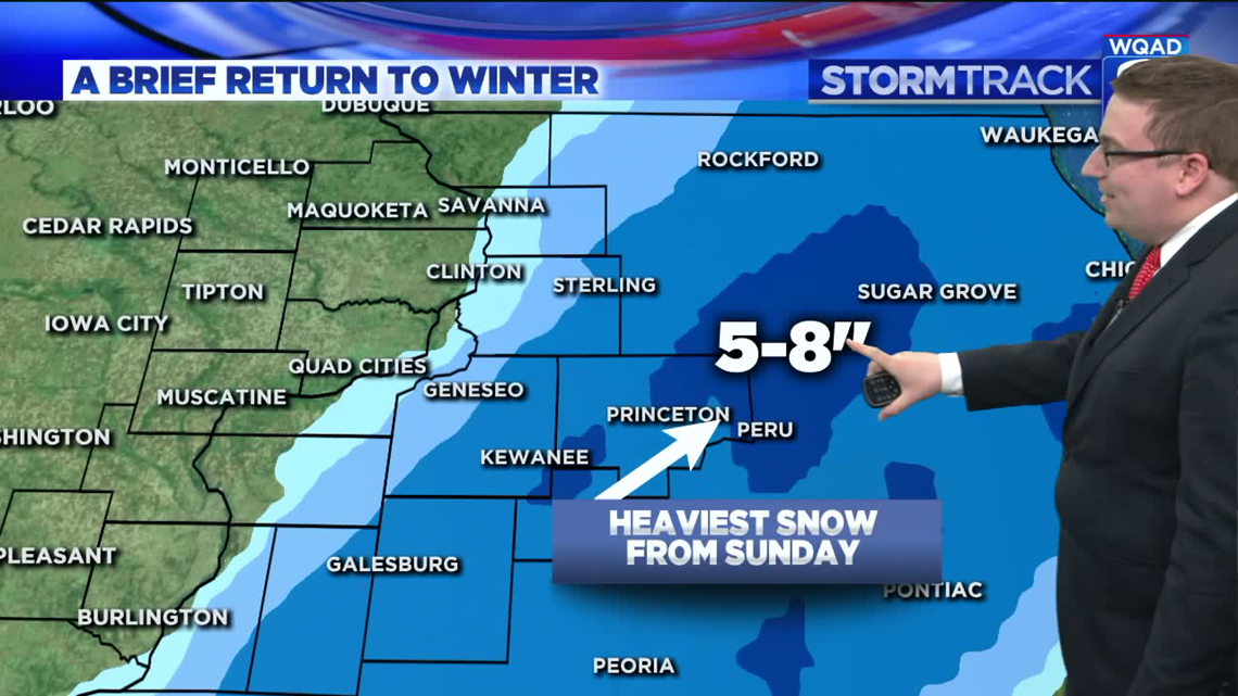
The heaviest axis of snow fell roughly along a 50-mile radius surrounding I39 between Princeton and Chicago. That's where several reports of at least five inches were common. Princeton, IL came in with the highest total in the local area with 8 inches measured.
While inconvenient and downright ugly to some, snow isn't impossible during the month of April. Looking back at the statistics for the latest snowfall in the Quad Cities, here is where the records stand:
Record latest (1.0"+) snowfall in the Quad Cities: April 23, 1967
Record latest (0.1") snowfall in the Quad Cities: May 3, 1935
Yes, you can even have snow in May! Let's hope that doesn't happen this year.
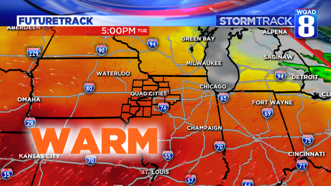
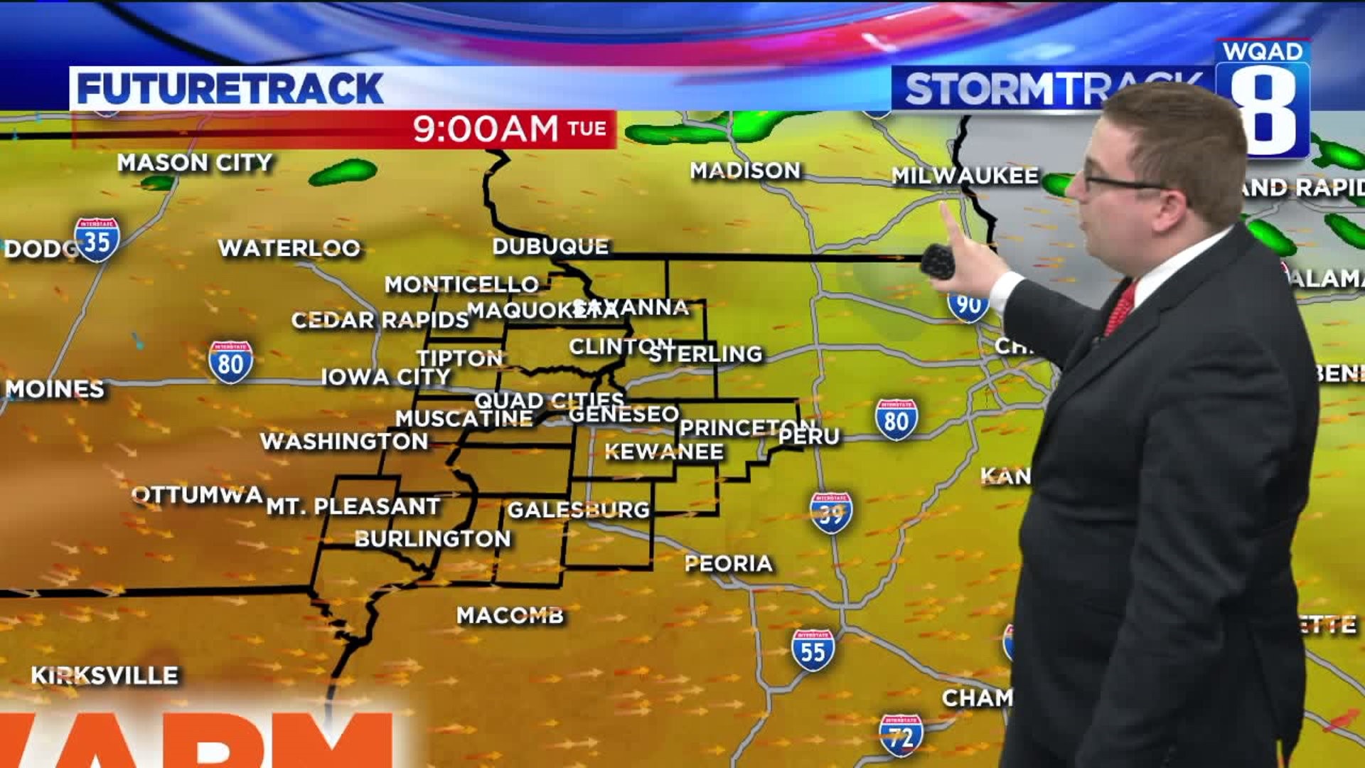
Whatever snow may be on the ground will quickly vanish in the next 24 to 48 hours as significant warmth finds its way back into the Midwest. By Tuesday afternoon high temperatures will be well into the 70s area wide.

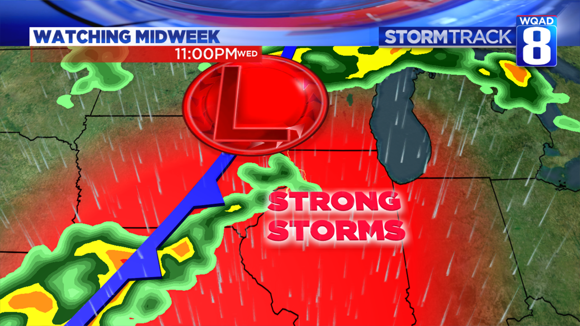
Along with the warmth will come another risk of strong to severe storms as we get into Wednesday evening and Thursday morning. An area of low pressure moving along a cold front will increase the amount of moisture in the region. That combined with a bit of instability will drive a cluster of storms to the west by Wednesday afternoon. This activity will then move into the local area after dark and into Thursday morning. Large hail and gusty winds will be the primary threat, along with heavy rainfall. We'll be tracking this potential and be able to fine-tune the timing and threats by Tuesday morning.

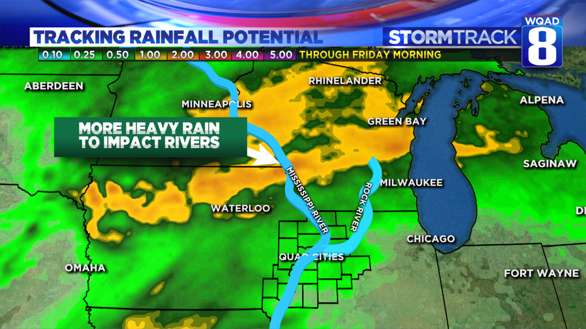
Speaking of heavy rain, another round of it looks likely to our north which will keep area rivers running high. The National Weather Service now expects flooding to continue on the Mississippi River through May at this rate, which is no surprise given how active our pattern has been as of late. We'll be learning more about the next potential incoming crest in the next few days. Stay tuned!
Meteorologist Andrew Stutzke
Download the News 8 Weather App — for iOS, click here and for Android, click here
Download the free News 8 App — for iOS, click here and for Android, click here