A new tool from the Midwestern Regional Climate Center is giving us more insight when it comes to comparing different winter seasons and their severity.
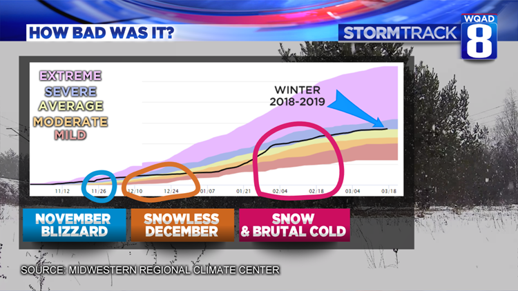
The AWSSI (Accumulated Winter Season Severity Index) looks at variables like temperatures, snowfall, and snow depth along with precipitation and then assigns points to each of these values which become weighted against data from previous winters. The result is a fairly accurate depiction of the type of winter that was experienced based on historical data. Heres how the winter of 2018-2019 ranked:

November kicked things off quickly as the Quad Cities achieved “Extreme Winter” status thanks to a healthy blizzard that dropped more than a foot of snow. This early season system pushed our severity index towards the top of the scale before it leveled off later in the month as things became much quieter.
That quiet pattern would continue through December when much of the area remained snow free, pushing the severity down to the “Mild Winter” category until January and February came along. It was during those two months when record-breaking cold and snow quickly filled the calendar sending our severity index soaring back up to a “Severe Winter” status where it has remained ever since.
The one thing this model does not include in its measurements is ice, which we have had plenty of this past winter. There is no doubt that if ice was a factor with this ranking system, we would likely rank higher on the scale towards the high-end severe, low-end extreme winter.
The winter of 1978-1979 remains fresh on several minds and is quite a contrast when you compare it with this year.
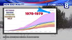
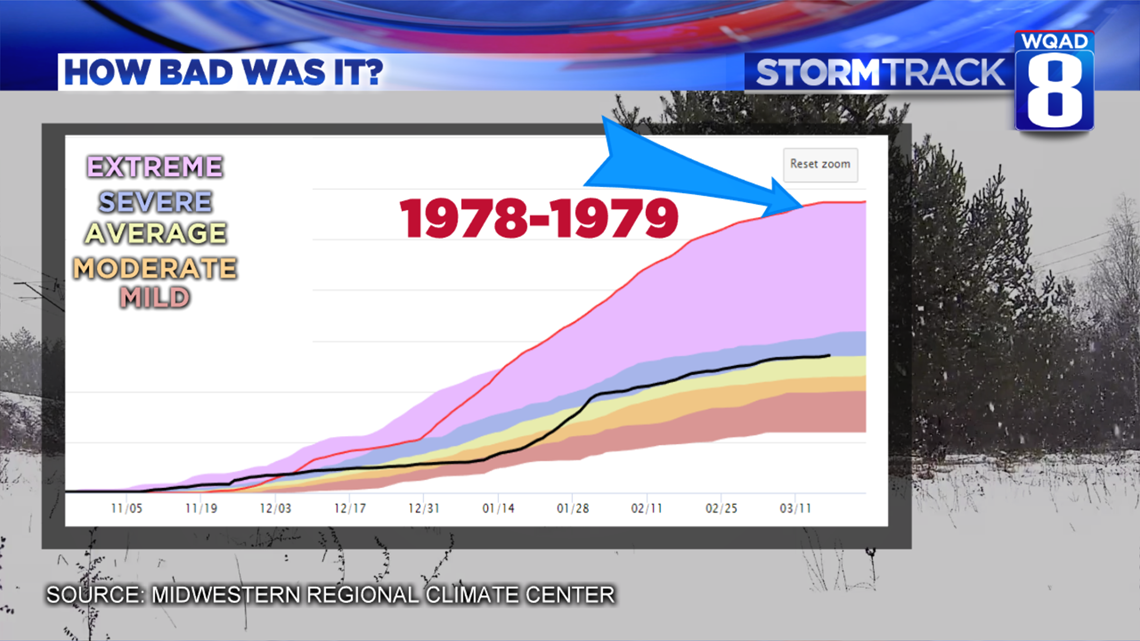
’78 and ’79 also had an early season start on the severity index, but once it peaked in December, it kept on creeping up the scale and stayed at the extreme end of the index for the remainder of the winter, thanks to several heavy snowfall events. As indicated by the red line on the graph above, you can see how different that winter was compared to this winter (black line). Let’s hope we don’t repeat that anytime soon!

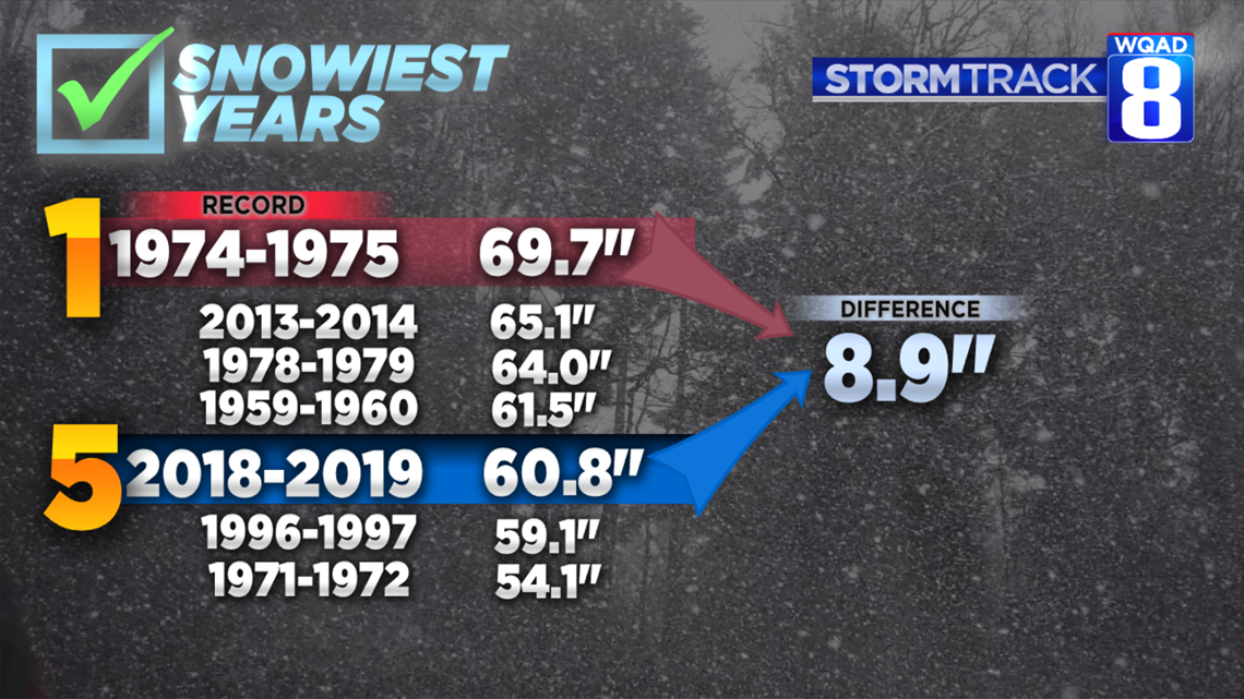
We’re still a good distance away from reaching the all-time snowiest period on record for the Quad Cities, with a little less than nine inches of snowfall needed to meet or exceed the record. As we dive deeper into March and especially into April, it will take a “freak” storm of sorts to drop snowfall amounts that hefty, but after what we have gone through this winter, ANYTHING is possible at this point. Stay tuned!
Meteorologist Andrew Stutzke