We are just a few weeks away from entering one of the many transition seasons in the Midwest which will likely continue to provide a wild ride for us weather-wise.
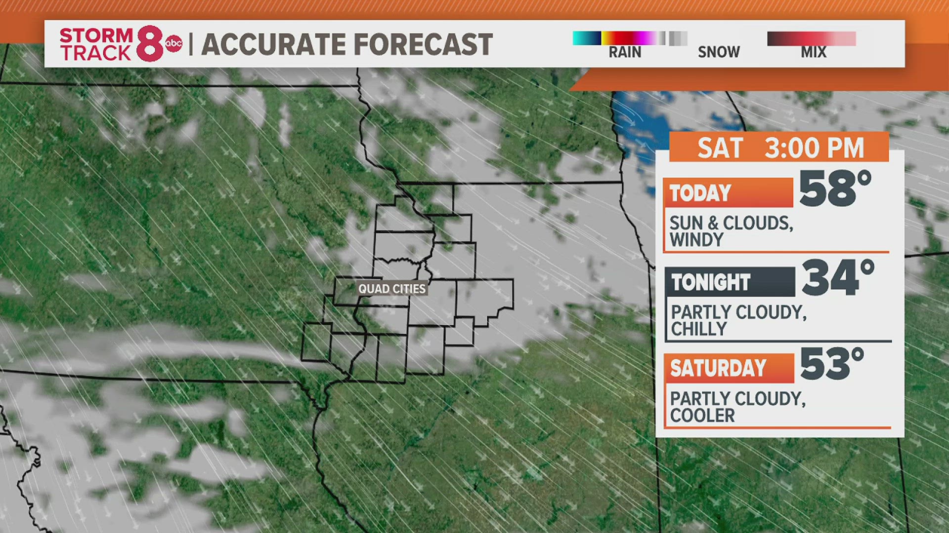
A few weaker storm systems are likely to bring snow flurries and pockets of freezing drizzle at times from Tuesday through Thursday. Nothing too major is expected in terms of impacts from these systems, and thankfully the winds won’t be nearly as strong as what we experienced this past weekend.
In the next several weeks our temperature pattern will continue to try and transition as the Spring equinox gets closer. What this typically means is more storms with strong winds and wild precipitation types/amounts. We’ve already seen that first hand this past weekend when a record amount of rain fell here in the Quad Cities followed by some extreme wind speeds that you would typically only find in severe thunderstorms.
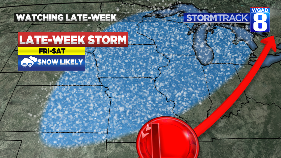
A pattern transition will likely mean another powerful winter storm somewhere in the Midwest before the start of next weekend. Many model solutions are coming into agreement that a piece of energy could phase with a strong jet stream overhead to drive a healthy chance for accumulating snows Friday into Saturday. Just how much snow falls remains in question and that is something we will fine tune in the days ahead.

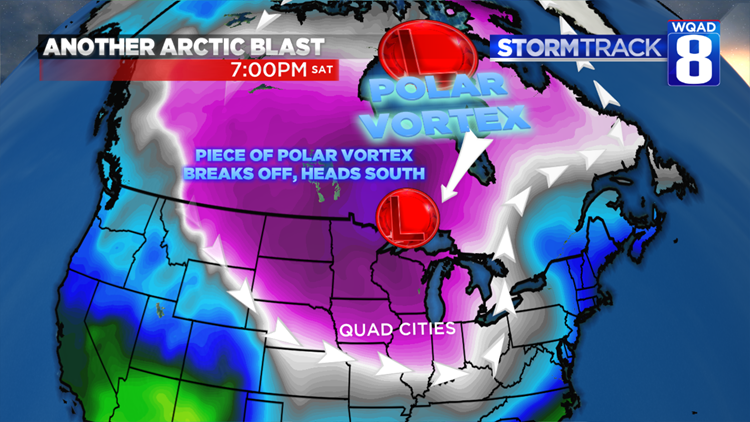
One signal that we are fairly confident of though, is that the beginning of March looks quite cold across the northern half of the country. The polar vortex, which is typically located near to the North Pole, will break off into several pieces, sending one of those waves diving south into the Midwest by next weekend. While our last flirt with this feature yielded record low temperatures and several miserable days, one thing we have on our side this time of year is the increasing sun angle.


Late December into January is when the least amount of solar energy arrives here at the surface. You’ve likely noticed now that we are at the end of February, on a sunny day you no longer need to turn the heat on in your car. The sun does all that heavy lifting for you. This increase in solar energy reaching the surface will act to temper the next arctic outbreak some. While we won’t likely spend too much time below zero, it will certainly feel cold by the weekend and early next week with a few days spending highs in the single digits. You can also bet that some nights will be spent below zero.
This late-week system will certainly be something to watch, especially if you have travel plans around this time. We’ll keep tracking the latest developments as we get closer to this system developing.
Looking even further out, the Climate Prediction Center is forecasting a 40-50% chance of seeing below average temperatures through the month of March and equal chances for above or below average precipitation. By no means is winter showing any signs of letting up anytime soon.
Meteorologist Andrew Stutzke