
Tuesday night's storm system proved to be mesmerizing in more ways than one. Not only did we see freezing rain and sleet we also experienced thunder-sleet! Many of you commented that you saw several flashes of lightning and heard loud booms of thunder as the sleet came pouring down from the sky. Temperatures were actually below freezing during this crazy episode, so how in the world did we get thunderstorms and why was it raining so heavily at times instead of snowing? Let's take a trip upstairs!

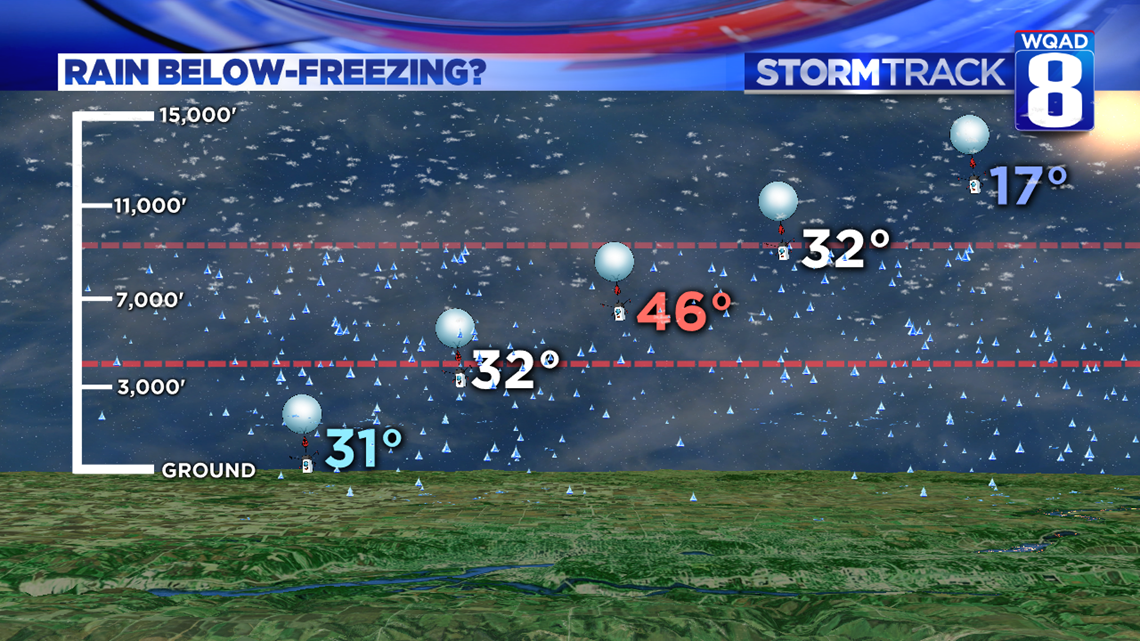
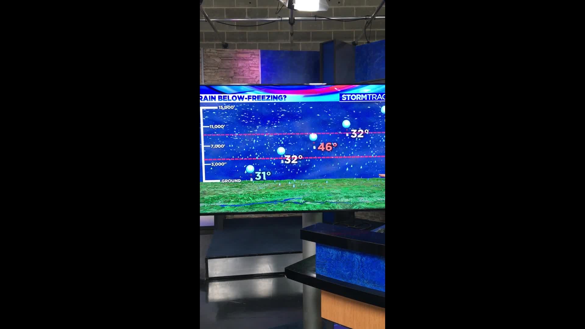
Late Tuesday afternoon the National Weather Service in the Quad Cities released a special weather balloon to take a temperature profile of the atmosphere above us. The profile, or sounding as its called, showed quite a substantial layer of warm air just above the surface where temperatures were well into the 40s. Meanwhile, here at ground level, our temperatures remained just below freezing, around 31 degrees throughout this event. If you look even higher above the surface, temperatures were well below freezing, around 17 degrees just a little more than 12,000 feet above the ground. The transition that the precipitation had to go through was simply amazing to watch!
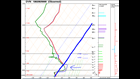

Here's a snapshot of the data that the weather balloon collected. This chart can be extremely confusing to read because the temperature lines are going sideways, but it illustrates quite well the magnitude of the warmer air that existed just above the surface. The red line is the temperature that was measured by the instrument as it rose into the atmosphere. The dark, thick blue line is the freezing line. Notice how the red line veers to the right of the freezing line? That is where temperatures are above 32°F, or in this case, 0°C.
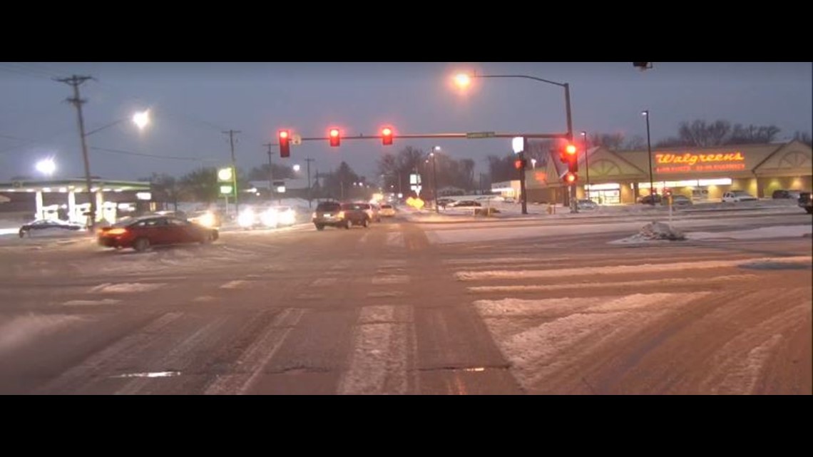
What started out as snow quickly melted in that warm layer before re-freezing when reaching the ground, creating sleet and also some freezing rain. As the thunderstorms moved through, even some hail production was seen. These storms were also loaded with frozen precipitation producing quite a vivid lightning display as more water particles collided with each other. The more intense storms were able to transition the precipitation to heavy freezing rain since it was falling so rapidly and spending less time in the colder air mass here at the ground and freezing instantly upon touching things like roads, power lines, and tree branches.

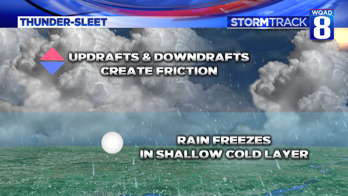
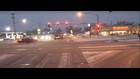
Thunder-sleet is no different than thundersnow, other than the temperature profile. Strong updrafts and downdrafts create the friction necessary to produce lightning and thunder. The rain that happens to fall from the storm will freeze into sleet once it enters a shallow pocket of colder air sitting near the surface. It also accumulates rapidly on surfaces that are already below freezing, like roads, sidewalks, and parking lots. That was the case Tuesday as the stronger storms moved through and a substantial amount of ice and sleet began covering up the roadways. This is exactly what we witnessed while roaming in The Beast Tuesday evening.
As we continue to move through the month of February, the sun will continue to provide more energy that reaches the surface, hence warming our temperatures more substantially. Meanwhile, colder air from the north will continue to battle its way in from time to time, creating events just like this one where we see many different types of precipitation all at once. A great time to be a weather-weenie!
Meteorologist Andrew Stutzke