
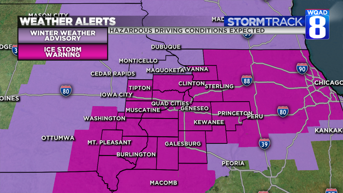
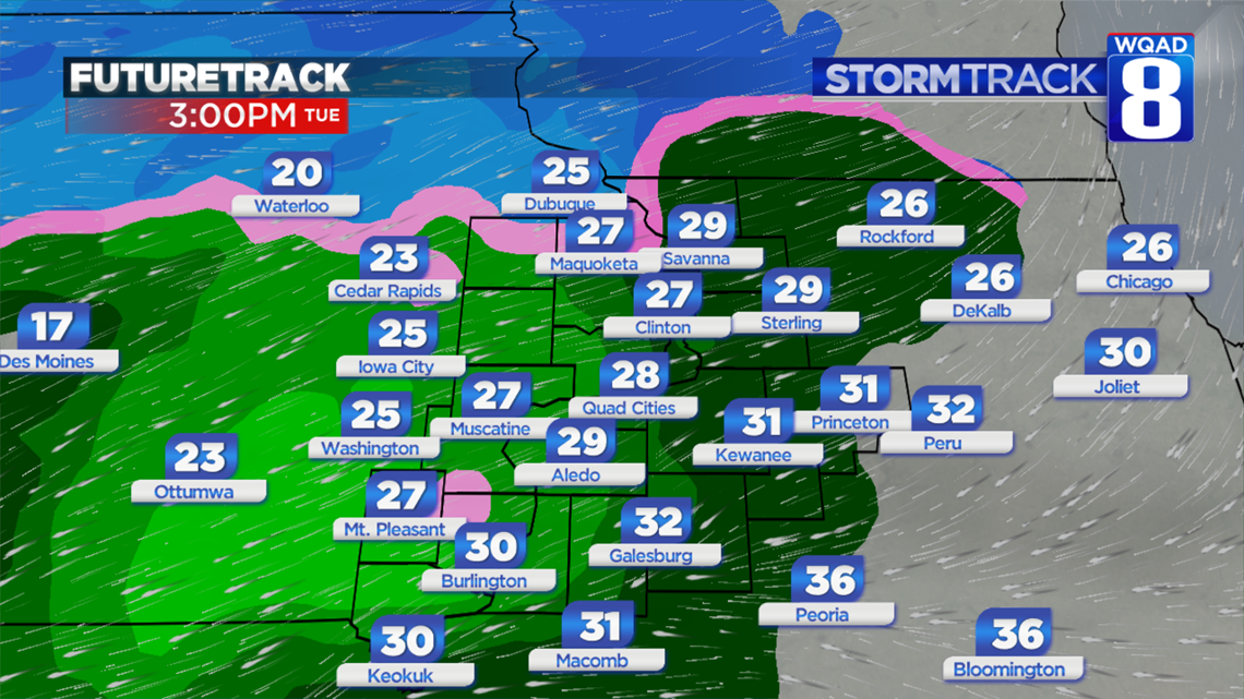
An Ice Storm Warning goes into effect at 3 p.m. today, lasting through 6 a.m. tomorrow morning.

Rain will begin across the area from west to east during the early afternoon, but instead of the rain falling and running off, it will fall upon frozen surfaces, causing the water to freeze. This will create a glaze of ice that will significantly impact travel.
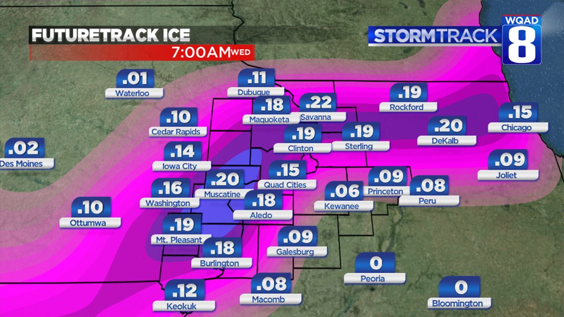
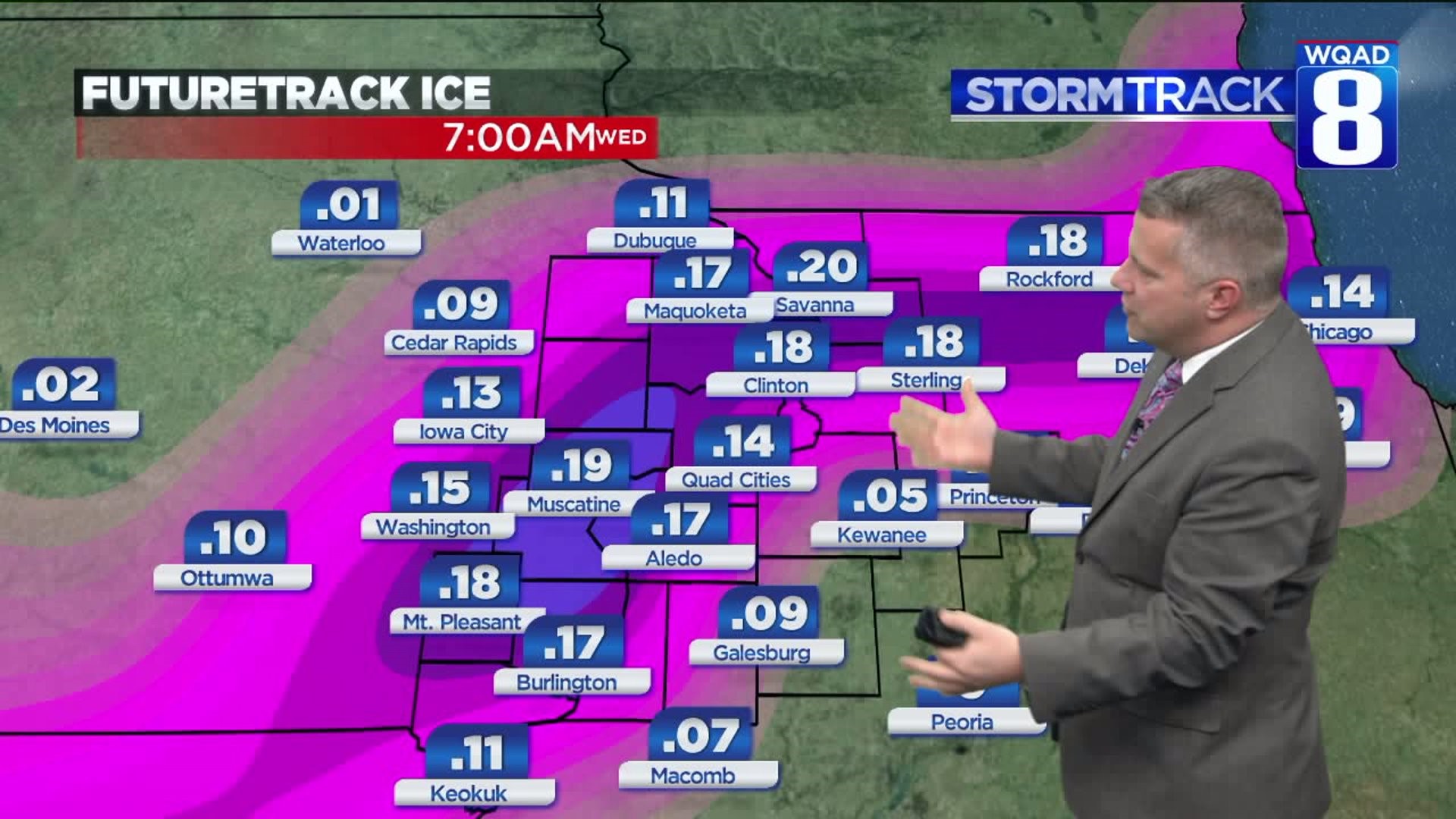
By the time this is wrapped up during the wee hours of Thursday, a quarter of an inch of ice accumulation can be expected. Because there's a chance of some thunderstorms this evening, the highest ice accumulations will be around 4/10 of an inch. That will be enough to cause power interruptions and bring down tree limbs. If you're in your car and have a slide-off or crash, remain in your vehicle with your seat belt on as chain-reaction crashes are more likely during icy conditions. We also have to pay close attention to the amount of wind. The higher wind increases the chance of tree limbs falling onto power lines.
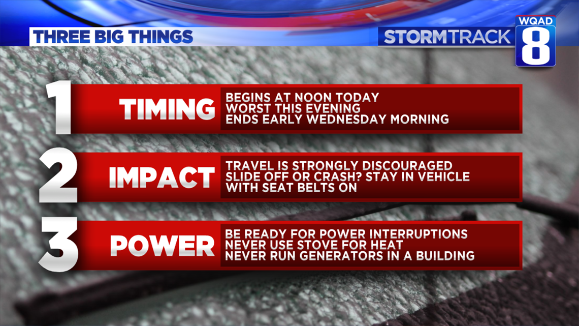
This will have significant impacts on travel, especially after sunset Tuesday through Wednesday morning.
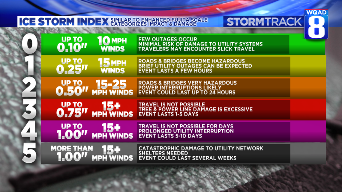
Did you know that there's an "Ice Storm Index?" It's similar to the Enhanced Fujita Scale for tornadoes. Most ice events in the Upper Midwest can be categorized in the 0-2 category. It's likely that today will be in the 1-2 range. The catastrophic ice storm that occurred in the Quad Cities in 2007 came with over an inch of ice. That is on the high side of the index.
Today: Temperatures will rise to 31 degrees today with temps staying below freezing this evening. Freezing rain will end during the wee hours of Wednesday with total ice accumulations around 4/10 of an inch possible. This is enough to bring down tree limbs and power lines. Travel is highly discouraged after 3 p.m. today, lasting into Wednesday morning.
Another surge of moisture is inbound for Wednesday afternoon, but by that time temperatures should be a few degrees above freezing. More wintry mix is possible Thursday before it turns mighty cold Friday.
-Meteorologist Eric Sorensen