I’m writing this blog entry before I see it online in an effort to cut off the mass hysteria, hype, and rumor surrounding our next potential winter storm.
The ECMWF model (or European model) gives Eastern Iowa and Western Illinois nearly two feet of snow on Monday, January 28th.

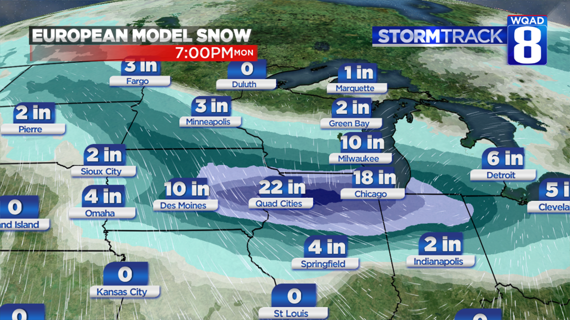
Is it legitimate? Yes, there’s one model that goes crazy with snow. Keep in mind, temperatures may be in the single digits so it would fluff up. But I call into question the amount of moisture available. I do NOT think this type of moisture will materialize out of an Alberta Clipper.
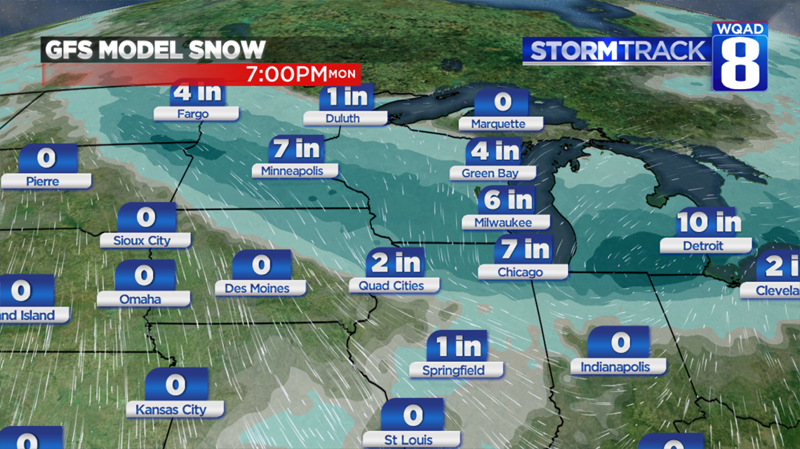
For comparison, this is the National Weather Service’s GFS computer model. Two inches. Total. Of note, the GFS model’s track is much different than the Euro’s…not nearly as robust with moisture. And that’s key. We don’t typically get tons of moisture out of clipper-type systems.
Wherever this ends up, it will produce some impressive snow amounts.
But can you believe it? Not yet.
Should Meteorologists and Weather Forecasters share it? Not yet.
Should you share it? Not yet.
Check back with us in the coming days. In all actuality for a storm coming Monday, we won’t have a good handle on it until Saturday…and today is Wednesday.
-Meteorologist Eric Sorensen