A wintry cocktail of rain, freezing rain, and snow is set to impact the region today not once, but twice. A Winter Weather Advisory has been issued for the morning hours that includes areas roughly north of I80. Areas along a line extending from Tipton, to DeWitt, to Mount Carroll will see the best chance at a thin glaze of ice forming on elevated surfaces, including some roads through mid-morning.
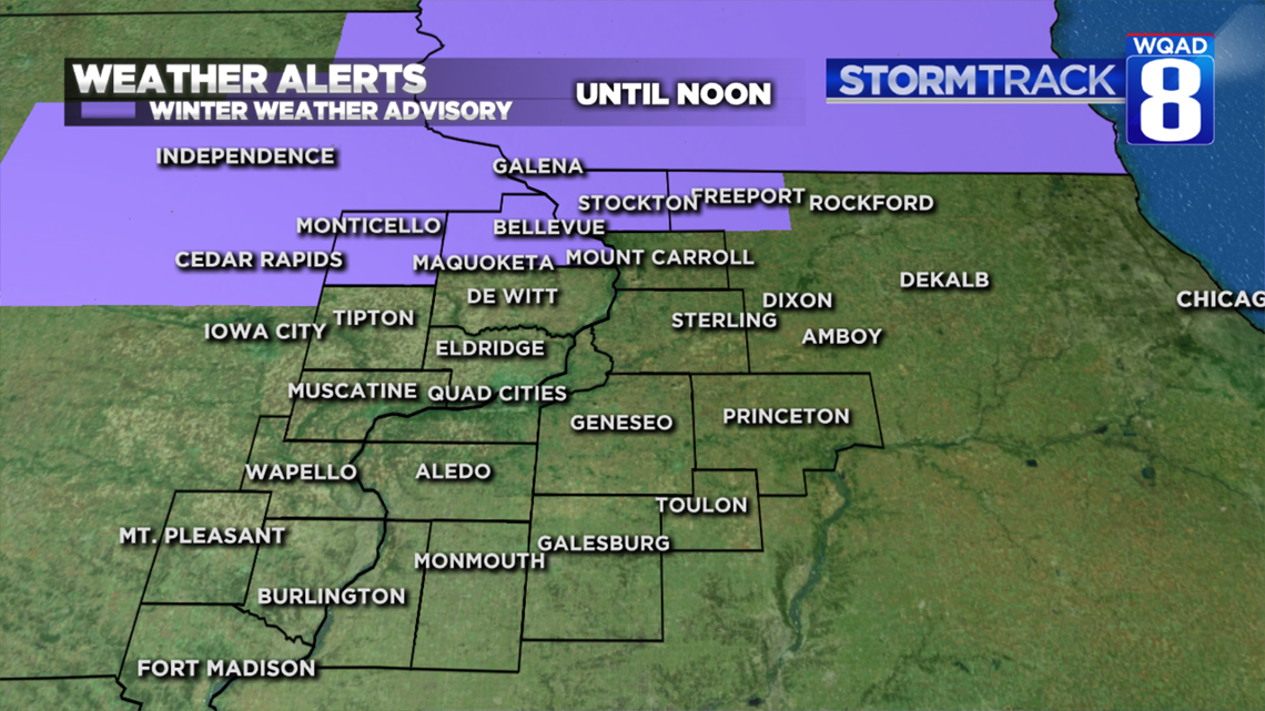
By this afternoon all of the precipitation will change over to rain decreasing the threat of ice accumulation.
Another round of wintry precipitation returns this evening with colder air filtering in behind this storm system. This will change the rain over to a rain, freezing rain, and snow mix before ending in the early evening. For the remainder of the night, areas of freezing drizzle will be likely creating another round of slick roads.
If you plan to travel, treat all wet-looking pavement with extreme caution through Tuesday morning.
Meteorologist Andrew Stutzke
Download the News 8 Weather App — for iOS, click here and for Android, click here
Download the free News 8 App — for iOS, click here and for Android, click here